
General Information
| Completion: | 1884 |
|---|---|
| Status: | in use |
Project Type
| Function / usage: |
Railroad (railway) bridge |
|---|
Location
| Location: |
East Providence, Providence County, Rhode Island, USA |
|---|---|
| Coordinates: | 41° 50' 7" N 71° 21' 42" W |
Technical Information
There currently is no technical data available.
Excerpt from Wikipedia
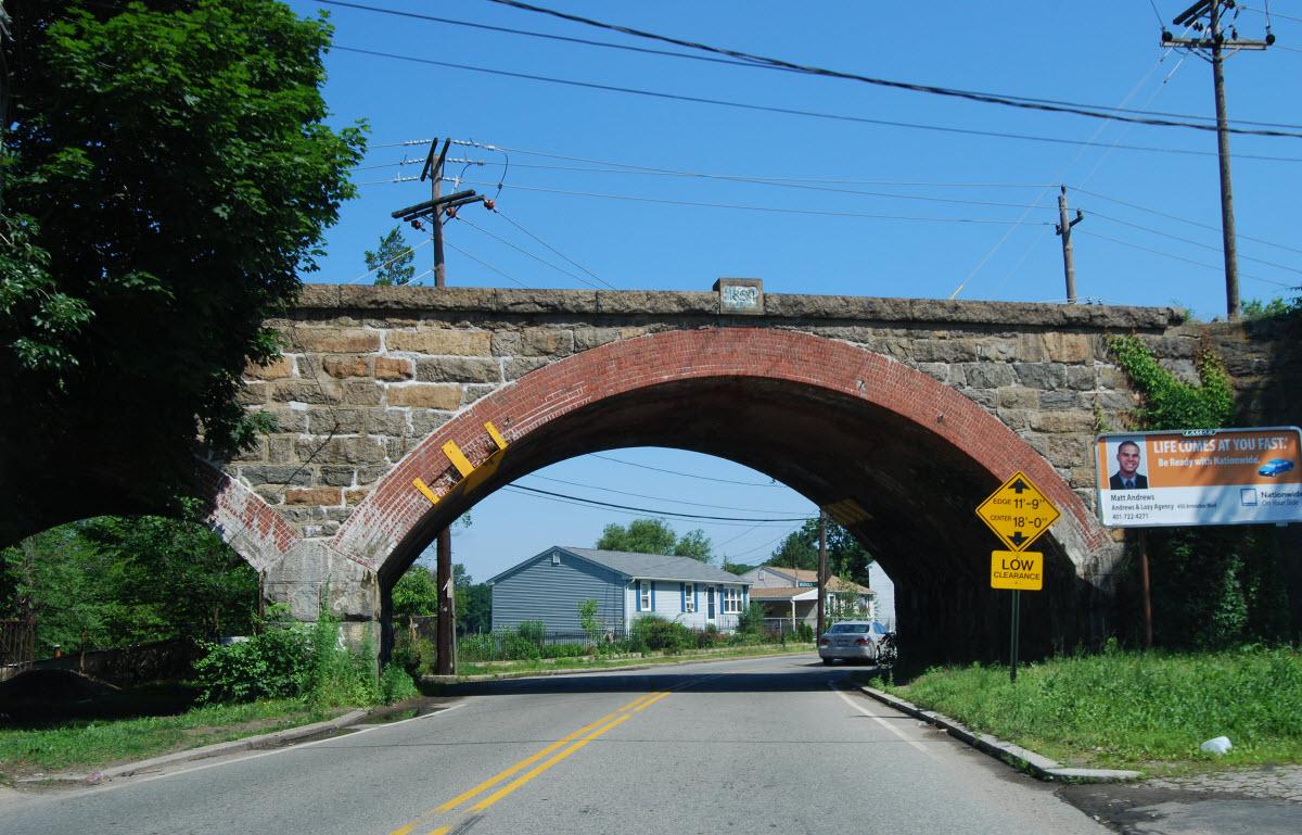
The Boston and Providence Railroad Bridge in East Providence is a railroad bridge on the East Junction Branch spanning Ten Mile River. A portion of the bridge also spans Roger Williams Avenue. The bridge was built in 1884 by the Boston and Providence Railroad, replacing an earlier structure on the line. The bridge abutments are faced in coursed ashlar stone, with brick-faced segmental-arch tunnels piercing them. The main span of the bridge consists of two Warren trusses resting on the abutments and a central pier in the Ten Mile River.
The bridge was listed on the National Register of Historic Places in 1980.
Text imported from Wikipedia article "Boston and Providence Railroad Bridge" and modified on 23 July 2019 under the CC-BY-SA 3.0 license.
Participants
Currently there is no information available about persons or companies having participated in this project.
Relevant Web Sites

- About this
data sheet - Structure-ID
20047984 - Published on:
25/08/2009 - Last updated on:
05/02/2016
Structurae cooperates with


