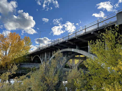
Informations générales
| Achèvement: | 1956 |
|---|---|
| Etat: | en service |
Type de construction
| Structure: |
Pont en arc avec tablier supérieur |
|---|---|
| Fonction / utilisation: |
Pont routier (pont-route) |
| Matériau: |
Pont en béton armé Structurae Plus/Pro - Abonnez-vous maintenant ! |
Situation de l'ouvrage
| Lieu: |
Spokane, Spokane County, Washington, États-Unis |
|---|---|
| Coordonnées: | 47° 40' 42.07" N 117° 21' 49.67" W |
Informations techniques
Dimensions
| portée principale | 40.5 m | |
| longueur totale | 138.1 m |
Matériaux
| tablier |
béton armé
|
|---|---|
| piles |
béton armé
|
| arcs |
béton armé
|
| culées |
béton armé
|
| pilettes sur l'arc |
béton armé
|
Intervenants
Pour l'instant aucune information est disponible à propos des participants (personnes ou entreprises) dans ce projet.
Sites Internet pertinents
Aucun lien pertinent n'a été répertorié pour l'instant.
Publications pertinentes
- : Spanning Washington. Historic Highway Bridges of the Evergreen State. Washington State University Press, Pullman (États-Unis), pp. 130-131.
- Informations
sur cette fiche - Structure-ID
20052141 - Publié(e) le:
16.01.2010 - Modifié(e) le:
25.09.2022


