
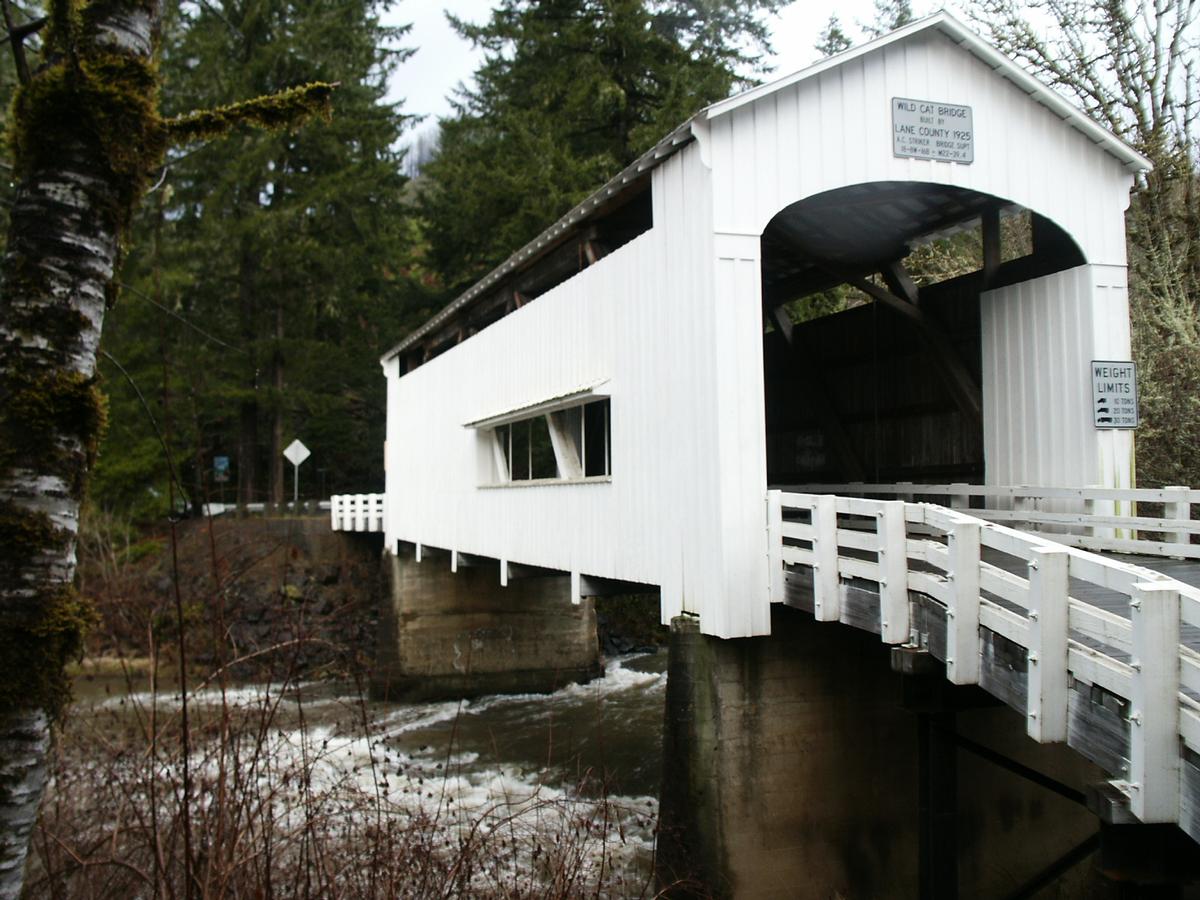
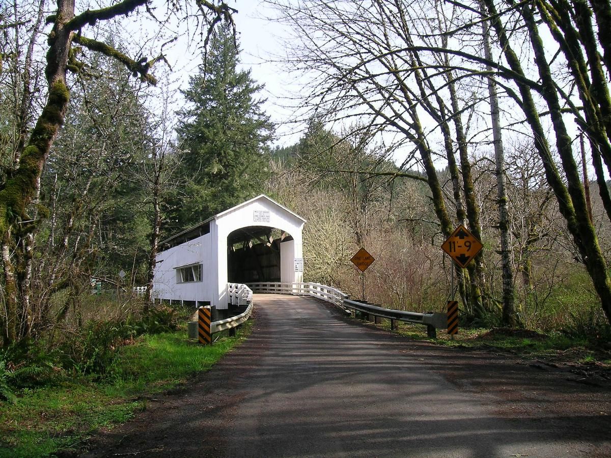
Informations générales
| Autre nom(s): | Wildcat Creek Covered Bridge |
|---|---|
| Achèvement: | 1925 |
| Etat: | en service |
Type de construction
Situation de l'ouvrage
| Lieu: |
Lane County, Oregon, États-Unis |
|---|---|
| Adresse: | Austa Road |
| Coordonnées: | 44° 0' 10" N 123° 39' 16.99" W |
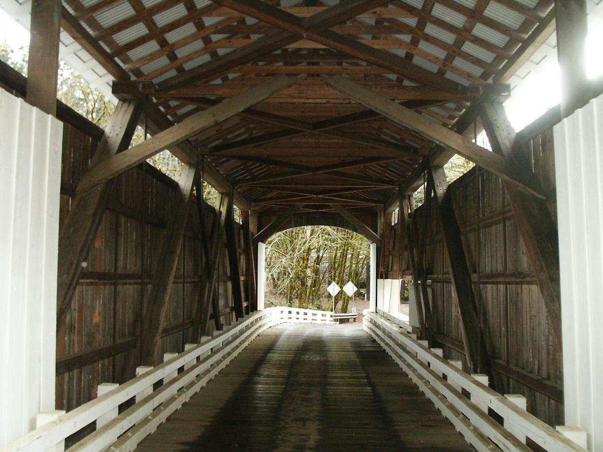
Informations techniques
Dimensions
| portée principale | 22.89 m | |
| longueur totale | 49.10 m |
Intervenants
Pour l'instant aucune information est disponible à propos des participants (personnes ou entreprises) dans ce projet.
Sites Internet pertinents
Aucun lien pertinent n'a été répertorié pour l'instant.
Publications pertinentes
- (1989): Historic Highway Bridges of Oregon. 2ème édition, Oregon Historical Society, Portland (États-Unis), pp. 178.
- Informations
sur cette fiche - Structure-ID
20031820 - Publié(e) le:
13.09.2007 - Modifié(e) le:
05.02.2016
Structurae coopère avec


