
General Information
| Name in local language: | Pont suspendu de Tournon |
|---|---|
| Completion: | 1825 |
| Duration of works: | 18 months |
| Status: | demolished (1965) |
Project Type
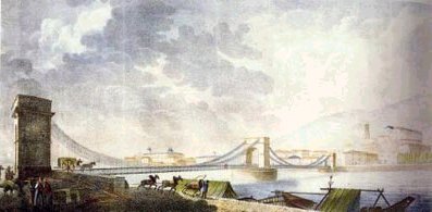
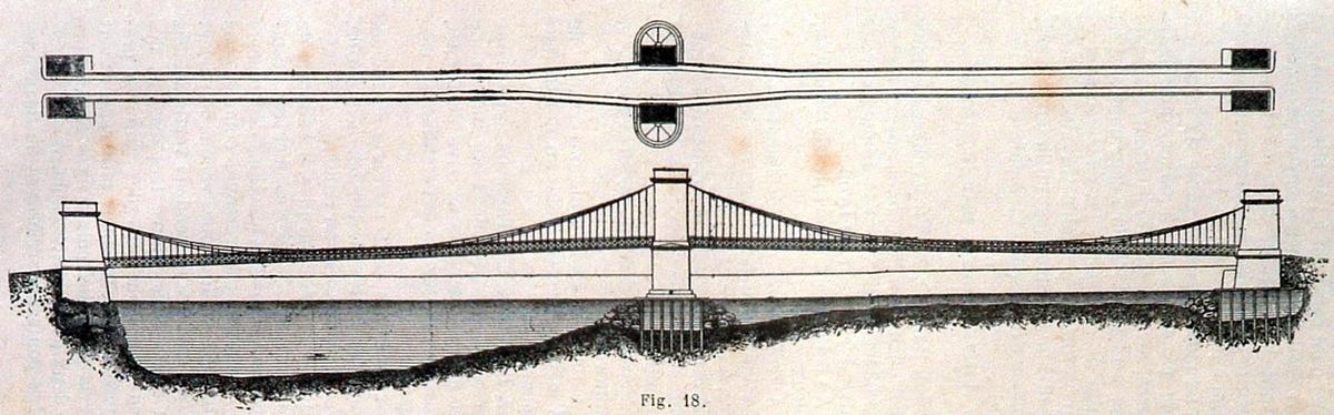
| Structure: |
Two-span three-tower suspension bridge |
|---|---|
| Function / usage: |
original use: Road bridge later use: Pedestrian bridge (footbridge) |
| Material: |
Iron bridge Structurae Plus/Pro - Subscribe Now! |
| Plan view: |
Structurae Plus/Pro - Subscribe Now! |
Location
| Location: |
Tournon-sur-Rhône, Ardèche (07), Auvergne-Rhône-Alpes, France Tain-L'Hermitage, Drôme (26), Auvergne-Rhône-Alpes, France |
|---|---|
| Crossed: |
|
| Near: |
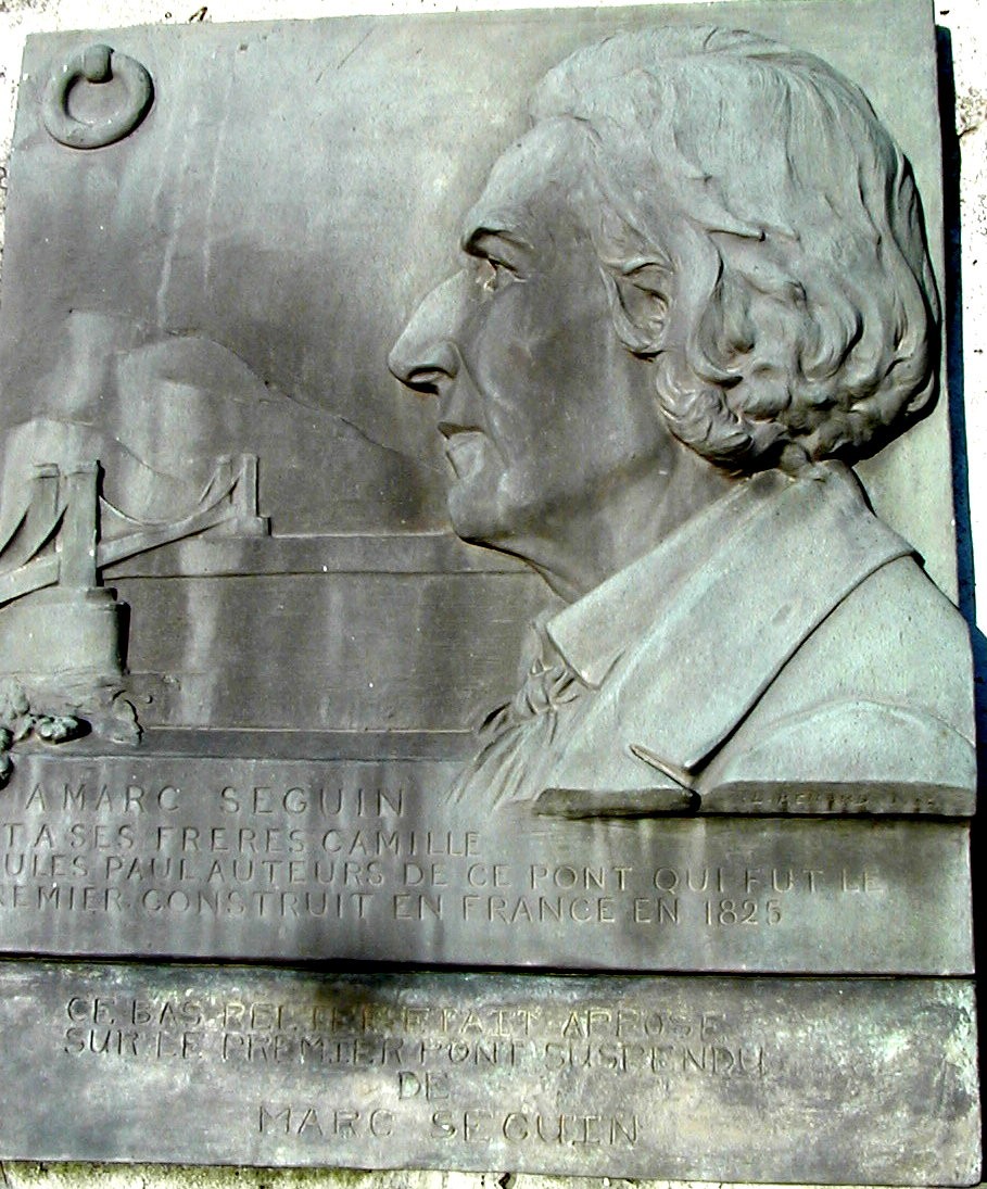
Marc Seguin Bridge (1849)
|
| Coordinates: | 45° 4' 9.70" N 4° 50' 1.34" E |
Technical Information
Dimensions
| total length | 180 m | |
| span lengths | 2 x 90 m | |
| number of spans | 2 |
Materials
| superstructure |
wrought iron
|
|---|---|
| cables |
iron wire
|
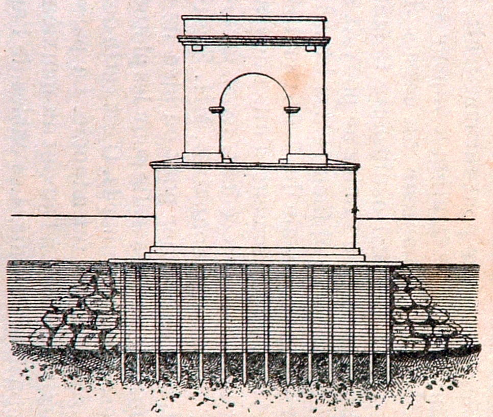
| pylons |
masonry
|
Chronology
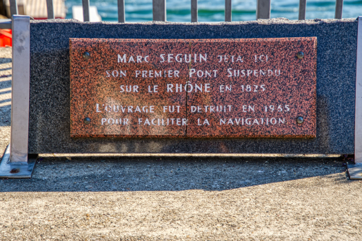
| 7 February 1847 | Due to the insufficient clearance over the river for steam boats, a royal ordinance requires the brothers Seguins to build a new bridge and destroy the current one or transform it to a footbridge after lifting the deck. They choose the latter. |
|---|---|
| 25 April 1965 | The bridge is demolished. |
Participants
Relevant Web Sites
There currently are no relevant websites listed.
Relevant Publications
- (1986): L'architecture du fer. France: XIXe siècle. Editions Champ Vallon, Seyssel (France), ISBN 9782903528713, pp. 119.
- (1997): L'art de l'ingénieur. constructeur, entrepeneur, inventeur. Éditions du Centre Georges Pompidou, Paris (France), pp. 510-511.
- (1995): On the foundation works of the Tain-Tournon bridge designed by Marc Seguin. In: Historical Studies in Civil Engineering, v. 15 ( 1995), pp. 175-186.
- (1999): Le Patrimoine de la SNCF et des chemins de fer français (2 Tomes). Flohic Editions, Paris (France), pp. 32.
- (1990): Les ponts modernes - 18e et 19e siècles. 1st edition, Picard Editeur, Paris (France), pp. 118-126.
- About this
data sheet - Structure-ID
20000156 - Published on:
21/04/1999 - Last updated on:
18/04/2023
Structurae cooperates with


