
General Information
| Name in local language: | Estakáda Spišské Podhradie na diaľnici D1 |
|---|---|
| Beginning of works: | 2009 |
| Completion: | 2012 |
| Status: | in use |
Project Type
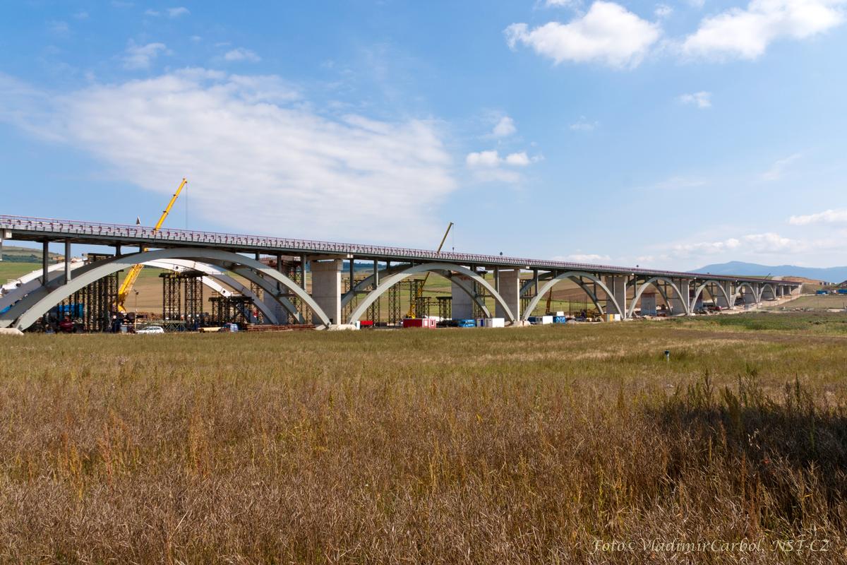
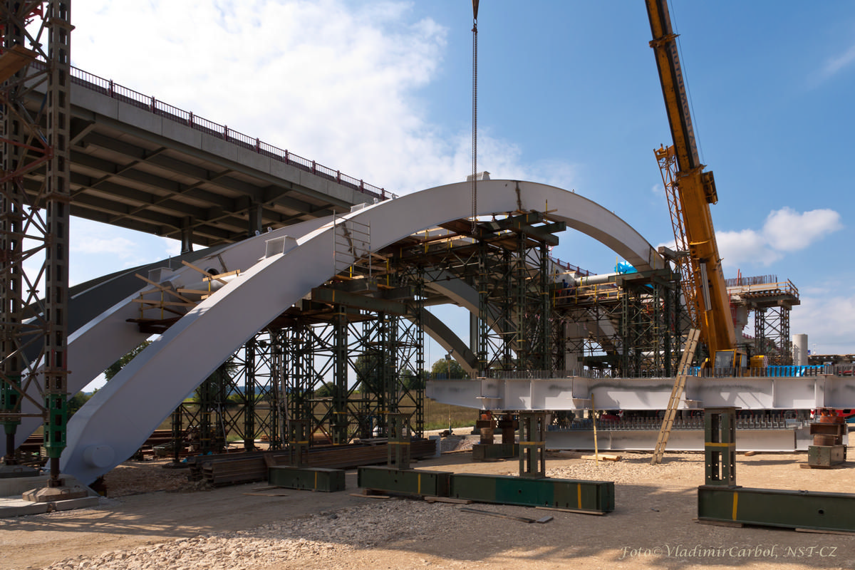
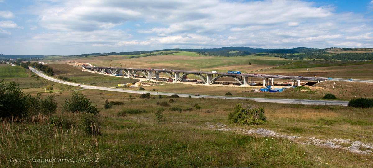
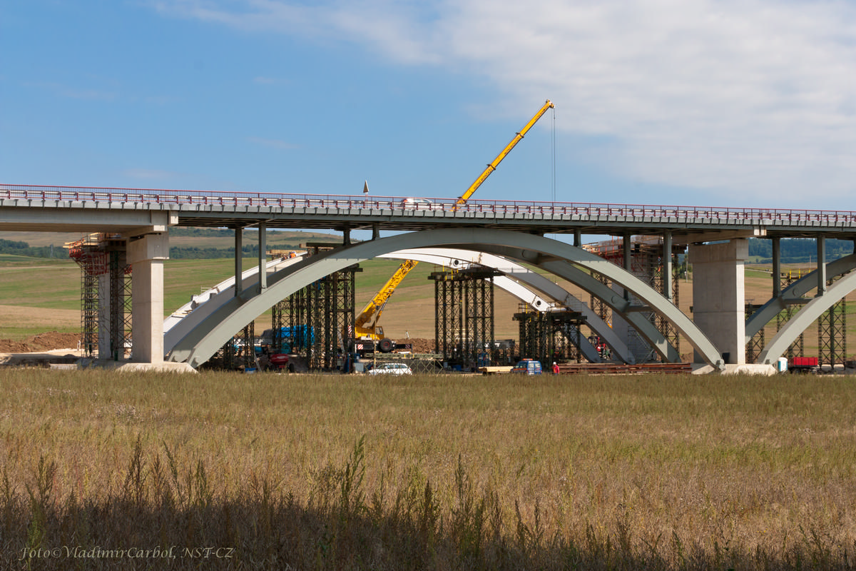
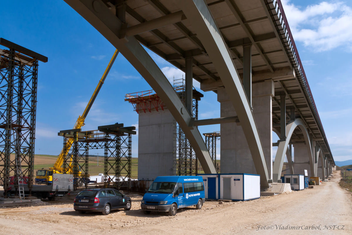
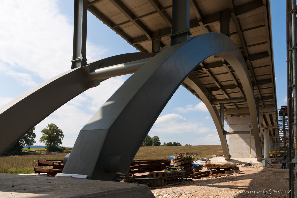
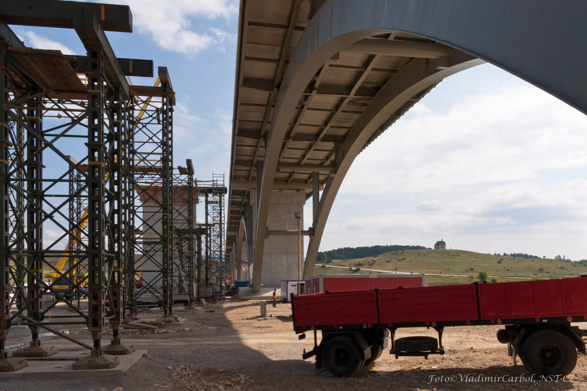
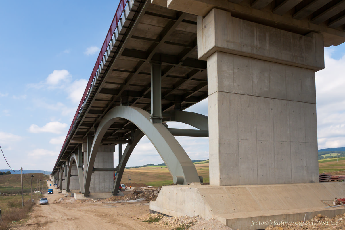
| Structure: |
Deck arch bridge Two-hinged arch bridge |
|---|---|
| Function / usage: |
Motorway bridge / freeway bridge |
| Material: |
Steel-reinforced concrete composite bridge Structurae Plus/Pro - Subscribe Now! |
Location
| Location: |
Spišské Podhradie, Prešov Region, Slovakia Jablonov, Prešov Region, Slovakia |
|---|---|
| Part of: | |
| Coordinates: | 49° 0' 29.65" N 20° 43' 2.15" E |
Technical Information
Dimensions
| total length | ca. 699 m | |
| deck width | 2 x 11.75 m | |
| longitudinal slope | 1.05 % | |
| superelevation | 2.5 % | |
| arches | span lengths | 55.00 m - 65.00 m - 3 x 75.00 m - 65.00 m - 55.00 m |
| number of spans | 7 | |
| piers | deck depth at abutments | 12 |
Materials
| piers |
reinforced concrete
|
|---|---|
| arches |
steel
|
| deck slab |
reinforced concrete
|
| abutments |
reinforced concrete
|
| cross beams |
steel
|
| piers on arch |
steel
|
Participants
Owner
General designers
Structural engineering
- DISTLER-ŠUPPA, spol. s r.o. (steel)
Main contractor
Co-contractor
Steel supplier

Relevant Web Sites
There currently are no relevant websites listed.
Relevant Publications
- (2012): Highway Section D1, Jablonov – Studenec, Bridge 205, the 1,650th km, Right Traffic Lane. In: Procedia Engineering, v. 40 ( 2012), pp. 85-90.
- About this
data sheet - Structure-ID
20061104 - Published on:
02/09/2011 - Last updated on:
29/04/2021
Structurae cooperates with


