
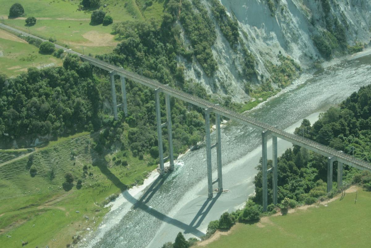
General Information
| Completion: | 1981 |
|---|---|
| Status: | in use |
Project Type
| Structure: |
Box girder bridge |
|---|---|
| Function / usage: |
Railroad (railway) bridge |
| Material: |
Prestressed concrete bridge Structurae Plus/Pro - Subscribe Now! |
Location
| Location: |
Mangaweka, Manawatu-Wanganui, New Zealand Taihape, Manawatu-Wanganui, New Zealand |
|---|---|
| Crosses: |
|
| Coordinates: | 39° 47' 51.57" S 175° 48' 30.21" E |
Technical Information
Dimensions
| total length | 315 m | |
| height above valley floor or water | 78 m |
Materials
| piers |
reinforced concrete
|
|---|---|
| girder |
prestressed concrete
|
Participants
Design
Contractor
Prestressing

Relevant Web Sites
There currently are no relevant websites listed.
Relevant Publications
- (1990): Les grands ponts du monde: Hors d'Europe. Brissaud, Poitiers (France), pp. 302.
- About this
data sheet - Structure-ID
20005436 - Published on:
23/09/2002 - Last updated on:
29/12/2018
Structurae cooperates with


