
General Information
| Completion: | April 2006 |
|---|---|
| Status: | in use |
Project Type
| Structure: |
Embankment dam |
|---|---|
| Function / usage: |
Causeway (road) |
Location
| Location: |
North Jeolla, South Korea |
|---|---|
| Coordinates: | 35° 41' 53" N 126° 33' 25.37" E |
| Coordinates: | 35° 48' 59.49" N 126° 28' 41.72" E |
| Coordinates: | 35° 56' 3.49" N 126° 31' 59.71" E |
Technical Information
Dimensions
| length | 33 km |
Excerpt from Wikipedia
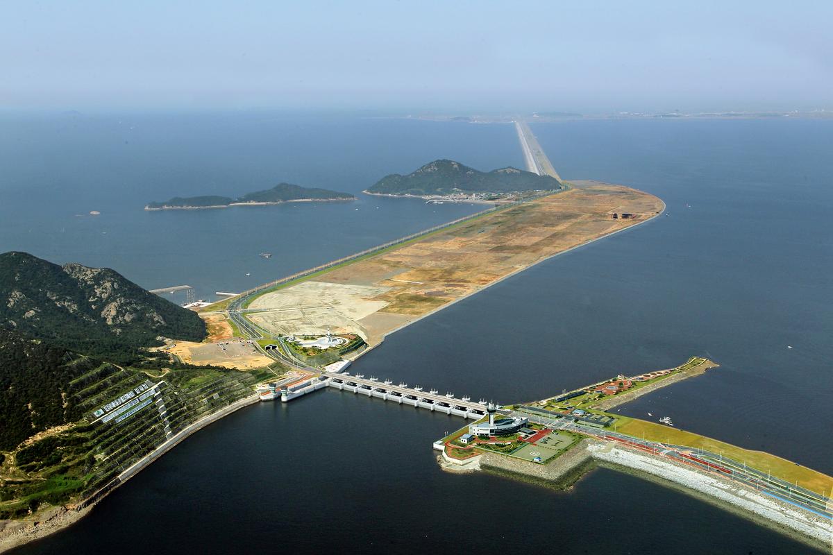
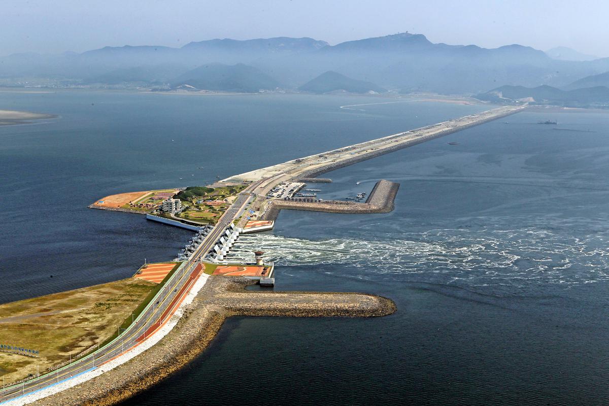
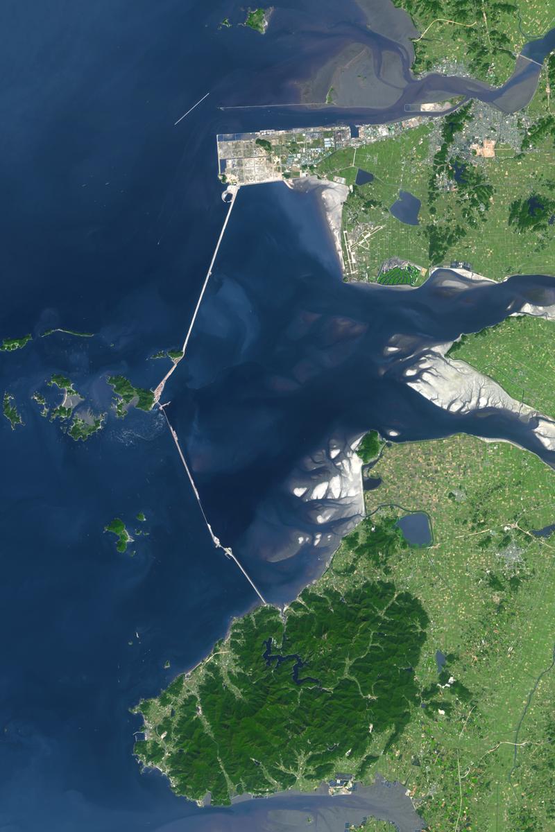
The Saemangeum Seawall, located on the southwest coast of the Korean peninsula, is the world's longest man-made dyke, measuring 33 kilometres (21 mi). It runs between two headlands, and separates the Yellow Sea and the former Saemangeum estuary.
In 1991, the South Korean government announced that a dyke would be constructed to link three headlands just south of the South Korean industrial port city of Gunsan, 270 kilometres (168 mi) southwest of Seoul, to create 400 square kilometres (150 sq mi) of farmland and a freshwater reservoir. Since then, the government has spent nearly 2 trillion won (1.82 billion USD) on construction of the dyke, with another 220 billion won (199.89 million USD) budgeted on strengthening the dyke and a further 1.31 trillion won (1.19 billion USD) to transform the tidal flats into arable land and the reservoir. The average width of the sea wall/earth dam is 290 metres (950 ft) (it is 535 metres (1,755 ft) at ist widest) and the average height is 36 metres (118 ft) (54 metres (177 ft) at ist highest).
The construction of the Saemangeum Seawall has caused controversy from the moment it was announced as environmental groups protested against the impact of the dyke on the local environment. Supreme Court challenges in 1999 and 2005 led to temporary production stoppages but ultimately failed to stop the project. Major construction was completed in April 2006, with the seawall 500 metres (1,600 ft) longer than the Afsluitdijk in the Ijsselmeer, the Netherlands, previously the longest seawall-dyke in the world.
With remaining minor construction and inspection finished, the seawall was officially open to the public on April 27, 2010. Then South Korean president Lee Myung Bak commented that Saemangeum would be "the kernel and the gateway of South Korea's west coast industrial belt", and is "another effort by us for low-carbon and green growth, along with the four-rivers project". A ceremony was held in Saemangeum the same day, with cabinet officials, politicians, and delegates from other countries.
Composition
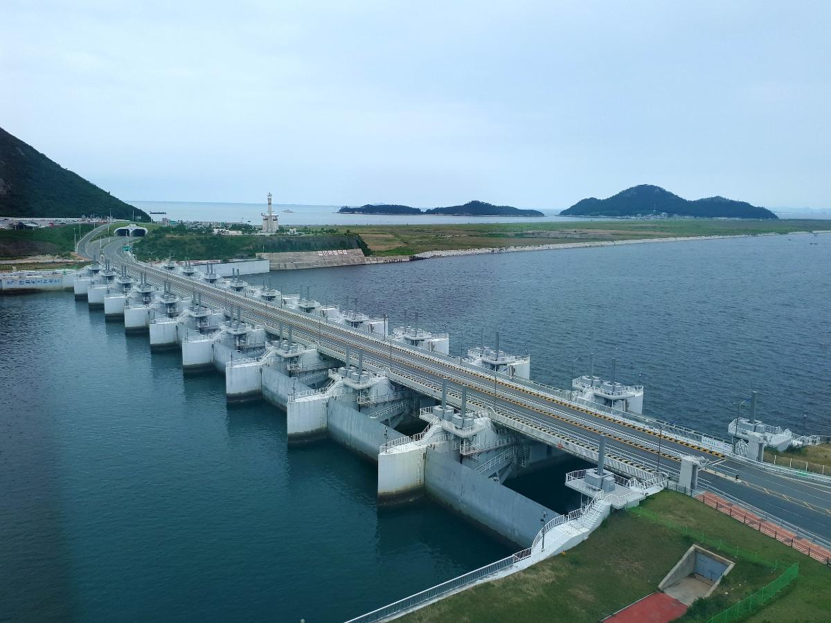
The road on Saemangeum Seawall with the length of 33km, connects Buan County to Gunsan is a part of National Route 77.
Text imported from Wikipedia article "Saemangeum Seawall" and modified on 23 July 2019 under the CC-BY-SA 3.0 license.
Participants
Currently there is no information available about persons or companies having participated in this project.
Relevant Web Sites

- About this
data sheet - Structure-ID
20036515 - Published on:
13/04/2008 - Last updated on:
19/02/2023
Structurae cooperates with


