
General Information
Project Type
| Function / usage: |
Hydroelectric dam / plant |
|---|
Location
| Location: |
Yakima County, Washington, USA Grant County, Washington, USA |
|---|---|
| Crosses: |
|
| Coordinates: | 46° 38' 35.52" N 119° 54' 32.40" W |
Technical Information
There currently is no technical data available.
Excerpt from Wikipedia
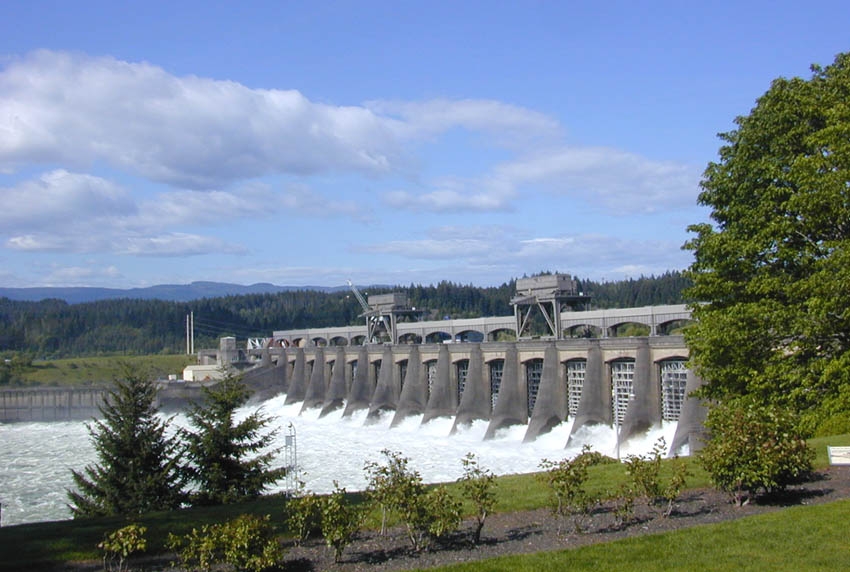
Priest Rapids Dam is a hydroelectric, concrete gravity dam; located on the Columbia River, between the Yakima Firing Range and the Hanford Nuclear Reservation, and bridges Yakima County and Grant County, in the U.S. state of Washington. The dam is 24 miles south of the town of Vantage, and 47 miles northwest of the city of Richland. It is located at mile marker 397.1 from the mouth of the Columbia. It is owned by the Grant County Public Utility District (PUD). Priest Rapids, for which the dam was named, are now submerged beneath the dam's reservoir.
Priest Rapids Dam is part of the Columbia River Basin system of dams.
History
After the disaster of 1949 Vanport Flood on the lower Columbia River, around Vancouver, Washington, and Portland, Oregon, the federal government established the Priest Rapids Project under the Flood Control Act of 1950 (Public Law 81-516; May 17, 1950). The U.S. Army Corps of Engineers decided the project would not be a top priority, so the Grant PUD began looking at taking over the project from the USACE in 1952. With the passage of Public Law 83-544 in 1955, Congress gave Grant PUD the right to proceed. Revenue bonds were issued for construction to begin in July 1956, first generation occurred in 1959, and the dam was completed in 1961. Its reservoir is named Priest Rapids Lake, and extends 18 miles upstream to spillway of Wanapum Dam. Downriver from Priest Rapids Dam is Hanford Reach, the only free-flowing, non-tidal stretch of the Columbia River in the United States.
The initial license expired in 2005, after which the Grant County PUD operated the dam on yearly license extensions while negotiations for license extension proceeded. The Federal Energy Regulatory Commission approved a license extension of 44 years for both this dam and the upstream Wanapum Dam on April 17, 2008. The license extension was conditioned upon programs to:
- modernize the power generation capability of the dam
- monitor water quality
- improve wildlife habitat
- protect nearly 700 Wanapum Tribe archaeological sites in the vicinity
- enhance recreation with new campsites, picnic areas and trails
Problems
An explosion injured six employees on October 8, 2015. Grant County PUD was fined $35,000 for safety violations.
Leaks have been discovered in the spillway monoliths. A "non-failure emergency" was declared, and the water level behind the dam was reduced by about three feet.
Text imported from Wikipedia article "Priest Rapids Dam" and modified on 20 April 2020 under the CC-BY-SA 3.0 license.
Participants
Currently there is no information available about persons or companies having participated in this project.
Relevant Web Sites

- About this
data sheet - Structure-ID
20031666 - Published on:
16/09/2007 - Last updated on:
27/09/2022
Structurae cooperates with


