
General Information
Project Type
| Structure: |
Deck arch bridge secondary arches: Two-hinged arch bridge |
|---|---|
| Function / usage: |
Road bridge |
| Material: |
Reinforced concrete bridge Structurae Plus/Pro - Subscribe Now! |
Location
| Location: |
Podolsko, South Bohemian Region, Czechia |
|---|---|
| Crosses: |
|
| Coordinates: | 49° 21' 25.72" N 14° 16' 21.13" E |
Technical Information
Dimensions
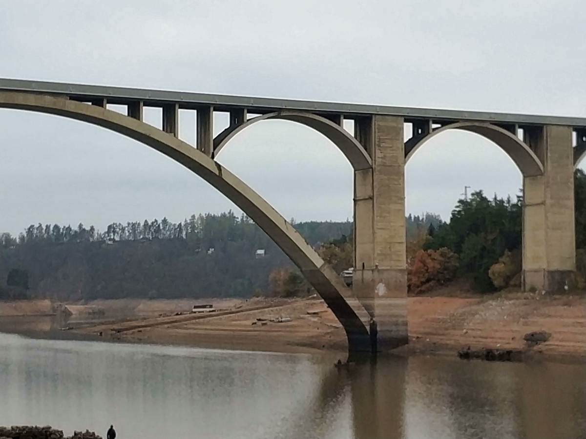
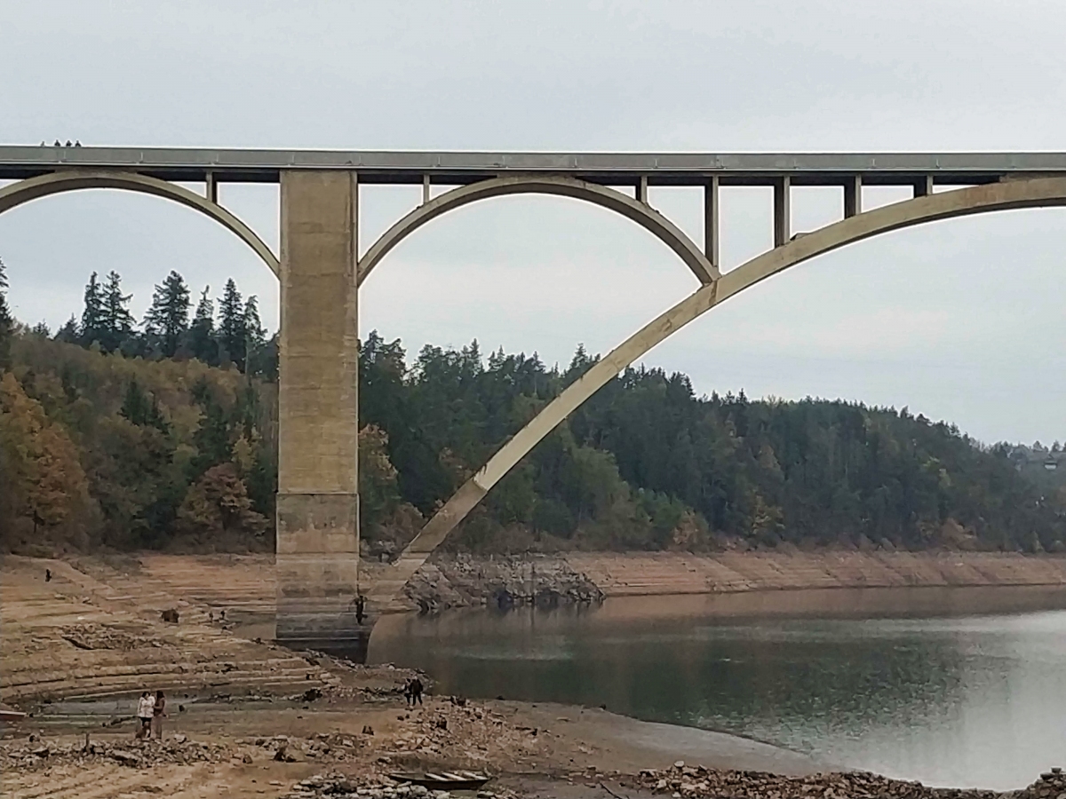
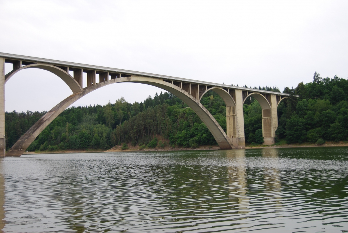
| main span | 150 m | |
| total length | 510.50 m | |
| span lengths | 2 x 35.65 m - 150.00 m - 6 x 35.65 m | |
| number of spans | 9 | |
| roadway / carriageway width | 6.50 m | |
| walkway width | 2 x 1.00 m | |
| main arch | rise | 41.80 m |
| thickness | 2 m | |
| piers | width | 7.40 m |
| thickness | 7.50 m | |
| secondary arches | rise | 9.885 m |
| thickness | 0.75 m |
Materials
| piers |
reinforced concrete
|
|---|---|
| arches |
reinforced concrete
|
| abutments |
reinforced concrete
|
| piers on arch |
reinforced concrete
|
Excerpt from Wikipedia
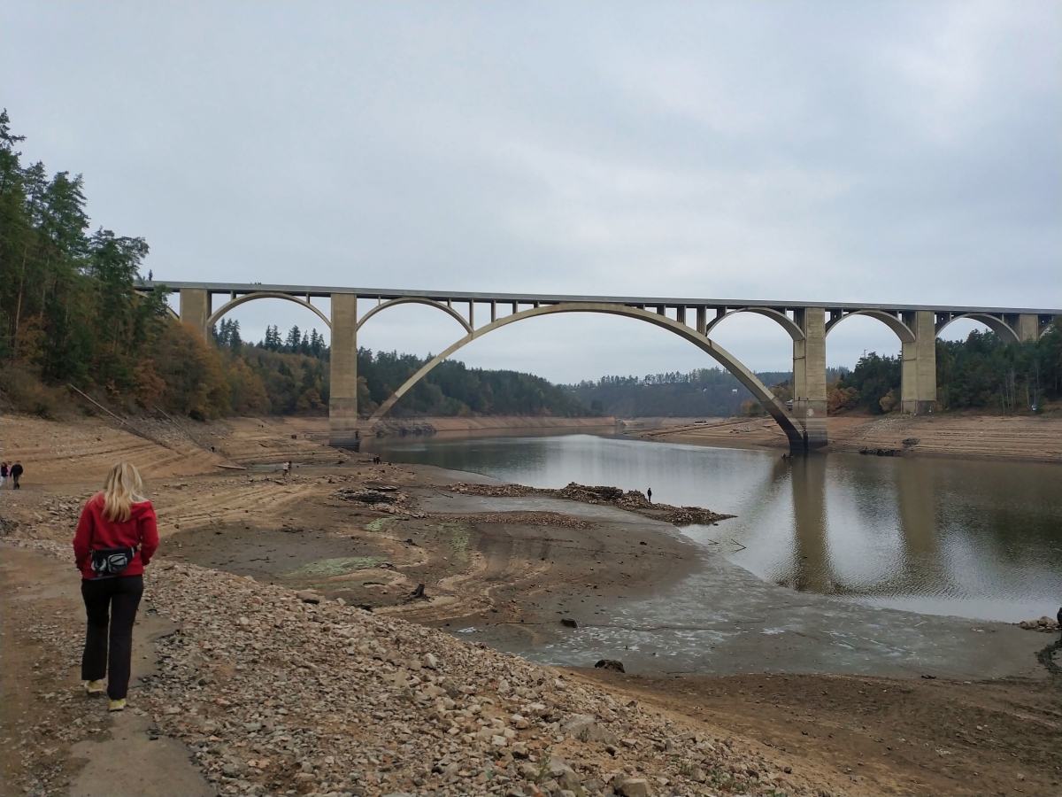
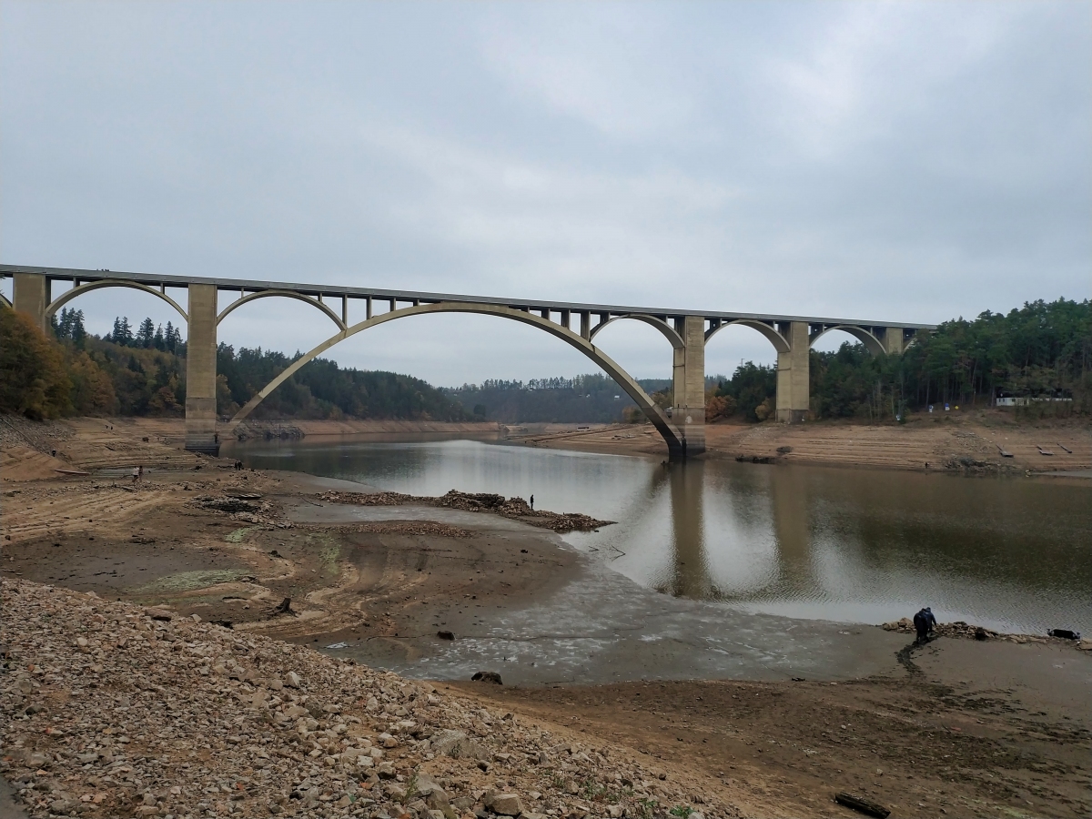
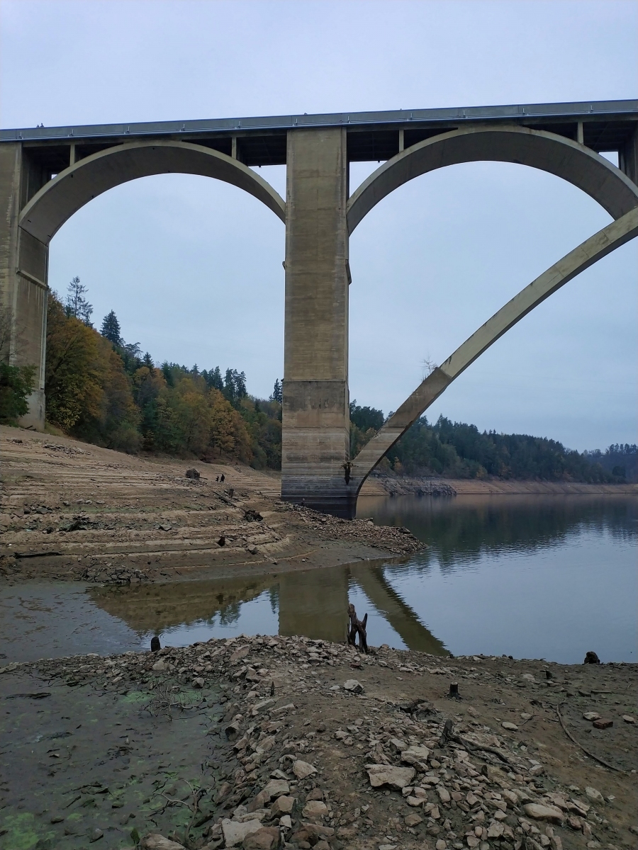
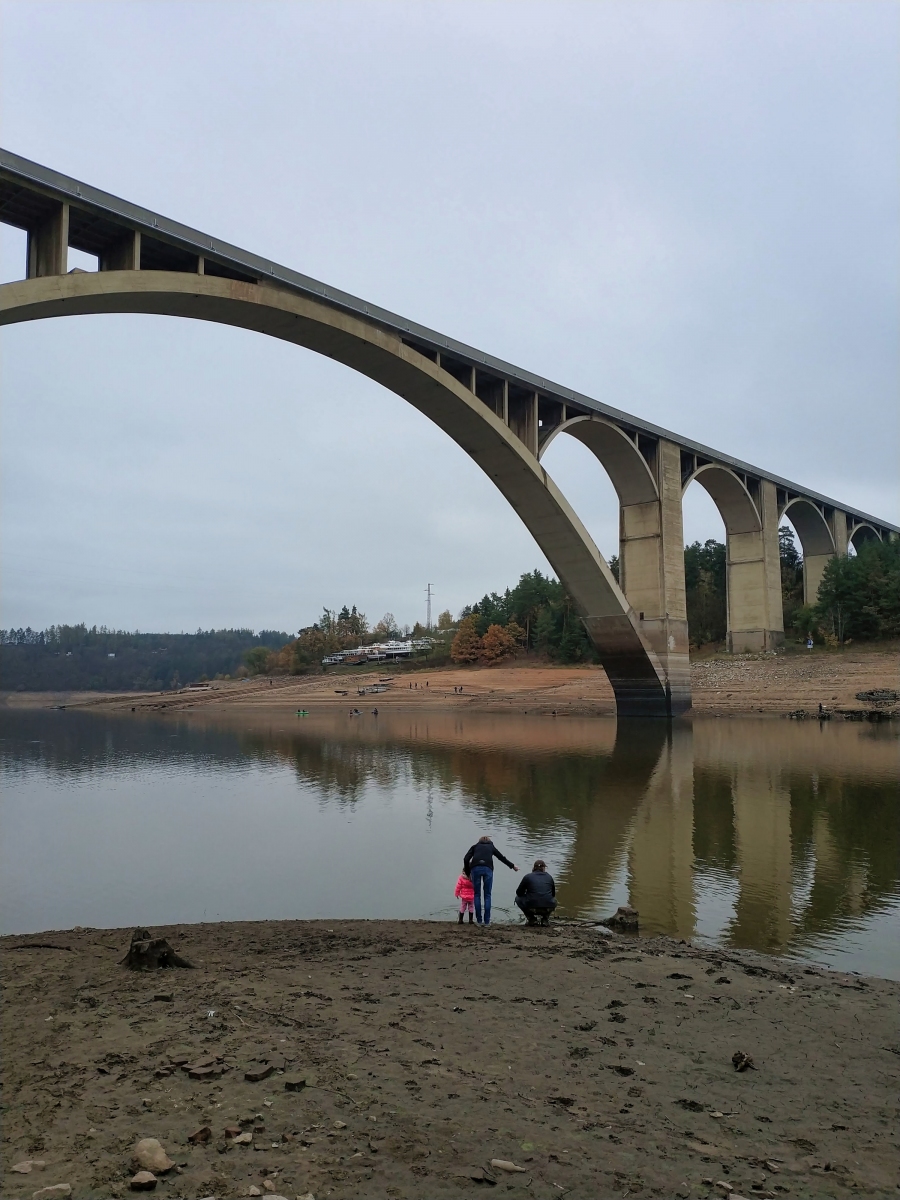
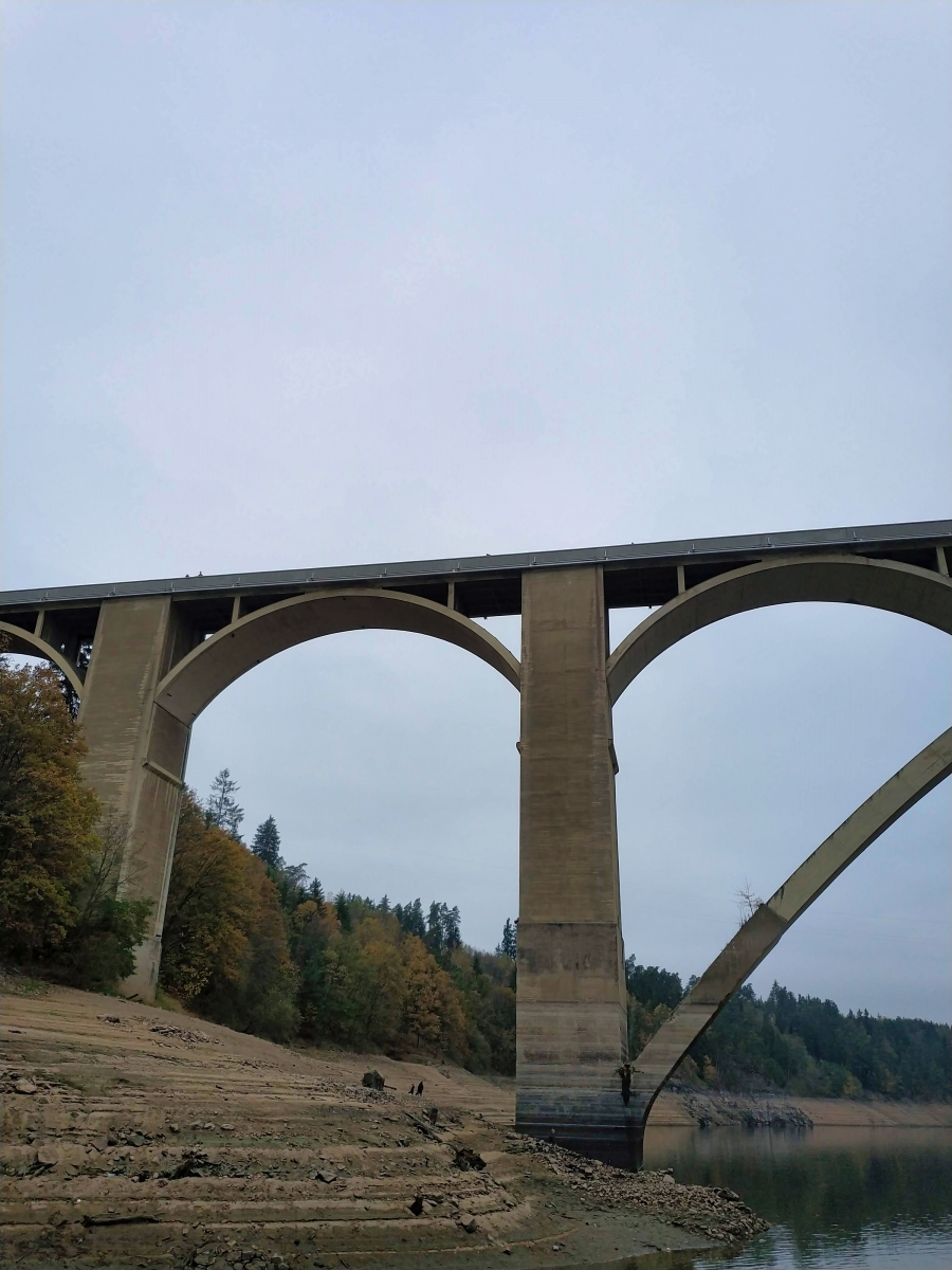
The Podolsko Bridge is an arch bridge that spans the Vltava between Podolsko and Temešvár in Písek District, Czech Republic. At the time of its completion in 1949, it was the longest arch bridge in Czechoslovakia.
Design was by the Ministry of Public Works. Experimental Stress Analysis photoelasticity was by Jaroslav Josef Polívka of the University of California.
After the Orlík Dam was completed in 1961, the Vltava rose 19 meters and covered part of the supports.
Text imported from Wikipedia article "Podolsko Bridge" and modified on 23 July 2019 under the CC-BY-SA 3.0 license.
Participants
Design
- Antonín Brebera (designer)
- Václav Janák (designer)
Detailed design
- J. Blažek (structural engineer)
Relevant Web Sites

Relevant Publications
- (2020): Development of Concrete Bridges in the Czech Republic. Presented at: IABSE Symposium: Synergy of Culture and Civil Engineering – History and Challenges, Wrocław, Poland, 7-9 October 2020, pp. 307-314.
- Les grands ponts-routes en béton armé en Tchécoslovaquie. Presented at: Troisième Congrès de l'AIPC = Dritter Kongress der IVBH = Third Congress of IABSE, Liège, 13-18 Septembre 1948, pp. 317-324.
- About this
data sheet - Structure-ID
20013572 - Published on:
30/09/2004 - Last updated on:
10/06/2020
Structurae cooperates with


