
General Information
| Completion: | 1918 |
|---|---|
| Status: | in use |
Project Type
| Structure: |
Parallel-chord truss bridge |
|---|---|
| Function / usage: |
Railroad (railway) bridge |
Location
| Location: |
Peace River, Alberta, Canada |
|---|---|
| Crosses: |
|
| Coordinates: | 56° 14' 21.26" N 117° 18' 14.62" W |
Technical Information
Dimensions
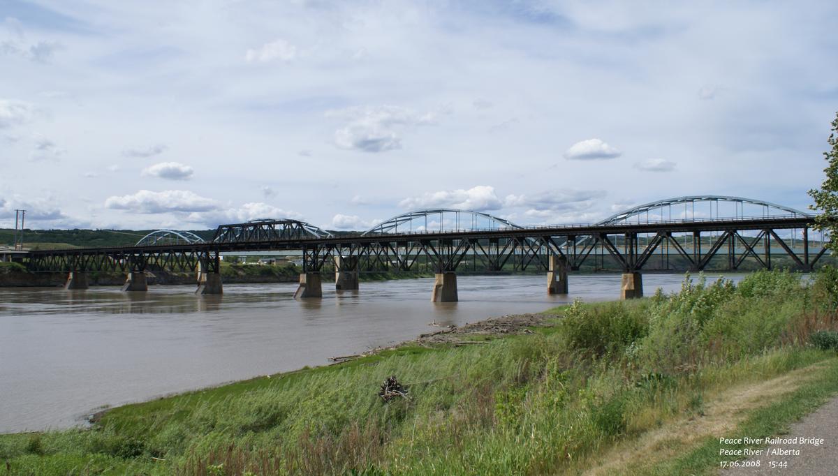
| total length | 529.1 m | |
| number of spans | 9 |
Notes
Originally intended only for rail traffic it was modified to carry road traffic which lasted until a separate road bridge was built in 1968. It is still in use as a railway bridge, being a vital link in a line running to Hay River on the south shore of Great Slave Lake in the Northwest Territories.
The structure from east to west consists of 9 spans; 1 deck plate girder, 3 deck trusses, 1 through truss (for navigation clearance when built), 3 deck trusses and 1 deck plate girder.
Participants
Contractor
Relevant Web Sites
There currently are no relevant websites listed.
- About this
data sheet - Structure-ID
20038640 - Published on:
01/08/2008 - Last updated on:
05/02/2016
Structurae cooperates with


