
General Information
| Name in local language: | Ponte da Mizarela |
|---|---|
| Completion: | 19th century |
| Status: | in use |
Project Type
| Structure: |
Semi-circular arch bridge |
|---|---|
| Function / usage: |
Pedestrian bridge (footbridge) |
| Material: |
Masonry bridge |
Location
| Location: |
Vieira do Minho, Braga, Portugal Montalegre, Vila Real, Portugal |
|---|---|
| Crosses: |
|
| Coordinates: | 41° 41' 31.21" N 8° 1' 10.44" W |
Technical Information
Dimensions
| number of spans | 1 |
Excerpt from Wikipedia
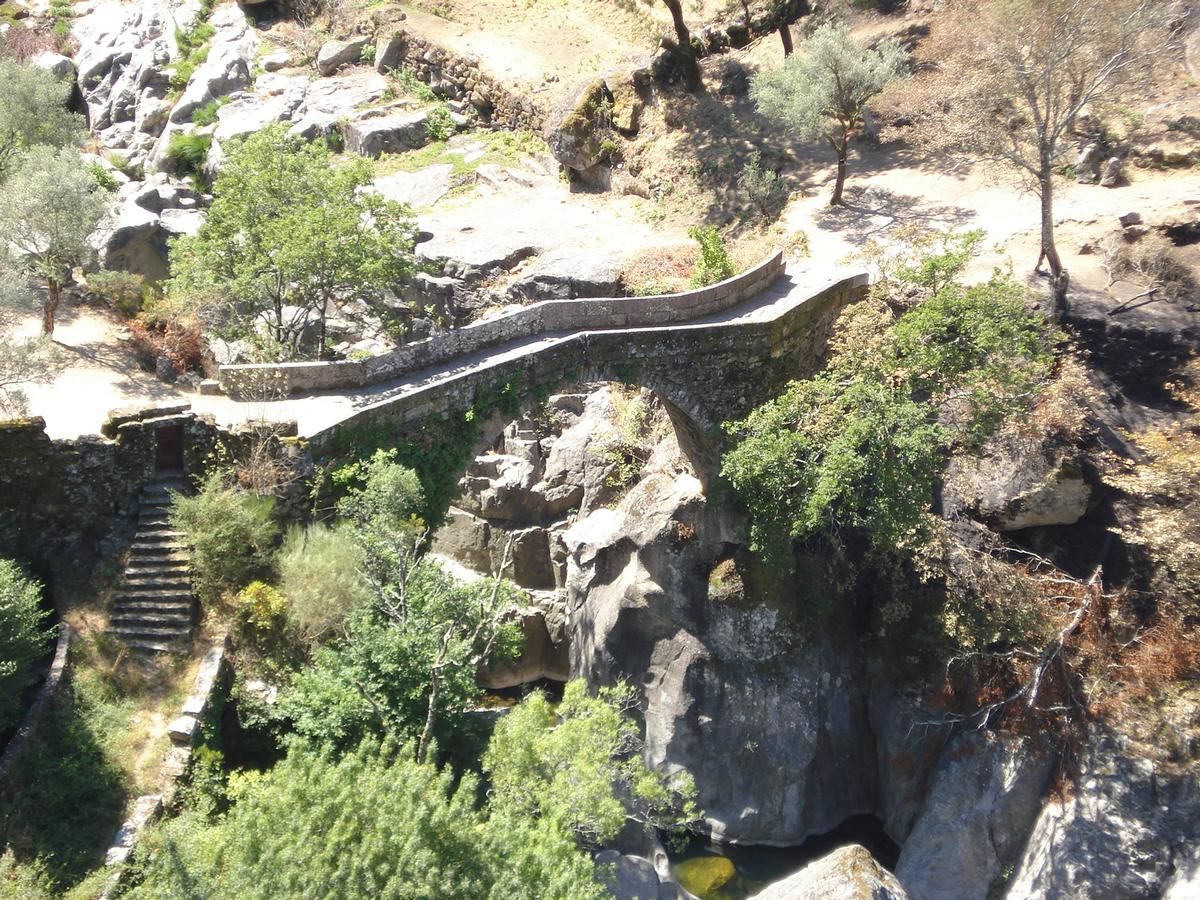
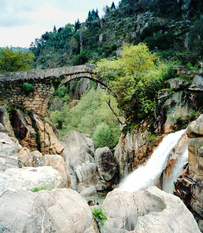
Bridge of Mizarela (Portuguese:Ponte da Mizarela) is a medieval bridge that crosses the Rio Rabagão, between the civil parish of Ruivães (municipality of Vieira do Minho) and civil parish of Ferral (in the municipality of Montalegre), the Portuguese district of Braga.
History
It was built in the Middle Ages and was reconstructed in the beginning of the 19th century.
Characteristics
It is implemented in an escarpment, set in rocks with some altitude relative to the riverbed. It consists of a single arch with a span of 13 m (43 ft).
Text imported from Wikipedia article "Ponte da Mizarela" and modified on 23 July 2019 under the CC-BY-SA 3.0 license.
Participants
Currently there is no information available about persons or companies having participated in this project.
Relevant Web Sites

- About this
data sheet - Structure-ID
20019584 - Published on:
17/02/2006 - Last updated on:
28/05/2021
Structurae cooperates with


