
General Information
| Other name(s): | Marshall Ford Dam |
|---|---|
| Beginning of works: | 19 February 1937 |
| Completion: | May 1942 |
| Status: | in use |
Project Type
| Structure: |
Gravity dam Embankment dam |
|---|---|
| Function / usage: |
Hydroelectric dam / plant Flood-control dam |
| Material: |
Concrete dam |
Location
| Location: |
Marshall Ford, Austin, Travis County, Texas, USA |
|---|---|
| Impounds: |
|
| Coordinates: | 30° 23' 31.92" N 97° 54' 25.92" W |
Technical Information
Dimensions
| height | 84.79 m | |
| length | 1 553 m | |
| crest length | 2 161 m | |
| base thickness | 65 m | |
| spillway capacity | 3 700 m³/s |
Materials
| dam structure |
concrete
|
|---|
Excerpt from Wikipedia
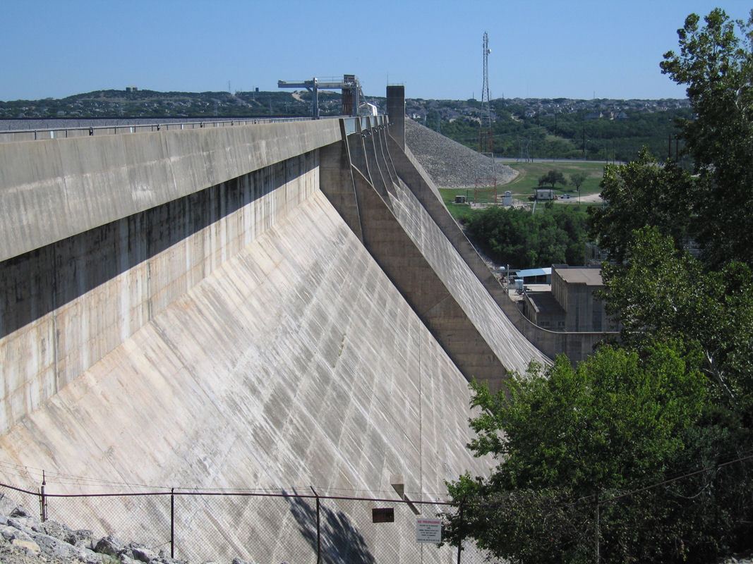
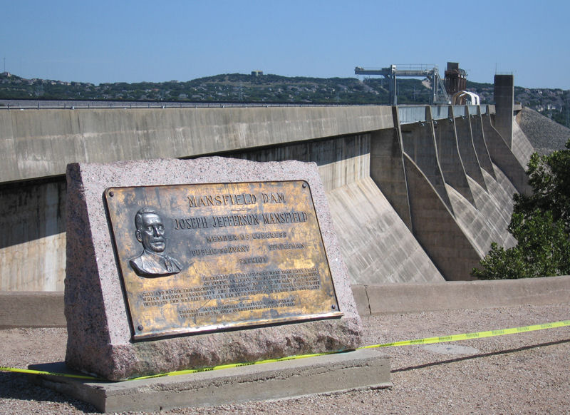
Mansfield Dam (formerly Marshall Ford Dam) is a dam located across a canyon at Marshall Ford on the Colorado River, 13 miles (21 km) northwest of Austin, Texas. The groundbreaking ceremony occurred on February 19, 1937, with United States Secretary of the Interior Harold L. Ickes attending. The dam was a joint project by the Lower Colorado River Authority (LCRA) and the United States Bureau of Reclamation, with partial funding provided by the Public Works Administration. Brown and Root, headed by James E. Walters, Sr., was the prime contractor. The dam was completed in 1941. Originally called Marshall Ford Dam, the name was changed in 1941 in honor of United States Representative J.J. Mansfield. The reservoir behind Mansfield Dam is named Lake Travis. The dam is owned and operated by the LCRA.
Mansfield Dam is 278 feet (85 m) high, 7,089 feet (2 km) long, and 213 feet (65 m) thick at the base. The concrete gravity dam with embankment wings and saddle dikes was designed to control flooding; to store 1.4 km³ (369 billion US gallons) of water; and to generate hydroelectric power (108 megawatts). The Spillway Elevation is 714 feet above Mean Sea Level (MSL). LCRA begins to open floods gates when water reaches 681 feet above MSL. At 681 feet above MSL, discharge capacity exceeds 130,000 cfs as the lake rises.
A two-lane highway, RM 620, crossed the top of the dam, but traffic congestion brought on by the growth of the city of Austin and expanded popularity of recreation at Lake Travis forced the state to build a four-lane highway bridge on the downstream side of the dam. Traffic is no longer allowed on the road across the dam, except for service vehicles.
Text imported from Wikipedia article "Mansfield Dam"
and modified on 23 July 2019 under the CC-BY-SA 3.0 license.
Participants
Design
Relevant Web Sites

Relevant Publications
- (1984): Great American Bridges and Dams. A National Trust Guide. John Wiley & Sons, New York (USA), pp. 257-258.
- About this
data sheet - Structure-ID
20003654 - Published on:
17/06/2002 - Last updated on:
27/01/2022
Structurae cooperates with


