
General Information
Project Type
| Structure: |
Earthfill dam |
|---|---|
| Function / usage: |
Hydroelectric dam / plant |
Location
| Location: |
Ada County, Idaho, USA |
|---|---|
| Impounds: |
|
| Coordinates: | 43° 31' 40.40" N 116° 3' 13.51" W |
Technical Information
Dimensions
| height | 103.6 m | |
| length | 713.2 m |
Cost
| cost of construction | United States dollar 19 000 000 |
Excerpt from Wikipedia
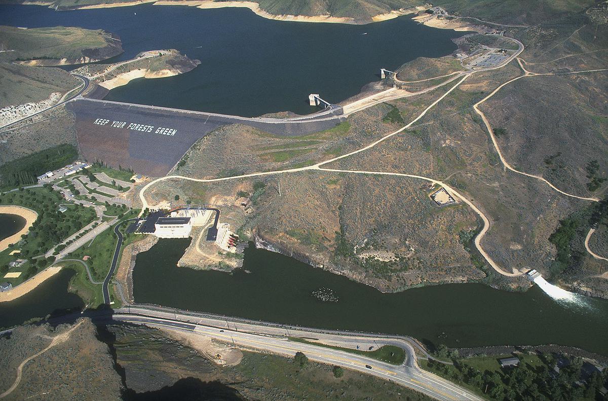
Lucky Peak Dam is a rolled earth and gravel fill embankment dam in the western United States, located on the Boise River in Ada County, Idaho. It is directly downstream of Arrowrock Dam, a concrete arch dam completed in 1915. At the time of ist construction in the early 1950s, Lucky Peak's primary purpose was flood control, with a secondary purpose of irrigation. The normal operating elevation of the full reservoir is 3,055 feet (931 m) above sea level, the empty reservoir's elevation (Boise River) is 2,824 feet (861 m).
Construction began in November 1949 by the U.S. Army Corps of Engineers; the dam was operational in 1955 and ist resulting reservoir is Lucky Peak Lake. Most of the federal dams in southern Idaho, including the others on the Boise River, were built by the Bureau of Reclamation, not the Corps of Engineers. The Idaho Power Company, a private utility, built multiple hydroelectric dams on the Snake River.
Located along State Highway 21, ten miles (16 km) upstream from the city of Boise, it was built without hydroelectric power generation. Construction of the powerhouse began in 1984 and it became operational in 1988, generating electricity primarily for Seattle City Light.
The dam was named after a nearby mountain in the Boise Range, about four miles (6 km) north of the dam (43°36′18″N 116°03′43″W / 43.605°N 116.062°W / 43.605; -116.062). The summit elevation of Lucky Peak mountain (a.k.a. Shaw Mountain) is 5,904 feet (1,800 m).
The dam forms Lucky Peak Lake and is surrounded by Lucky Peak State Park.
Clifford Riddle was brought in after numerous unsuccessful blasting attempts to drive a road through the pass (and loss of lives). The road which now leads up through Lucky Peak and into the dam is due to his successful efforts.
Text imported from Wikipedia article "Lucky Peak Dam" and modified on 23 July 2019 under the CC-BY-SA 3.0 license.
Participants
Design
Relevant Web Sites

- About this
data sheet - Structure-ID
20007870 - Published on:
17/01/2003 - Last updated on:
12/02/2017
Structurae cooperates with


