
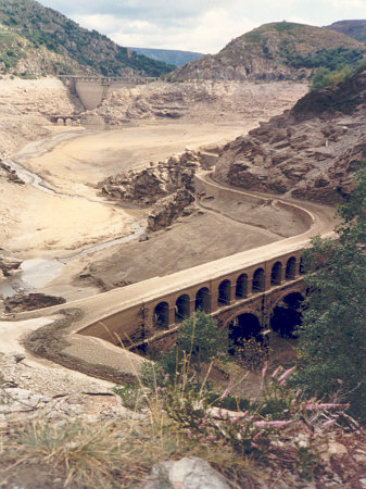
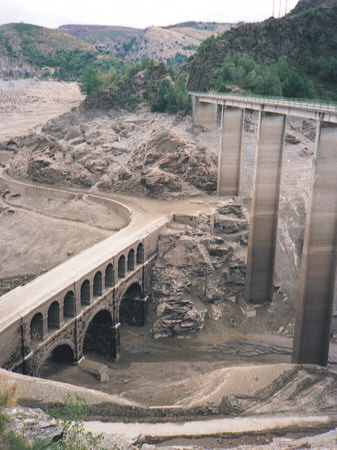
General Information
| Name in local language: | Pont Louis-Philippe |
|---|---|
| Beginning of works: | 1843 |
| Status: | submerged |
Project Type
| Structure: |
Two-story semi-circular arch bridge |
|---|---|
| Function / usage: |
Road bridge |
| Material: |
Masonry bridge Structurae Plus/Pro - Subscribe Now! |
Location
| Location: |
Villefort, Lozère (48), Occitanie, France |
|---|---|
| Crossed: |
|
| Coordinates: | 44° 26' 58.35" N 3° 55' 19.31" E |
Technical Information
Materials
| piers |
stone
|
|---|---|
| arches |
stone
|
Participants
Currently there is no information available about persons or companies having participated in this project.
Relevant Web Sites
There currently are no relevant websites listed.
- About this
data sheet - Structure-ID
20013899 - Published on:
20/10/2004 - Last updated on:
05/02/2016
Structurae cooperates with


