


General Information
| Other name(s): | Interstate I-74 |
|---|---|
| Status: | in use |
Project Type
| Function / usage: |
Motorway / Freeway / Interstate |
|---|
Location
| km | Name |
Technical Information
Dimensions
| total length | 672 km |
Excerpt from Wikipedia
Interstate 74 (I-74) is an Interstate Highway in the midwestern and southeastern United States. Its western end is at an interchange with Interstate 80 in Davenport, Iowa (Quad Cities); the eastern end of its Midwest segment is at an interchange with Interstate 75 in Cincinnati, Ohio. The major cities that I-74 connects to includes Davenport, Iowa; Peoria, Illinois; Champaign, Illinois; Indianapolis, Indiana; and Cincinnati, Ohio. I-74 also exists as several disconnected sections of highways in North Carolina.
Route description
Iowa
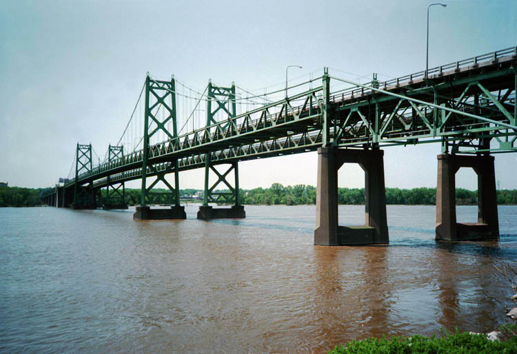
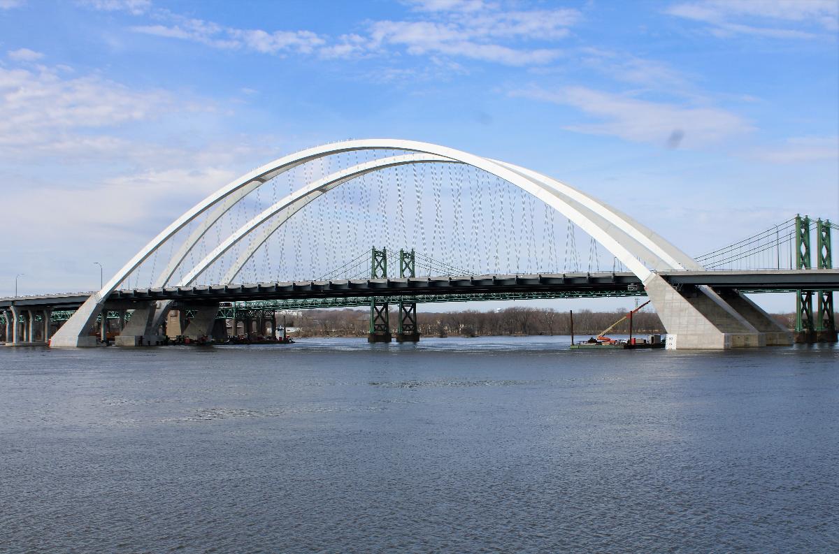
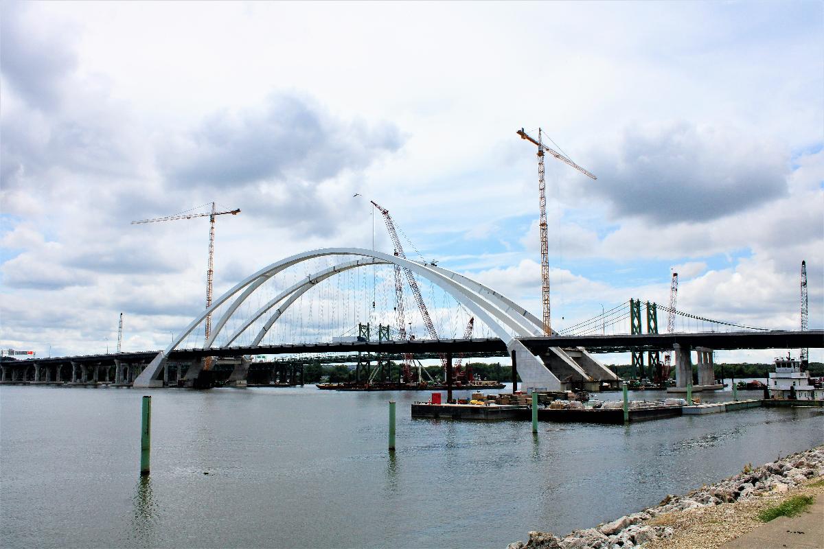
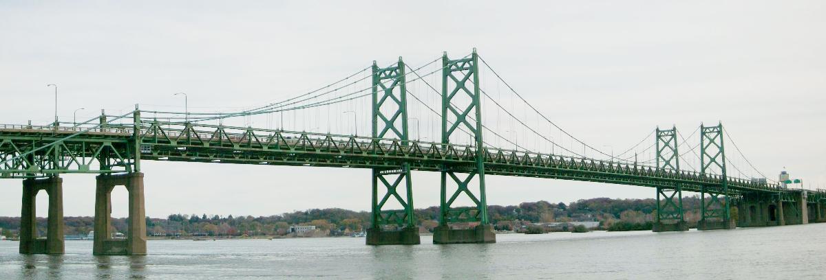
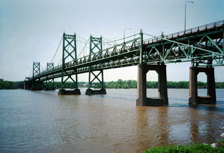
In the state of Iowa, Interstate 74 runs south from Interstate 80 for 5.36 miles (8.63 km) before crossing into Illinois on the Interstate 74 Bridge. North of the Mississippi River, I-74 bisects Bettendorf and Davenport.
Illinois
In the state of Illinois, Interstate 74 runs south from Moline to Galesburg; from this point it runs southeast through Peoria to the Bloomington-Normal area and Interstate 55. I-74 continues southeast to the Champaign-Urbana area, intersecting with Interstate 57. The interstate then runs east past Danville at the Illinois-Indiana state line. U.S. Route 150 parallels Interstate 74 in Illinois for its entire length, save the last few miles on the eastern end (in Danville, when US 150 turns south on Illinois 1), where it parallels U.S. Route 136.
Indiana
In the state of Indiana, Interstate 74 runs east from the Illinois state line to the Crawfordsville area before turning southeast. It then runs around the city center of Indianapolis along Interstate 465. Once I-74 reaches the southeast side of Indianapolis it diverges from I-465 and continues to the southeast. It then enters Ohio in Harrison, Ohio.
Ohio
In the state of Ohio, Interstate 74 runs southeast from the Indiana border to the western segment's current eastern terminus at Interstate 75 just north of downtown Cincinnati. It is also signed with U.S. Route 52 for its entire length. While planned to continue through West Virginia and Virginia to the Interstate 74 section in North Carolina, the route remains unsigned or unbuilt past Cincinnati. At this point, I-74 would follow U.S. Route 52 east from Cincinnati and the current Interstate 74.
North Carolina
In the state of North Carolina, as of the end of 2018 I-74 exists in several segments, starting with a concurrency with I-77 at the Virginia border. This includes the most western portion from Interstate 77 to US 52 just south of Mount Airy, a segment first opened to traffic as a bypass of High Point then extended west to I-40 east of Winston-Salem and east to Interstate 73 near Randleman, then another along the southern segment of Interstate 73 and U.S. Route 220 from just north of Asheboro to south of Ellerbe, and finally a more eastern segment that runs from Laurinburg to an end at NC 41 near Lumberton. The latest segment to be signed, from I-40 to High Point, occurred after the federal government approved signing this section as I-74 in the summer of 2013, despite the highway not being up to current interstate standards. It was uncertain why the Federal Highway Administration made an exception, but this might have been the result of a misinterpretation when a state highway administrator asked for interstate designation for another section and "Future Interstate" for the section already completed that did not meet standards.
Future
Southeast extension
The 1991 plan to build Interstate 73 soon included an extension of I-74 from where it ended in Hamilton County to I-73 at Portsmouth, Ohio, possibly along Ohio State Route 32.
In November 1991, the United States Congress passed the $151 billion Intermodal Surface Transportation Efficiency Act that included the I-73/74 North-South Corridor and made I-73 a priority and included an extension of I-74 from Hamilton County to I-73 at Portsmouth.
On August 31, 1992, the Ohio Turnpike Commission passed a resolution to study making the extension of I-74 a toll road. Congress had authorized paying for 80 percent of the cost, but the state would have to pay the remainder of the $56 million.
It was estimated that improving US 52 to interstate standards in West Virginia would cost $2 billion. Still, by 1994, improvements to US 52 were planned, and future plans called for I-73 to follow that route. The I-74 extension seemed more certain.
The Ohio Turnpike Commission proposed that the extension run along Ohio State Route 32; while Rep. Jim Bunning of Kentucky wanted the road to begin in the west as part of a greater Cincinnati / Northern Kentucky bypass, returning to Ohio near Maysville, Kentucky.
Long-range plans call for I-74 to continue east and south of Cincinnati to North Carolina using OH 32 from Cincinnati to Piketon, Ohio, and then the proposed I-73 from Portsmouth (OH) through West Virginia (along current U.S. Route 52) to I-77. It would then follow I-77 through Virginia into North Carolina, where I-74 splits from Interstate 77 near the Virginia state line and runs eastward to northwest U.S. Route 52, which it will eventually follow to Winston-Salem, then through High Point to I-73. I-73 and I-74 overlap to Rockingham. In 1996 AASHTO approved the signing of highways as I-74 along its proposed path east (south) of I-81 in Wytheville, Virginia, where those highways meet Interstate Highway standards. North Carolina started putting up I-74 signs along its roadways in 1997. As of October 2009, Interstate 74 remains unbuilt in the state of West Virginia. WVDOT is currently upgrading the Tolsia Highway to four lanes, but not to Interstate Highway standards. As of December 2008, Interstate 74 is proposed to follow the path of Interstate 77 through the state of Virginia, but remains unsigned from the West Virginia border to the North Carolina border.
Two sections of I-74 in North Carolina are currently under construction. These include building the first part of a bypass of Rockingham with Interstate 73 by reconstructing US 220 to interstate standards for 4 miles south of Ellerbe and is scheduled to be completed in 2018 and the first segment of the Eastern Half of the Winston-Salem Northern Beltway which is constructing 4 miles (6.4 km) of the future I-74 freeway between Business 40/US 421 and U.S. 158, this project should also be completed by 2018.
The proposed path of I-74 east of I-95 in North Carolina is still being debated. The current plan takes the route along US 74 to NC 211 near Bolton then south along US 17 to near the South Carolina border. These sections are not currently proposed to be built perhaps for another 20 to 30 years. The N.C. Turnpike Authority–at the request of officials in Brunswick County–are studying whether a toll road could get the section of I-74 in that county built faster.
At one time, both I-73 and I-74 were to end at Georgetown, South Carolina.
On February 11, 2005, the North and South Carolina Departments of Transportation came to an agreement over where I-74 (and I-73) would cross the border between the two states. It was decided that I-74 would cross the line as a northern extension of the S.C. Highway 31. I-74 is then proposed to end south of Myrtle Beach at S.C. 707.
Starting around Laurinburg and Maxton and to the east, the I-74 runs concurrent with US 74. This was the first time that a U.S. and Interstate Highway with the same number have been designated on the same highway. A similar situation occurred more recently in June 2015 when Wisconsin started routing Interstate 41 along the route of U.S. 41.
Text imported from Wikipedia article "Interstate 74" and modified on 22 July 2019 under the CC-BY-SA 3.0 license.
Participants
Currently there is no information available about persons or companies having participated in this project.
Relevant Web Sites

Relevant Publications
- (2008): Simulation of Concrete Paving Operations on Interstate-74. In: Journal of Construction Engineering and Management, v. 134, n. 1 (January 2008), pp. 2-9.
- About this
data sheet - Structure-ID
10000748 - Published on:
20/08/2005 - Last updated on:
12/12/2023
Structurae cooperates with


