
General Information
Project Type
| Structure: |
Covered bridge Burr arch type truss bridge Through truss bridge |
|---|---|
| Support conditions: |
for registered users |
| Function / usage: |
original use: Road bridge |
| Material: |
Timber bridge |
| Plan view: |
Structurae Plus/Pro - Subscribe Now! |
Awards and Distinctions
| 2008 |
for registered users |
|---|
Location
| Location: |
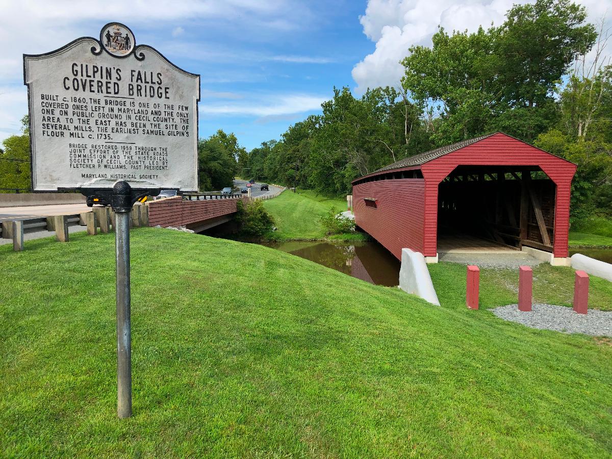
Bay View, Cecil County, Maryland, USA |
|---|---|
| Address: | North East Road (MD 272) |
| Coordinates: | 39° 38' 55.93" N 75° 57' 20.20" W |
Technical Information
Dimensions
| main span | 30.48 m | |
| total length | 36.27 m | |
| deck width | 4.27 m |
Notes
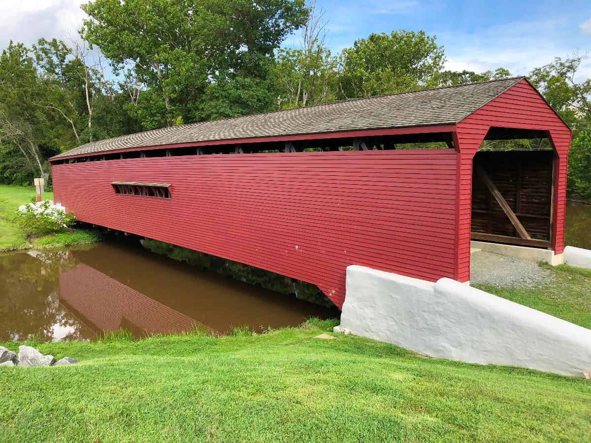
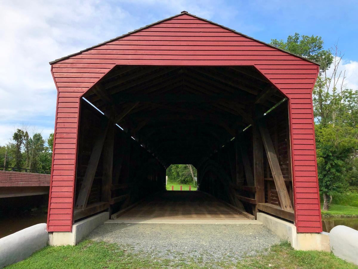
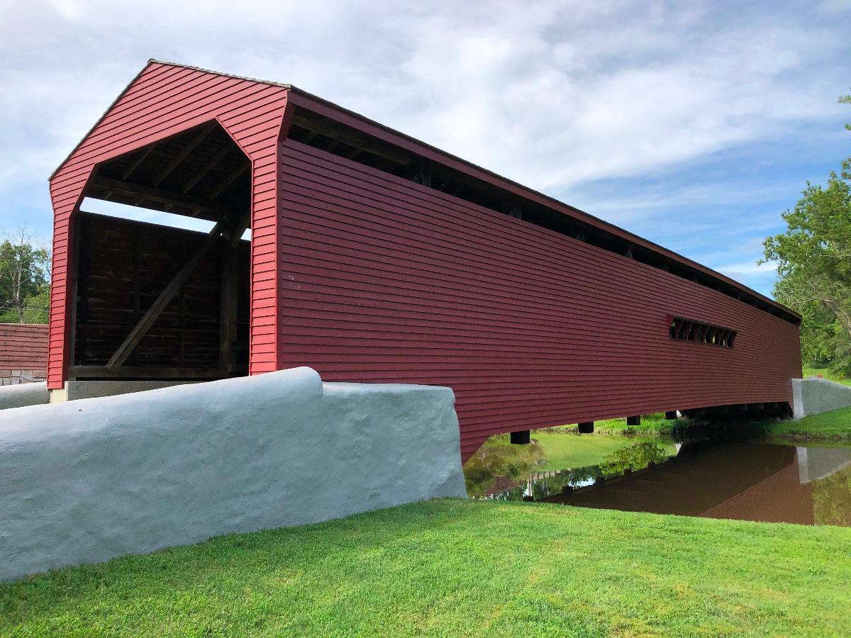
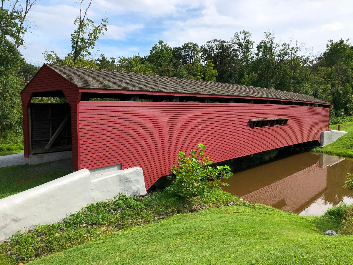
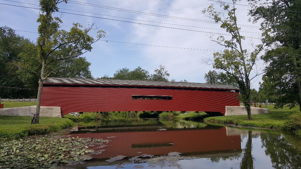
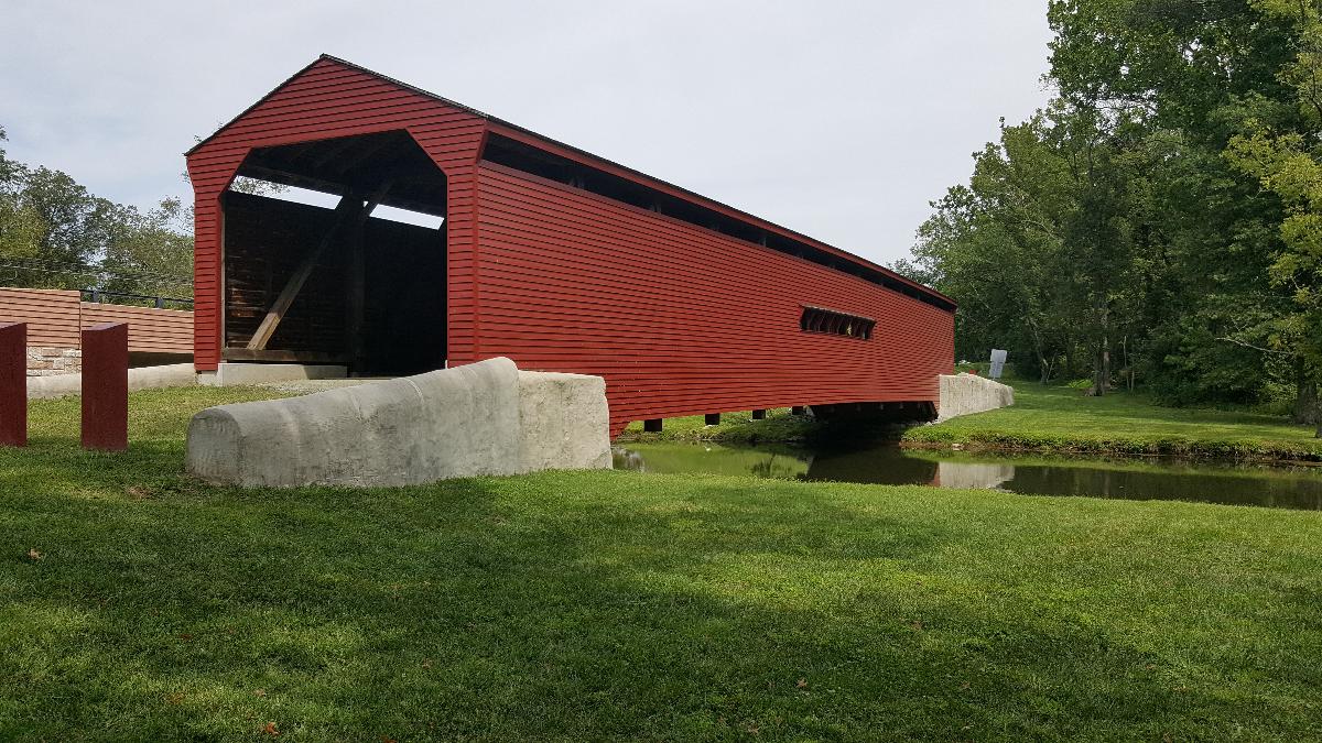
Gilpin’s Falls Covered Bridge spans North East Creek near the village of Bay View. It originally carried Nottingham Road, but was bypassed by the construction of MD Route 272 a short distance to the west (upstream). Constructed by contractor George Johnson in 1859-60, it is a Burr arch through truss structure. The bridge measures 119 feet in overall length, making it the longest surviving covered bridge in Maryland. The trusses consist of a series of twelve kingpost panels, with a pair of concentric timber arches fastened to the vertical members on both sides. The bridge rests on concrete abutments. The internal clear road width is 14 feet. Overhead clearance is approximately 13 feet. The bridge is capped with a gable roof covered in wood shingles; the exterior is clad in weatherboard siding which terminates below the eave line to allow light into the bridge. Horizontal window openings appear in both side walls, at mid-span. Just below the bridge, North East Creek drops 106 feet over Gilpin’s Falls, named for Samuel Gilpin, a distant relative of the Washington family, who acquired extensive land holdings in Cecil County in the early 1730s. Gilpin harnessed the Falls’ power to operate a grist and saw mill; in later years, a woolen mill and hydroelectric plant occupied the site. A dam breast, sluice, and foundation walls survive from these enterprises, located a short distance below the bridge. The Gilpin’s Falls Covered Bridge was closed to vehicular traffic in the early 1930s. Roofing and siding were replaced in 1958-59 following storm damage. Ownership was transferred to the Board of County Commissioners for Cecil County from the Maryland State Highway Administration in 1987. An engineering study in 1997 revealed significant deflection and side sway and advanced deterioration and insect infestation of the timbers, and the bridge was subsequently closed to pedestrian use. A comprehensive restoration is planned
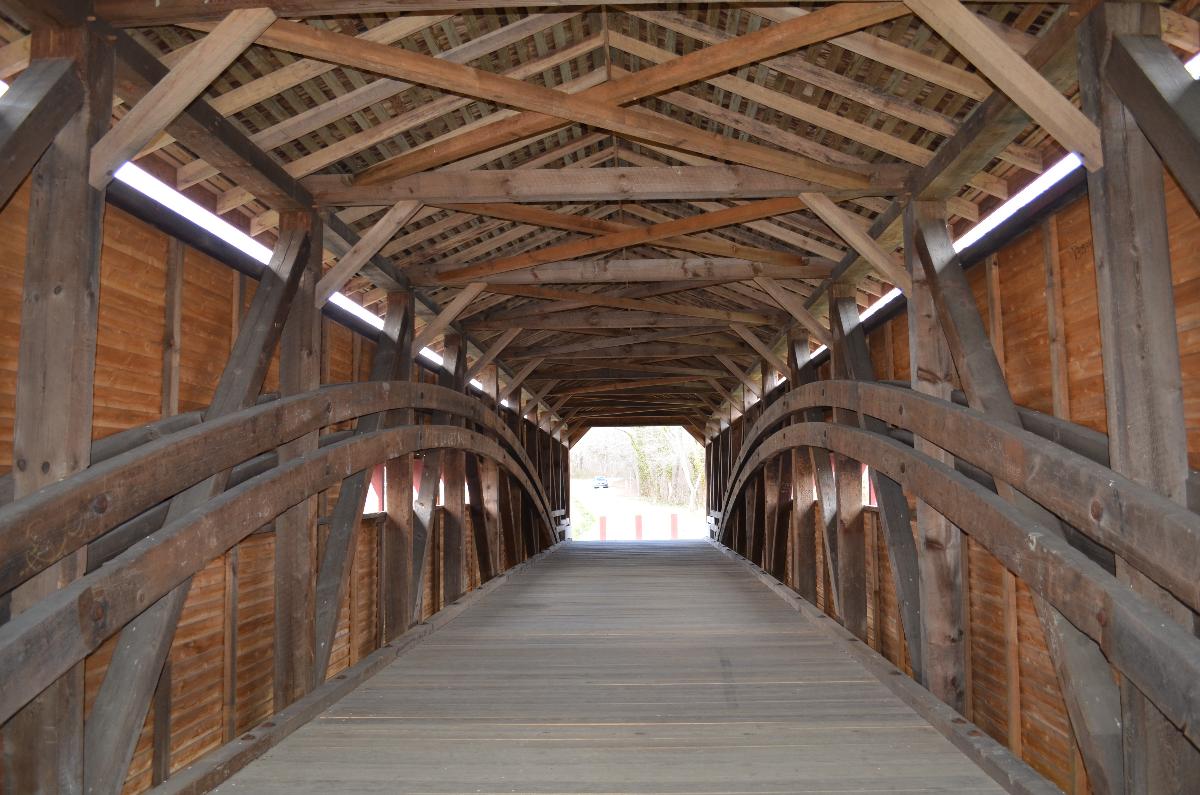
The Gilpin’s Falls Covered Bridge is architecturally significant as it exemplifies the type of structure patented by Theodore Burr of Connecticut in 1817. In Burr’s design, a series of king-post trusses was combined with a long wooden arch, a combination which resulted in a stronger bridge. Single king posts had been used since the Middle Ages for short crossings. Nineteenth-century bridge builders learned to combine a series of structural triangles into a unified span. In Burr’s truss, the arch, upper chord, and the diagonals act under compression; the vertical members and lower chord act under tension. A gable roof and weatherboard siding protected the structural members from deterioration by exposure to weather. The Gilpin’s Falls bridge is one of only six covered bridges surviving in Maryland, and one of two located in Cecil County. A ubiquitous form in the latter 19th century--some 50 covered bridges are said to have existed in Harford County alone--the covered timber bridge was quickly superseded by metal and , later, concrete structures which were invulnerable to rot, insects, and fire. Maryland’s surviving covered bridges include four Burr-truss structures: Gilpin’s Falls, Fair Hill, Jerusalem/Jericho (1865), and Utica (c. 1860). The other two were constructed without Burr’s reinforcing arch: Loys Station (c. 1865) is a multiple king-post truss, and Roddy Road (c. 1860) is a shorter span with a single king-post truss. At 119 feet in length, it is the longest remaining wooden covered bridge in Maryland.
Excerpt from Wikipedia
The Gilpin's Falls Covered Bridge is a Burr arch through truss wooden covered bridge in Bay View, Cecil County, Maryland, United States, close to the town of North East. The bridge was constructed by local Cecil County bridgewright Joseph George Johnson in the autumn and winter of 1860-61 across North East Creek. The bridge was erected adjacent to and upstream of Samuel Gilpin's mills and dam and crosses the millpond formed by it. This bridge has a span of 100 feet (30 m) and a total length of 119 feet (36 m) with its shelter panel overhangs, is 13.5 feet (4.1 m) wide, and is closed to all vehicular traffic.
The structure was restored in 1959 by the State Roads Commission and the Historical Society of Cecil County. In 2010 the bridge was rehabilitated by engineers Wallace, Montgomery & Associates, LLP; contractor Kinsley Construction; and specialist bridgwrighting subcontractors, Barns & Bridges of New England, the Truax Timberwright Woodworks, and New World Restoration.
Gilpin's Falls Covered Bridge was listed on the National Register of Historic Places in 2008.
Construction details
The bridge's trusses, floor beams, ties, and lateral bracing systems are framed almost entirely of Eastern White Pine (Pinus strobus), a species typically favored for wooden bridge framing in areas of the country where it was found, for its strength-to-weight ratio. So favored for this purpose, it was commonly imported into areas where it was unavailable as an indigenous species (minimizing dead load a strategy for increasing capacity for live load). Original rafters were quite easily identifiable from those replaced after the 1958 roof collapse, and were (as are the newly replicated replacements) framed with tulip poplar (Liriodendron tulipifera), also a lightweight species favored by the bridgewrighting community where available. Replicated rafters, like their predecessors, are tapered over their length, one inch wider at their tail than at the ridge. This was likely not an esthetic choice, but done as part of an overall strategy to minimize dead load. The original floor beams were replaced sometime in the 1920s, the bridges final decade of service, with mixed species ash and oak. This was an attempt to increase load capacity. The only original white pine floorbeam to escape replacement was the one found at the centerline of truss, which was tenoned through the king post at midspan. All others were bolted to the sides of their adjacent posts, and were easily replaced. This strategy seems to have failed (the bridge was bypassed in the following decade) and the additional weight was part of the reason why the bridge's framing became severely distorted in the decades of neglect to follow. These hardwood replacements had heavy infestations of deathwatch and powderpost beetles (Bostrichoidea) and were again replaced with timbers of appropriate species in the recently completed restoration.
Text imported from Wikipedia article "Gilpin's Falls Covered Bridge" and modified on 30 November 2021 according to the CC-BY-SA 3.0 license.
Participants
Contractor
Relevant Web Sites

- About this
data sheet - Structure-ID
20048083 - Published on:
09/09/2009 - Last updated on:
22/12/2021
Structurae cooperates with


