
General Information
Project Type
| Structure: |
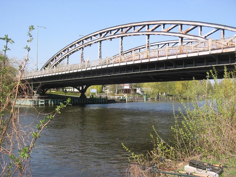
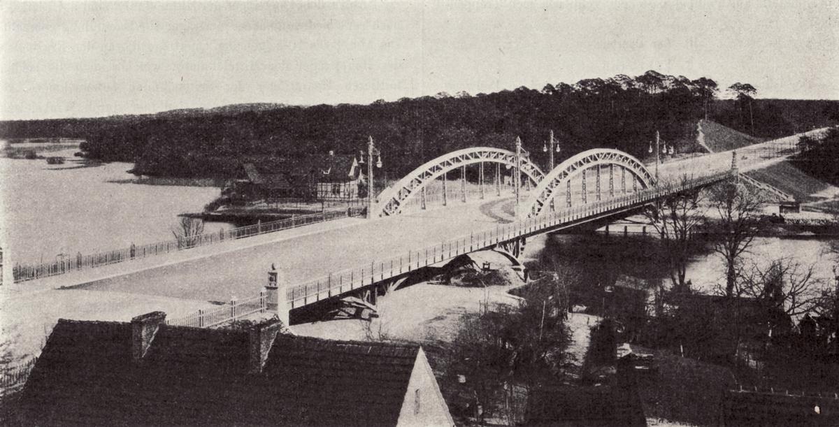
Truss arch bridge Through arch bridge |
|---|---|
| Function / usage: |
Road bridge |
Location
| Location: |
Berlin-Wilhelmstadt, Spandau, Berlin, Germany |
|---|---|
| Address: | Heerstraße (B 2/5) |
| Crosses: |
|
| Replaced by: |
Freybrücke (2017)
|
| Coordinates: | 52° 30' 42.36" N 13° 12' 11.27" E |
Technical Information
Dimensions
| main span | 63 m | |
| total length | 174 m |
Quantities
| timber | 24 m |
Participants
Design
- Karl Bernhard (designer)
Relevant Web Sites

Relevant Publications
- (2010): Der Bauingenieur Karl Bernhard. In: Bautechnik, v. 87, n. 4 (April 2010), pp. 220-228.
- (2016): Schicksal der Freybrücke - ein Baudenkmal wurde entsorgt. In: Stahlbau, v. 85, n. 2 (February 2016), pp. 161-168.
- (1911): Stößensee- und Havelbrücke im Zuge der Döberitzer Heerstraße. In: Zeitschrift für Bauwesen, v. 61 ( 1911), pp. 322–358.
- About this
data sheet - Structure-ID
20059244 - Published on:
19/01/2011 - Last updated on:
24/05/2016
Structurae cooperates with


