
Brooklyn Bridge – City Hall Subway Station (Lexington Avenue Line)
General Information
| Completion: | 1904 |
|---|---|
| Status: | in use |
Project Type
| Structure: |
Underground structure |
|---|---|
| Function / usage: |
Below grade metro or light-rail station |
Location
Technical Information
There currently is no technical data available.
Excerpt from Wikipedia
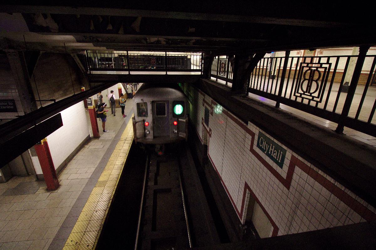
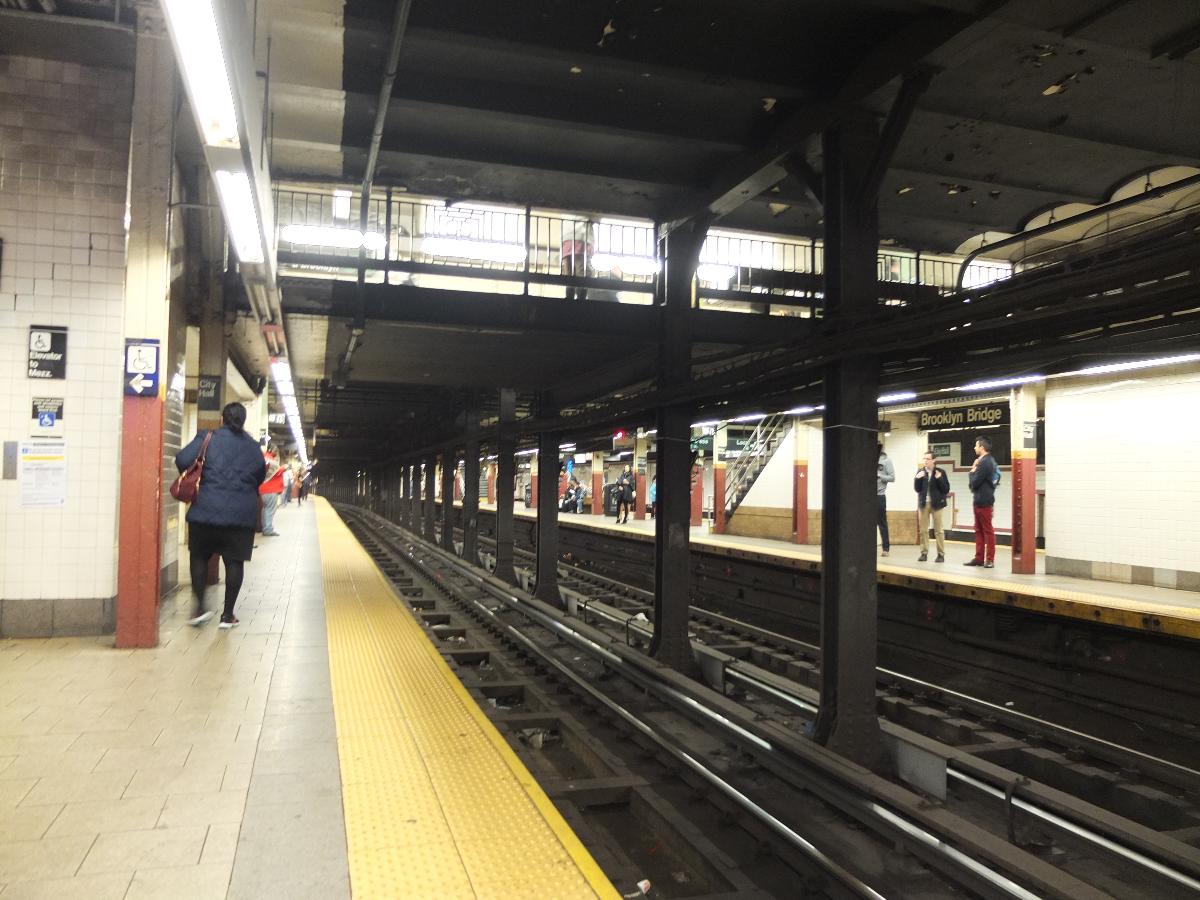
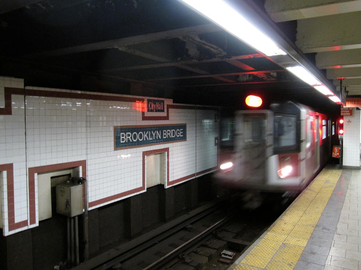
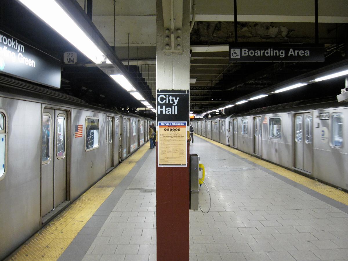
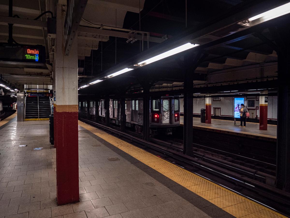
Brooklyn Bridge–City Hall/Chambers Street is a New York City Subway station complex in Lower Manhattan. The complex is served by trains of the IRT Lexington Avenue Line and the BMT Nassau Street Line. The following services stop at this station:
- 4, 6, and J trains at all times
- 5 train at all times except late nights
- <6> train on weekdays in the peak direction
- Z skip-stop train during rush hours in the peak direction
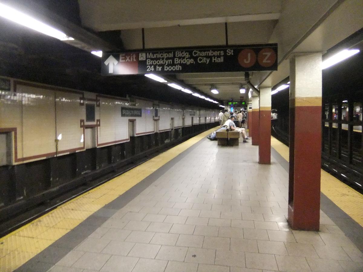
BMT Nassau Street Line platforms
Chambers Street on the BMT Nassau Street Line is located at the intersection of Centre and Chambers Streets beneath the Manhattan Municipal Building. The station has four tracks, three island platforms, and one side platform (originally two).
The southbound platform is slightly higher at the southern end of the station because the next stop south, Fulton Street, is bi-level with the southbound platform being above the northern one. The two "express" tracks, currently unused in regular revenue service, merge into a single tail track south of the station. The tail track is 620 feet (190 m) long from the switch points to the bumper block, where an emergency exit is available. The tail track south of the station was the site of a train crash on November 6, 2007.
North of this station, there are two stub tracks, which end behind the now-closed Queens-bound side platform. These tracks were formerly connected to the Manhattan Bridge, until they were disconnected in 1967 as part of the Chrystie Street Connection, with the BMT Broadway Line being connected to the bridge instead. Also north of this station, the former southbound express track (now the northbound track) splits into two tracks just south of Canal Street: the former northbound local track, and the former southbound express track (the current northbound track).
The tile work on this station includes a depiction of the nearby Brooklyn Bridge that has a subtle mistake: it features the parallel up-down cables between the main cable and the roadway (as seen alone on most suspension bridges) but misses the second set of diagonal cables that radiate from the bridge to the roadway (as seen on cable-stayed bridges).
History
The station opened on August 4, 1913. When it was being built before World War I, Chambers Street was designed to be the BMT's Manhattan hub, with trains arriving from Brooklyn in both directions, and terminating here. It was envisioned as a City Hall terminal, a kind of downtown Grand Central Terminal at a time when the business and population center of the city was still closer to the southern end of the island. Three years after the Chambers Street station opened, its four wide platforms were so overcrowded that one newspaper article described them as "more dangerous during the rush hours than at the Grand Central or the Fourteenth Street Stations."
Originally, trains arrived from the north via either the Williamsburg Bridge or the Manhattan Bridge; the connection to the Montague Street Tunnel had not yet been completed. The loop configuration permitted trains arriving in either direction from the BMT Fourth Avenue Line in Brooklyn to pass through Chambers Street and return to Fourth Avenue without having to reverse direction. The BMT Brooklyn Loops, a track connection to the Brooklyn Bridge that would have connected to the Williamsburg Bridge tracks, was planned in the station's design, but was only partially built. The finished portions of the tunnel to the Brooklyn Bridge led directly to wine vaults under the bridge.
By the mid-1920s, the subway itself was pushing the city's population north and leaving Chambers Street behind. The Nassau Street Loop was completed in 1931, making Chambers Street a through station south to the Montague Street Tunnel to Brooklyn. At this point, the center island platform and the two side platforms were closed. By the 1950s, many of the city's business interests had shifted to Midtown. The west side platform was walled up and most of it was destroyed when Brooklyn Bridge–City Hall on the IRT Lexington Avenue Line was rebuilt on the other side of the wall in 1960–62. The Chrystie Street Connection, completed in 1967, severed the Nassau line's connection to the Manhattan Bridge, so that the bridge tracks could connect instead to the uptown IND Sixth Avenue Line. The tracks heading towards the Manhattan Bridge (now used for train storage) are visible from northbound trains leaving Chambers Street.
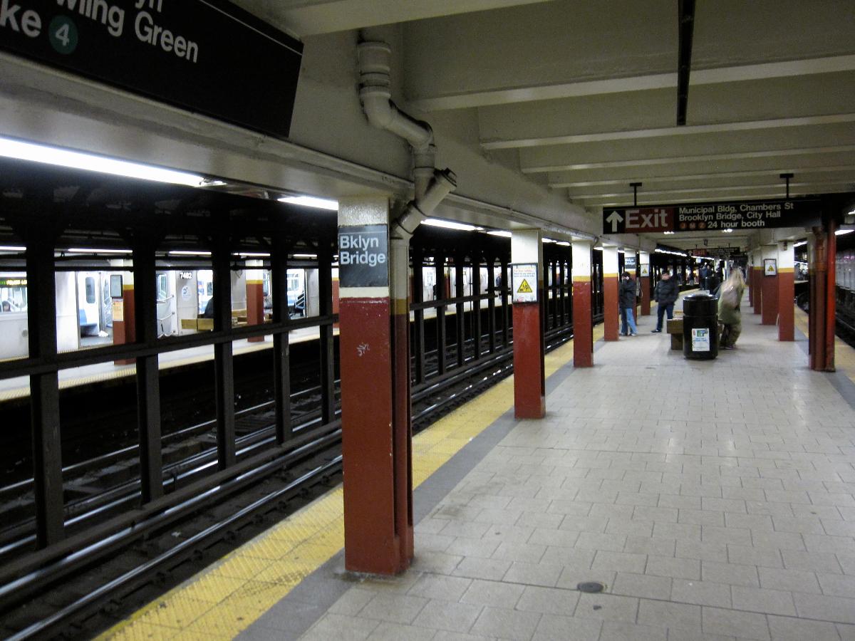
Although altered over the years to account for changing ridership patterns, the station has not been renovated. In a 2003 poll, it was voted the ugliest station in the system. In May 2018, it was announced that the MTA would start renovating the Chambers Street station that August. The station will receive two platform elevators and three new ramps in the mezzanine. One ramp will allow passengers using the Chambers Street mezzanine to use the street elevator in the Brooklyn Bridge–City Hall station. The two other ramps will lead to the two platform elevators. The station platforms will be modified to reduce the gap between trains and the platform edges, and a pedestrian bridge will be installed above the tracks, connecting both of the open platforms. To accommodate the ramps, elevators, and pedestrian bridge, portions of the station and mezzanine will need to be removed or reconfigured. These improvements will make the station compliant with the Americans with Disabilities Act of 1990, and are being funded as part of the 2015–2019 MTA Capital Program. The project will take at least 24 months to be completed. A contract for the elevators' construction was awarded in August 2018, and substantial completion is projected for August 2020.
Exits
The BMT station has two main exits/entrances, both of which are shared with the IRT station via a passageway:
- Stair on south edge of Foley Square
- Stair under Manhattan Municipal Building just southeast of the intersection of Centre and Chambers Streets
Text imported from Wikipedia article "Brooklyn Bridge-City Hall/Chambers Street station" and modified on 02 June 2020 according to the CC-BY-SA 3.0 license.
Participants
Currently there is no information available about persons or companies having participated in this project.
Relevant Web Sites

Relevant Publications
- Brooklyn Bridge Terminal Station and Subway Loop. In: Scientific American, v. 96, n. 4 (26 January 1907), pp. 86.
- About this
data sheet - Structure-ID
20055627 - Published on:
22/03/2010 - Last updated on:
11/08/2023
Structurae cooperates with


