
General Information
Project Type
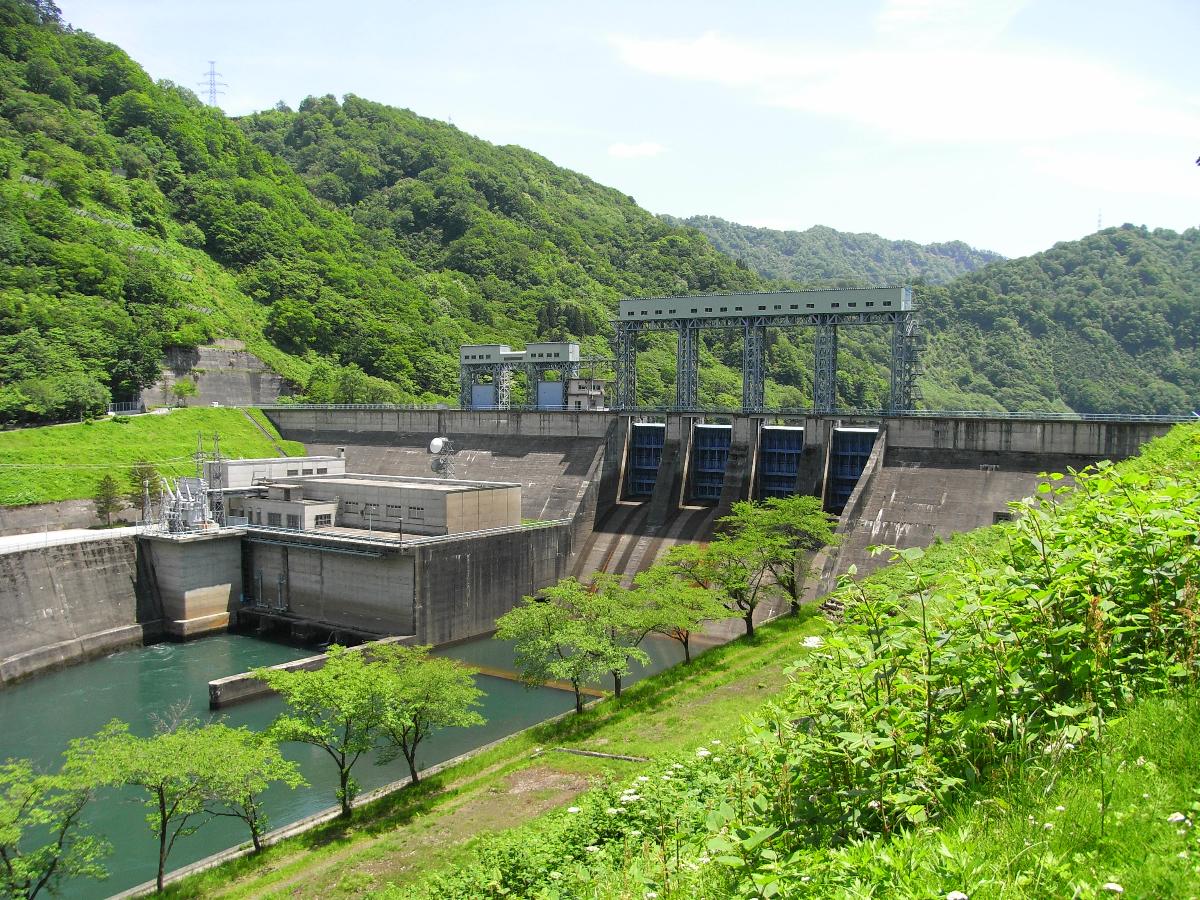
| Structure: |
Gravity dam |
|---|---|
| Function / usage: |
Hydroelectric dam / plant |
| Material: |
Concrete dam |
Location
Technical Information
Dimensions
| height | 46 m | |
| retained water volume | 27 000 000 m³ | |
| crest length | 264 m | |
| dam volume | 121 000 m³ |
Excerpt from Wikipedia
Taki Dam (滝ダム) is a gravity dam on the Tadami River, 7.3 km (5 mi) east of Tadami in Fukushima Prefecture, Japan. Surveys for the dam were carried out in 1958, construction began in 1959 and the dam was complete in 1961. The primary purpose of the dam is hydroelectric power generation and it supports a 92 MW power station consisting of 2 x 46 MW Kaplan turbines. The dam is 46 m (151 ft) tall and 264 m (866 ft) long. It creates a reservoir with a 27,000,000 m³ (21,889 acre⋅ft) capacity, of which 10,300,000 m³ (8,350 acre⋅ft) is active (or "useful") for power generation. The dam's spillway is controlled by four sluice gates and has a 200 m³/s (7,063 cu ft/s) discharge capacity.
Text imported from Wikipedia article "Taki Dam" and modified on 23 July 2019 under the CC-BY-SA 3.0 license.
Participants
Currently there is no information available about persons or companies having participated in this project.
Relevant Web Sites

- About this
data sheet - Structure-ID
20041522 - Published on:
18/12/2008 - Last updated on:
09/12/2015
Structurae cooperates with


