
General Information
| Completion: | 1st century |
|---|---|
| Status: | out of service |
Project Type
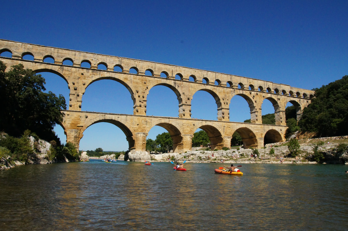
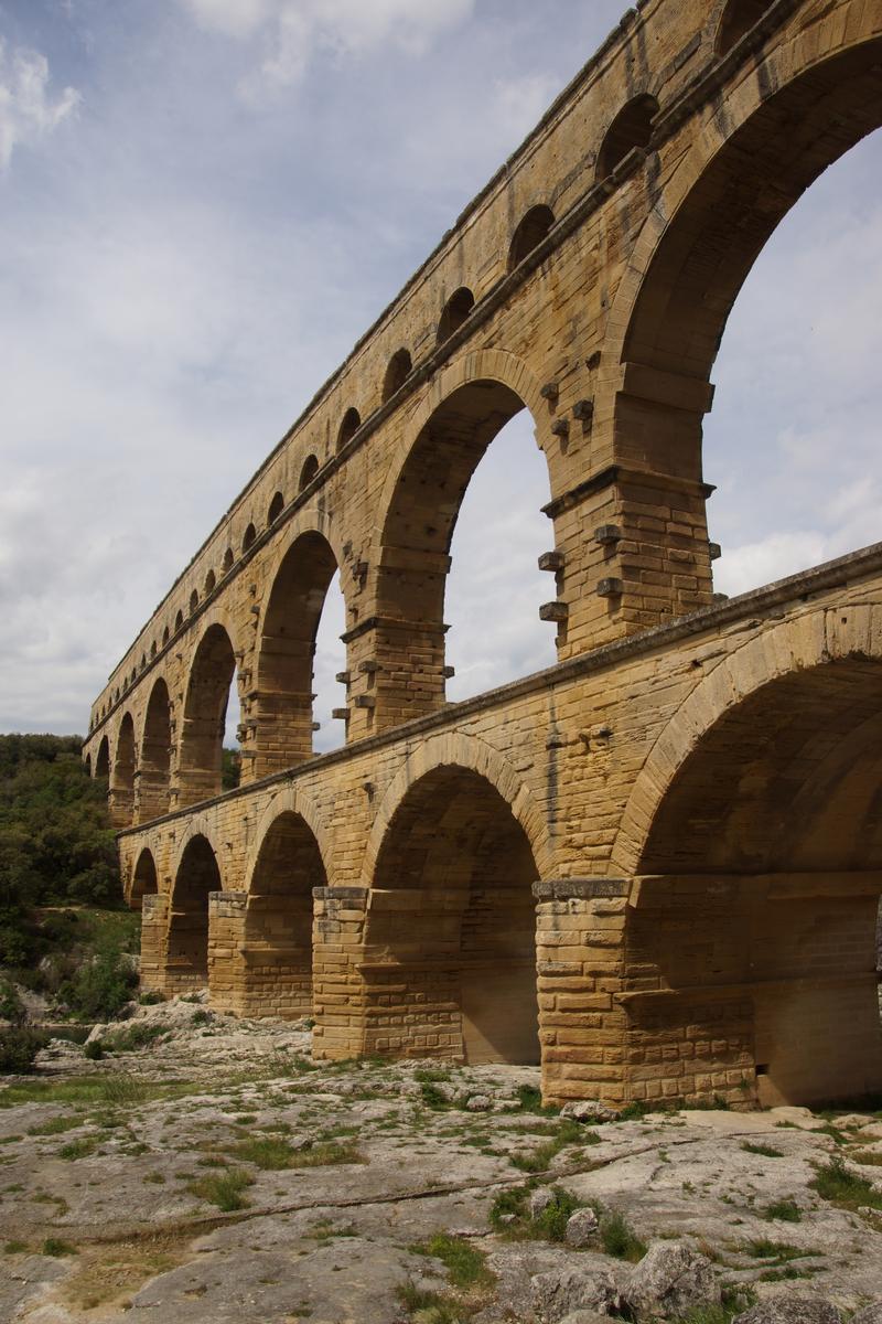
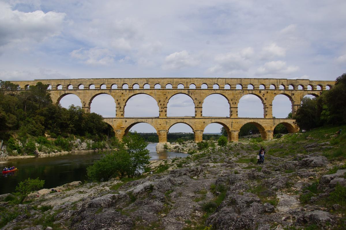
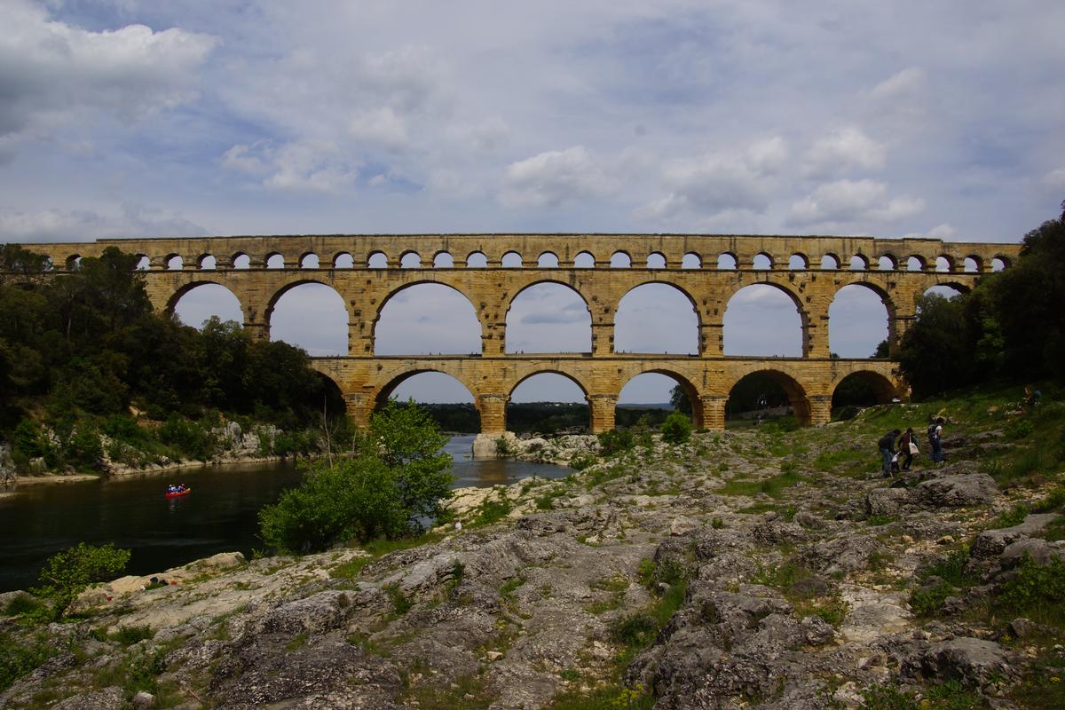
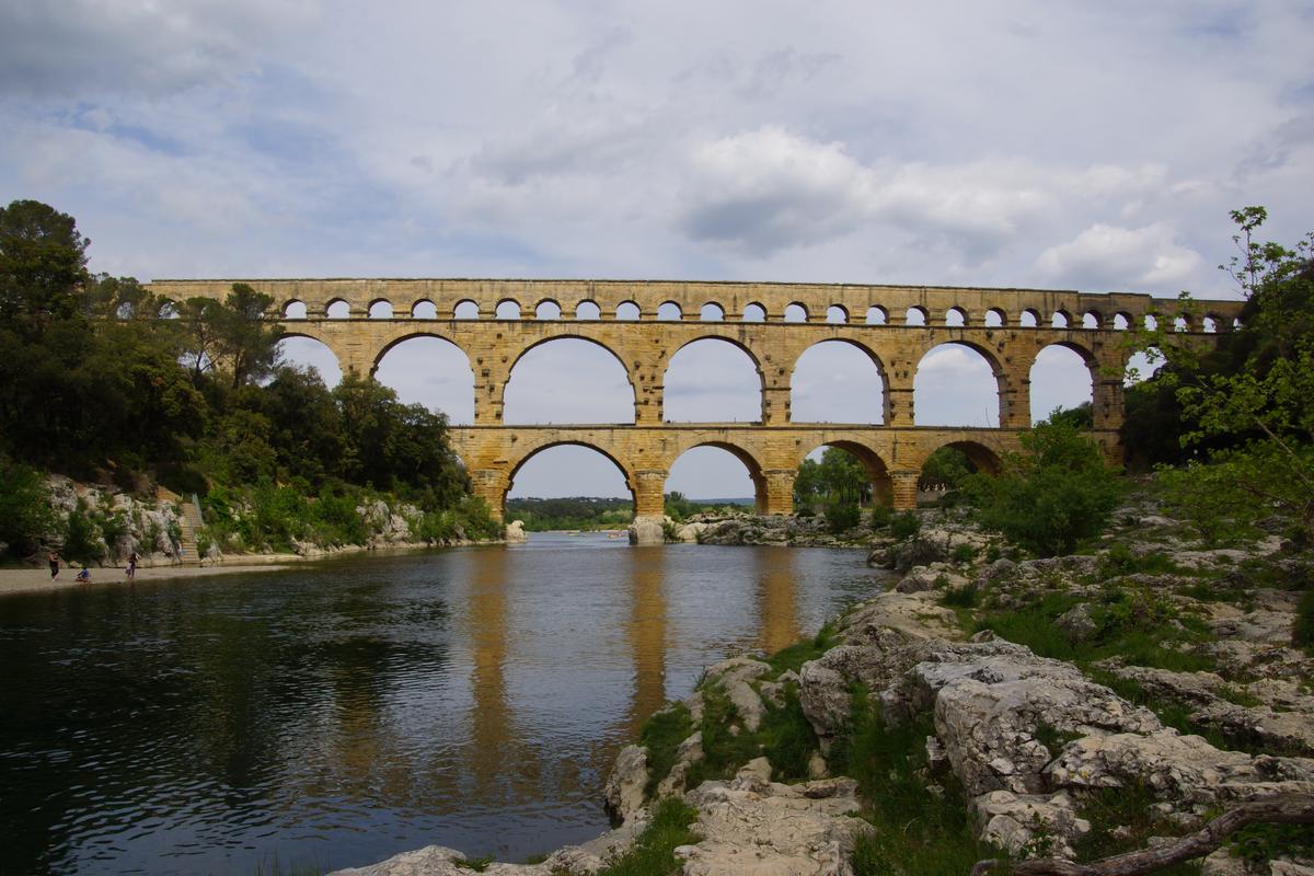
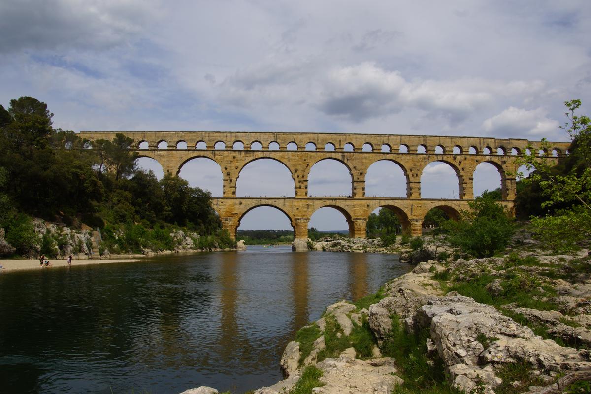
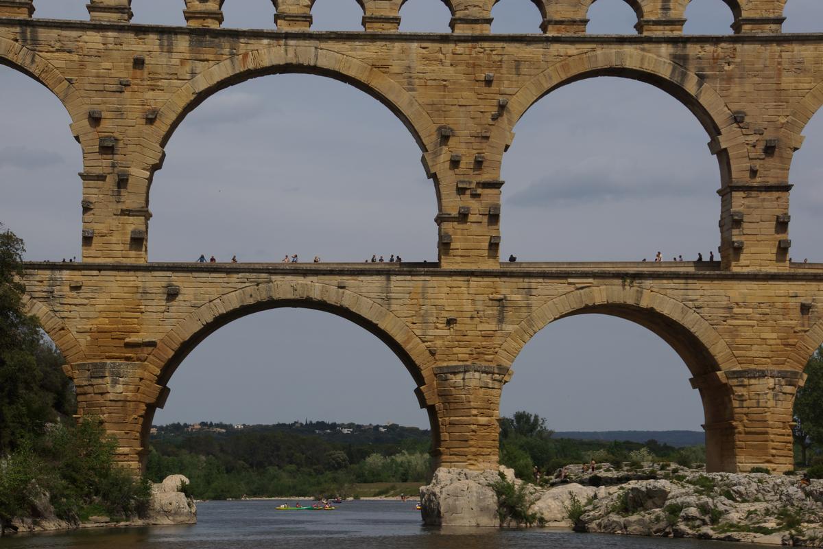
| Structure: |
Three-story semi-circular arch bridge |
|---|---|
| Function / usage: |
Aqueduct bridge later use: Road bridge |
| Material: |
Masonry bridge Structurae Plus/Pro - Subscribe Now! |
Awards and Distinctions
| 1985 |
for registered users |
|---|
Location
| Location: |
Vers-Pont-du-Gard, Gard (30), Occitanie, France |
|---|---|
| Crosses: |
|
| Part of: | |
| Coordinates: | 43° 56' 51" N 4° 32' 6" E |
Technical Information
Dimensions
| height | 47.40 m | |
| total length | 275 m | |
| longest span | 24.40 m | |
| slope of channel | 0.19 m / km | |
| width of channel | 1.20 m |
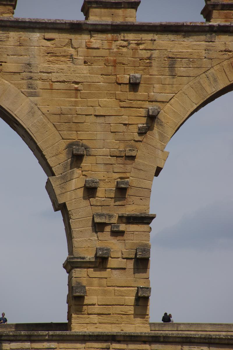
Materials
| piers |
stone
|
|---|---|
| arches |
stone
|
Chronology
| 40 A.D. — 60 | Approximate period of construction which is estimated to have taken 15 years in total for the entire aqueduct and 5 years for the Pont du Gard. Built in the reign of the emperors Claudius and Nero. |
|---|---|
| 1743 — 1745 | Lower arches widened to accommodate road bridge under the authority of Henri Pitot. |
| 1843 — 1850 | Restoration by architects Questel and Laisné due to Prosper Mérimée's interventions. |
| 6 December 1985 | Added to the World Heritage List of UNESCO. |
Participants
Relevant Web Sites


Relevant Publications
- (2000): L'aqueduc de Nîmes et le Pont du Gard. Archéologie - Géosystème - Histoire. 2nd edition, CNRS Éditions, Paris (France), pp. 483.
- (1993): L'art français (tome 1). Pré-moyen âge - Moyen âge. Flammarion, Paris (France), pp. 368.
- (2002): Bauplanung im Altertum. Werkstoffe, Tragsysteme, Konstruktionen und Verfahren. In: [ Umrisse ], v. 2, n. 3 ( 2002), pp. 6-13.
- (1997): Bridges. A history of the world's most famous and important spans. Black Dog & Leventhal, New York (USA), pp. 14-15.
- (2017): Bridges. A History of the World's Most Spectacular Spans. 2nd edition, Black Dog & Leventhal, New York (USA), ISBN 978-0316507943, pp. 12-13.
- About this
data sheet - Structure-ID
20000256 - Published on:
19/05/1999 - Last updated on:
30/05/2017
Structurae cooperates with


