
Reconstruction of Notre-Dame – 3D survey as immediate measure
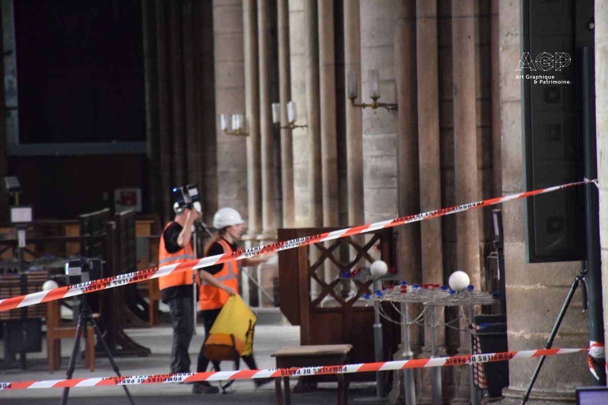
On Saturday, 20th April 2019, the AGP (Art Graphique & Patrimoine) team joined forces with FARO to carry out an emergency initiative to help save Notre-Dame. Conducted in just one day, this initiative involved carrying out a highly accurate 3D survey of the building in its post-fire state in order to assess the extent of the damage.
Media

The data collected during these initial post-disaster 3D surveys using laser scanners from FARO can now be compared to AGP's data from before the fire, thus providing useful information for the reconstruction process and ongoing investigation.
‘Operation Commando'
All of this data will allow everyone involved in the reconstruction process to access a reliable corpus of technical documents, 3D measurements and images. The purpose of that initiative, known as ‘Operation Commando', was to digitally map the entire cathedral, especially the parts that were most severely damaged. A week's worth of work was accomplished in just one day thanks to the hard work of the whole team. Taking into account the exceptional circumstances, FARO loaned its laser scanners to the digital mapping experts free of charge: this equipment has been used by AGP for more than 15 years and is perfectly suited for surveying our architectural heritage.
More than 300 colour scans, amounting to more than 30 billion points
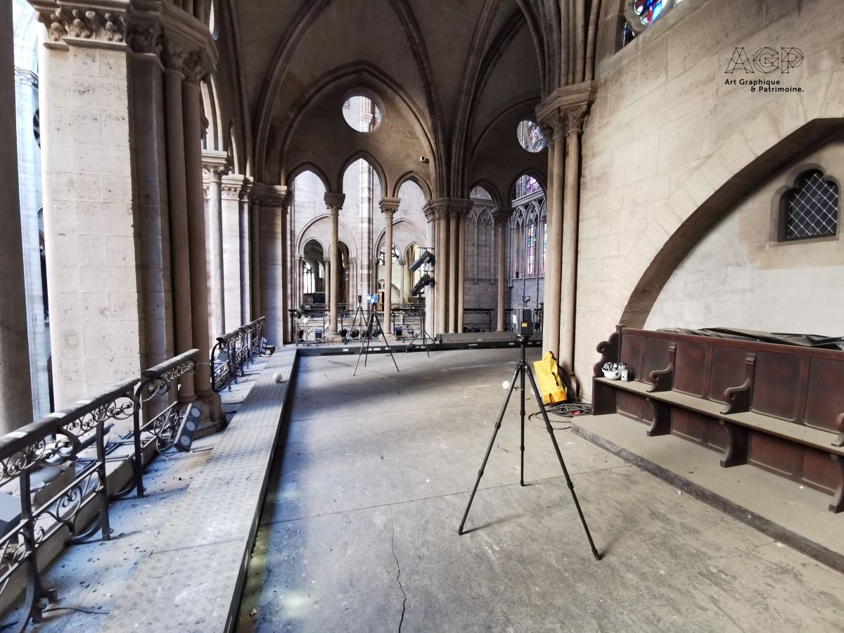
During this one-day operation, colour scans were taken from more than 300 positions, amounting to approximately 30 to 40 billion points. The inaccessible parts of the cathedral were mapped by means of photogrammetry using a drone.
This data will be used to assess the damage caused by the fire so as to ascertain which parts are most severely affected. This first stage of the reconstruction process is essential to saving the cathedral. Our teams are now working to process this mass of data (this involves assembling and consolidating the scans to form a complete point cloud, colourisation, and comparison with the pre-existing data).
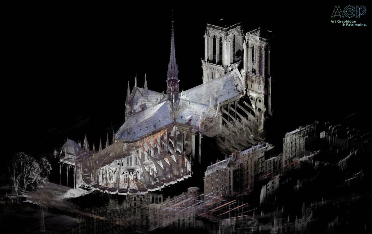
50 billion measurement points: The most complete 3D map of Notre-Dame
During the years that AGP has been in action, it has conducted multiple 3D surveys of the cathedral in collaboration with FARO using laser scanning technology and photogrammetry. Thanks to the assembled data, the team was able to generate point clouds of the parts of the building that were destroyed during the fire – namely the roof, the wooden frame (or ‘forest'), and the spire.
With 50 billion measurement points, AGP now has the most complete and accurate 3D map of Notre-Dame in existence, particularly in regards to the wooden frame and the spire, which were lost in the blaze.
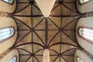
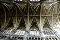
For the ‘forest structure', the following data has been collected: 150 scans with millimetre-level accuracy for a total of 3 to 5 billion points. The exceptional point density (approximately 1 to 2 points per mm²) allows for a recreation of the details of the wooden frame, roof and spine that is unrivalled in its accuracy. In 2010, AGP assisted and collaborated with Andrew Tallon in his campaign to digitally map Notre-Dame. Tallon carried out this digital mapping with millimetre-level accuracy based on a centimetre-level density as a part of his research into the construction systems used in cathedrals, and in so doing, obtained the general dimensions of the building. This video shows a journey through the point cloud of the roof structure.
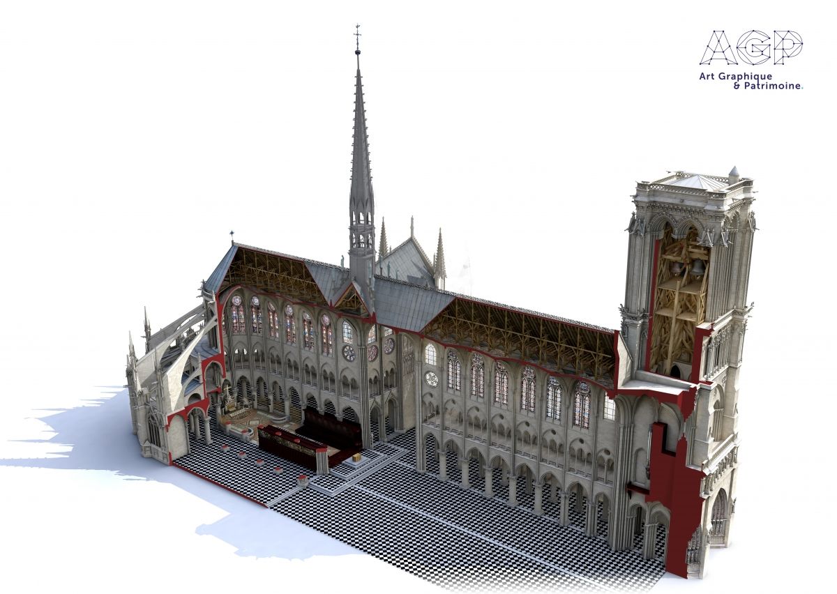
From 3D measurement to 3D modelling
Between 2010 and 2013, AGP's Laurence Stefanon also worked on a historic reconstruction of Notre-Dame by creating a 3D model encompassing 14 architectural phases, starting in 1163 and continuing right up to the present day. This 3D model was produced for an educational exhibition and includes a 3D reconstruction model of Notre-Dame that follows the development of the cathedral from its origins to the present day, before the fire occurred.
Details of the structure can be seen in this clip.
References

Structure Types
- About this
data sheet - Product-ID
7645 - Published on:
09/07/2019 - Last updated on:
09/07/2019