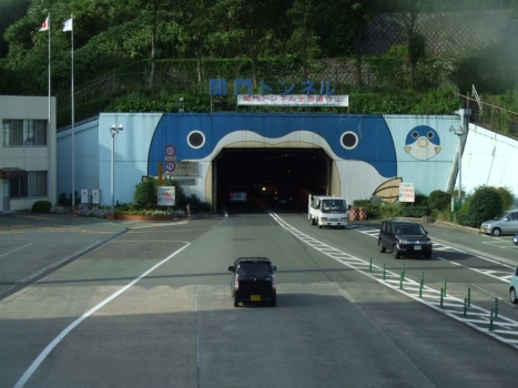
General Information
| Name in local language: | 関門国道トンネル (kanmon kokudō tonneru) |
|---|---|
| Beginning of works: | 1937 |
| Completion: | 9 March 1958 |
| Status: | in use |
Project Type
| Function / usage: |
Road tunnel |
|---|---|
| Structure: |
Tunnel |
| Function / usage: |
Subway (pedestrian tunnel) |
Location
| Location: |
Shimonoseki, Yamaguchi, Japan Kitakyushu, Fukuoka, Japan |
|---|---|
| Coordinates: | 33° 57' 5.08" N 130° 58' 8.41" E |
| Coordinates: | 33° 58' 30.60" N 130° 56' 50.86" E |
Technical Information
Dimensions
| tunnel length | 3 461 m |
Excerpt from Wikipedia
The Kanmon Railway Tunnel, Kanmon Roadway Tunnel, and Shin-Kanmon Tunnel are undersea tunnels crossing the Kanmon Straits between Shimonoseki, Yamaguchi, and Kitakyushu, Fukuoka in western Japan. When opened in 1942, the railway tunnel provided the first direct link between Honshu and Kyushu, two of Japan's four main islands.
Kanmon Roadway Tunnel
The Kanmon Roadway Tunnel (関門国道トンネル, kanmon kokudō tonneru) carries National Route 2 under the Kanmon Straits. It is the longest undersea road in the world. It opened in 1958. The overall length is 3,461 meters, and it is 58 meters below sea level at the deepest point. The endpoints are in Shimonoseki, Yamaguchi and Moji-ku, Kitakyushu.
Work on the Kanmon Roadway Tunnel began in 1937, but was halted in 1939 by World War II. Work resumed in 1952, and the tunnel was officially opened on March 9, 1958. The event was marked by a Japanese commemorative postage stamp. Major repairs were conducted in 2008.
Text imported from Wikipedia article "Kanmon Tunnel" and modified on July 23, 2019 according to the CC-BY-SA 4.0 International license.
Participants
Currently there is no information available about persons or companies having participated in this project.
Relevant Web Sites
There currently are no relevant websites listed.
- About this
data sheet - Structure-ID
20041659 - Published on:
25/12/2008 - Last updated on:
28/05/2021


