
General Information
Project Type
| Function / usage: |
Dirigible hangar |
|---|---|
| Material: |
Timber structure |
Awards and Distinctions
| 1993 |
for registered users |
|---|
Location
| Location: |
Tustin, Orange County, California, USA |
|---|---|
| Coordinates: | 33° 42' 35.25" N 117° 49' 29.30" W |
| Coordinates: | 33° 42' 10.64" N 117° 49' 26.52" W |
Technical Information
Dimensions
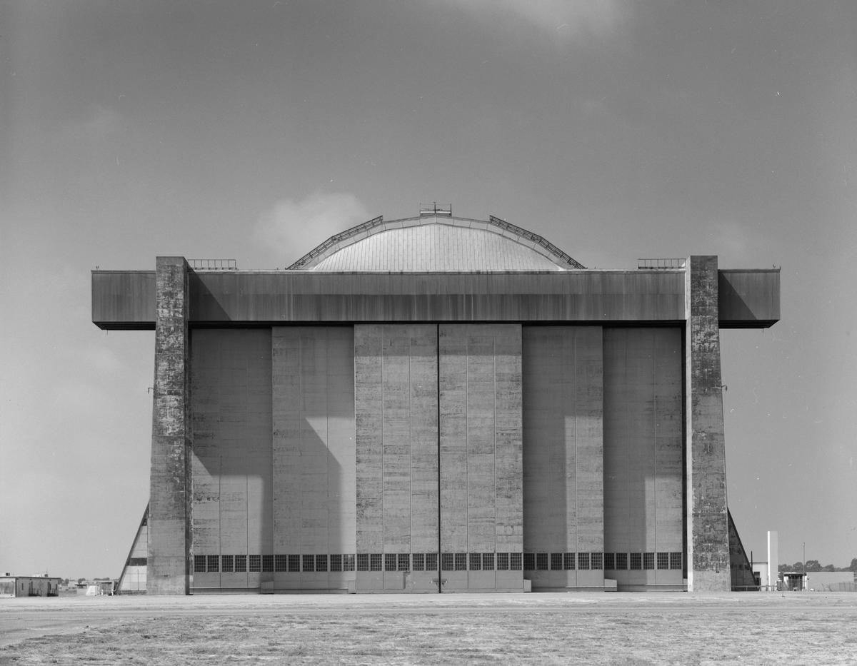
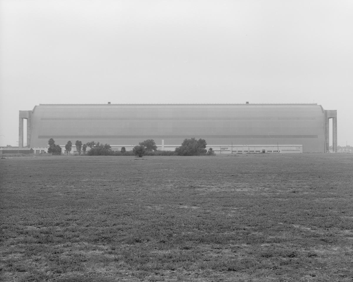
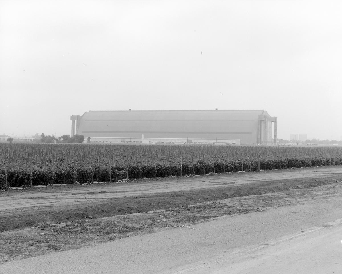
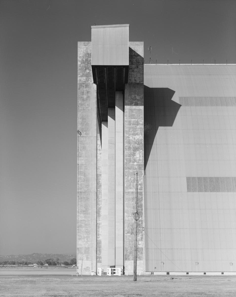
| width | 90.2 m | |
| height | 51.8 m | |
| length | 304.8 m | |
| door height | 36.6 m |
Cost
| cost of construction | United States dollar 2 500 000 |
Materials
| shell |
wood
|
|---|
Chronology
| 1 April 1942 | Construction begins. |
|---|---|
| October 1942 | Commissioned. |
| 1978 | Listed as a National Historic Landmark. |
Notes
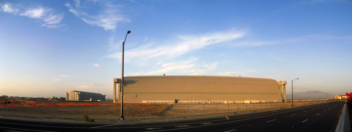
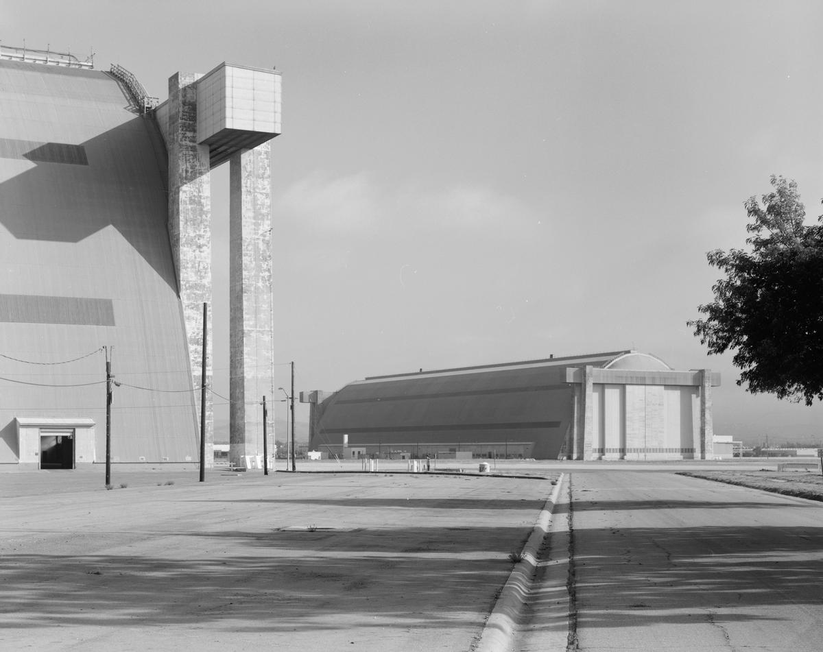
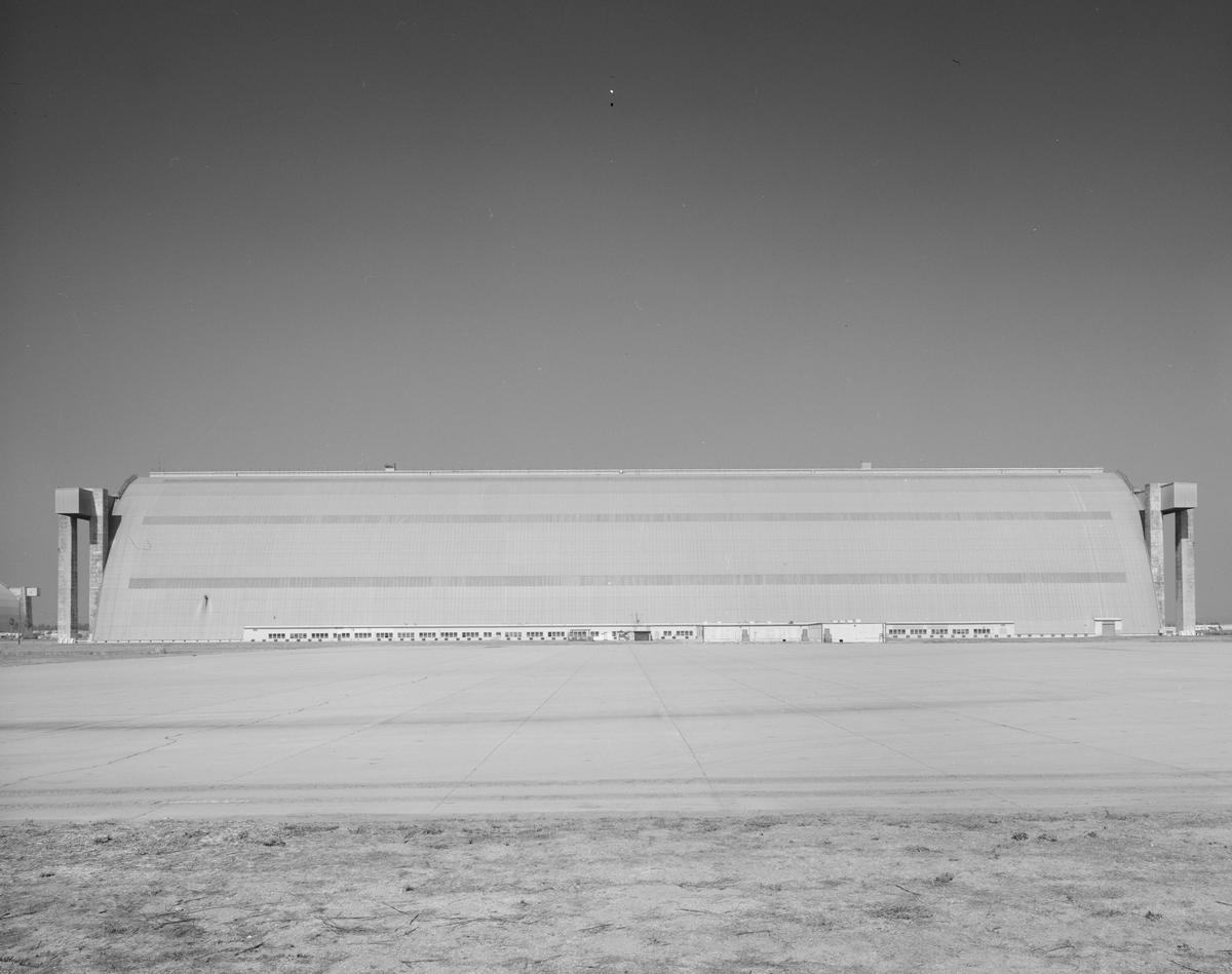
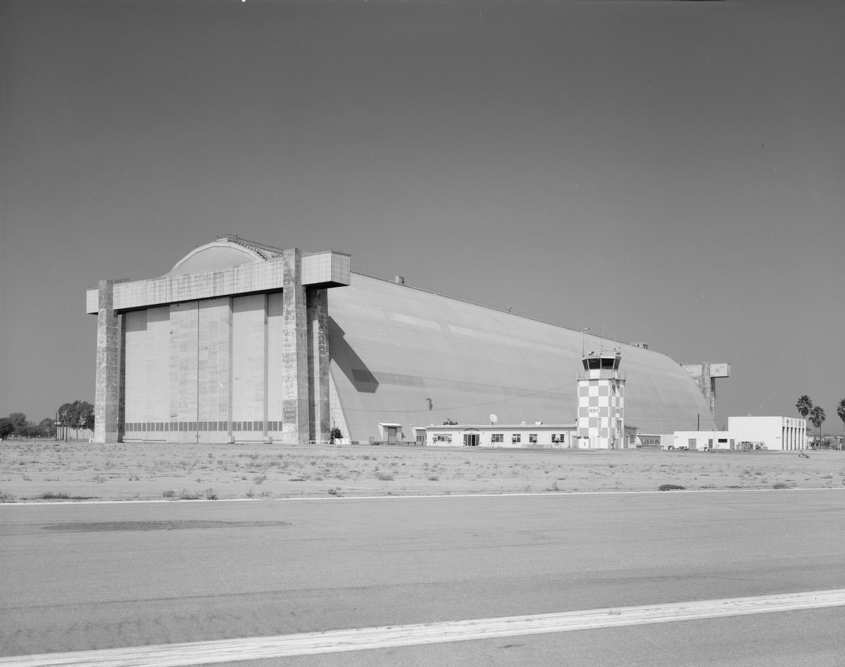
There were three basic designs for the hangers, a small, medium and large. These two hangers are the last of the largest design. Others have been lost to fire or destruction, or are not this size.
The hangers contain 296,000 sq. feet of open space, are 1000 feet long, 296 feet wide and 170 feet high. The doors on either end are 120 feet high. The door frames and the floor are the only cement parts. The doors are metal clad frames, opened and closed by electric drive motors. Each blimp hangar is tall enough to allow the Statue of Liberty inside and big enough to house 77 basketball courts, or the Eiffel Tower resting on its side.
They were built starting on April 1, 1942 at a cost of us$2.5 million each and commissioned in October 1942 (or opened in 1943, conflicting news articles) as "Santa Ana Naval Air Station". Each hangar housed six helium-filled airships that searched for enemy ships off the California coast.
Listed as a National Historic Landmark in 1978, the base is on it's way, slowly, to be consumed for housing and small industry, with hopes to keep one hanger intact (the one that is aligned east/west) as a museum and/or sound stage for Hollywood, who have already used it a few times. The one that is aligned north/south is in the way of the path of a major bottleneck in traffic, joining the streets Tustin Ranch Road in the north, to Von Karmen to the south, bisecting the base.
Participants
Structural engineering
Relevant Web Sites
-
Historic American Building Survey: Marine Corps Air Station Tustin, East of Red Hill Avenue between Edinger Avenue & Barranca Parkway, Tustin, Orange County, CA

-
Historic American Building Survey: Marine Corps Air Station Tustin, Northern Lighter Than Air Ship Hangar, Meffett Avenue & Maxfield Street, Tustin, Orange County, CA
-
Historic American Building Survey: Marine Corps Air Station Tustin, Southern Lighter Than Air Ship Hangar, Near intersection of Windmill Road & Johnson Street, Tustin, Orange County, CA
Relevant Publications
- (1996): Building for Air Travel. Architecture and Design for Commercial Aviation. The Art Institute of Chicago, Prestel, Munich (Germany), pp. 123.
- About this
data sheet - Structure-ID
20004305 - Published on:
24/07/2002 - Last updated on:
24/01/2018
Structurae cooperates with


