
General Information
Project Type
| Structure: |
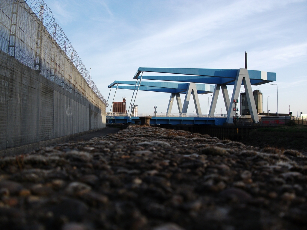
Draw bridge |
|---|---|
| Function / usage: |
Road bridge |
| Material: |
Steel bridge |
Location
| Location: |
Kingston upon Hull, East Riding of Yorkshire, Yorkshire and the Humber, England, United Kingdom |
|---|---|
| Address: | Ferry Lane |
| Crosses: |
|
| Coordinates: | 53° 46' 3.53" N 0° 19' 48.87" W |
| Coordinates: | 53° 46' 2.75" N 0° 19' 47.95" W |
Technical Information
Dimensions
| main span | 31 m |
Materials
| deck |
steel
|
|---|---|
| piles |
steel tubes
|
| abutments |
reinforced concrete
|
Chronology
| 23 July 1991 | Opened to traffic. |
|---|
Notes
Twin Shadoof-type bascule bridges with 32 meter counterbalanced counter leavers.
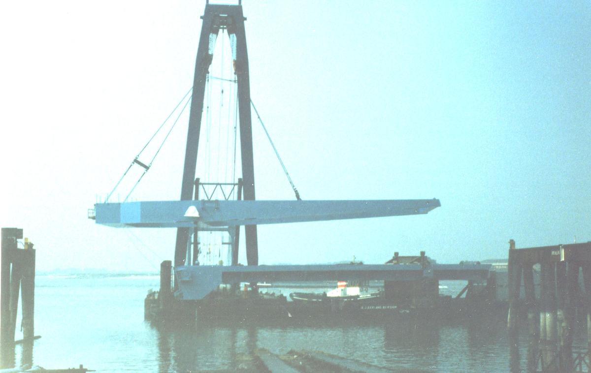
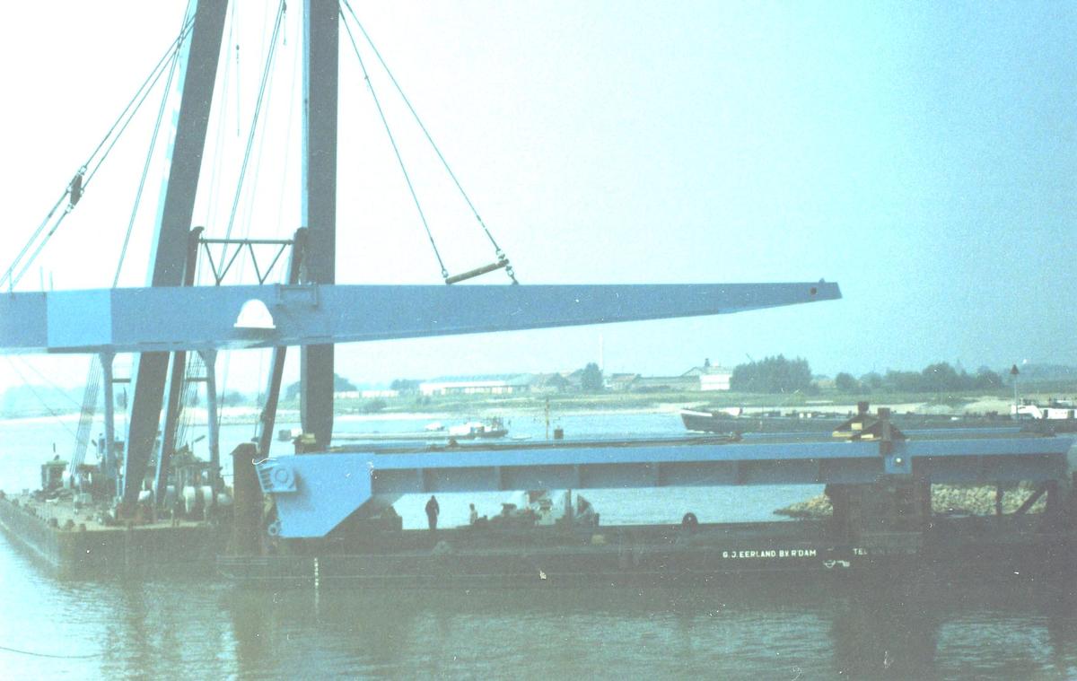
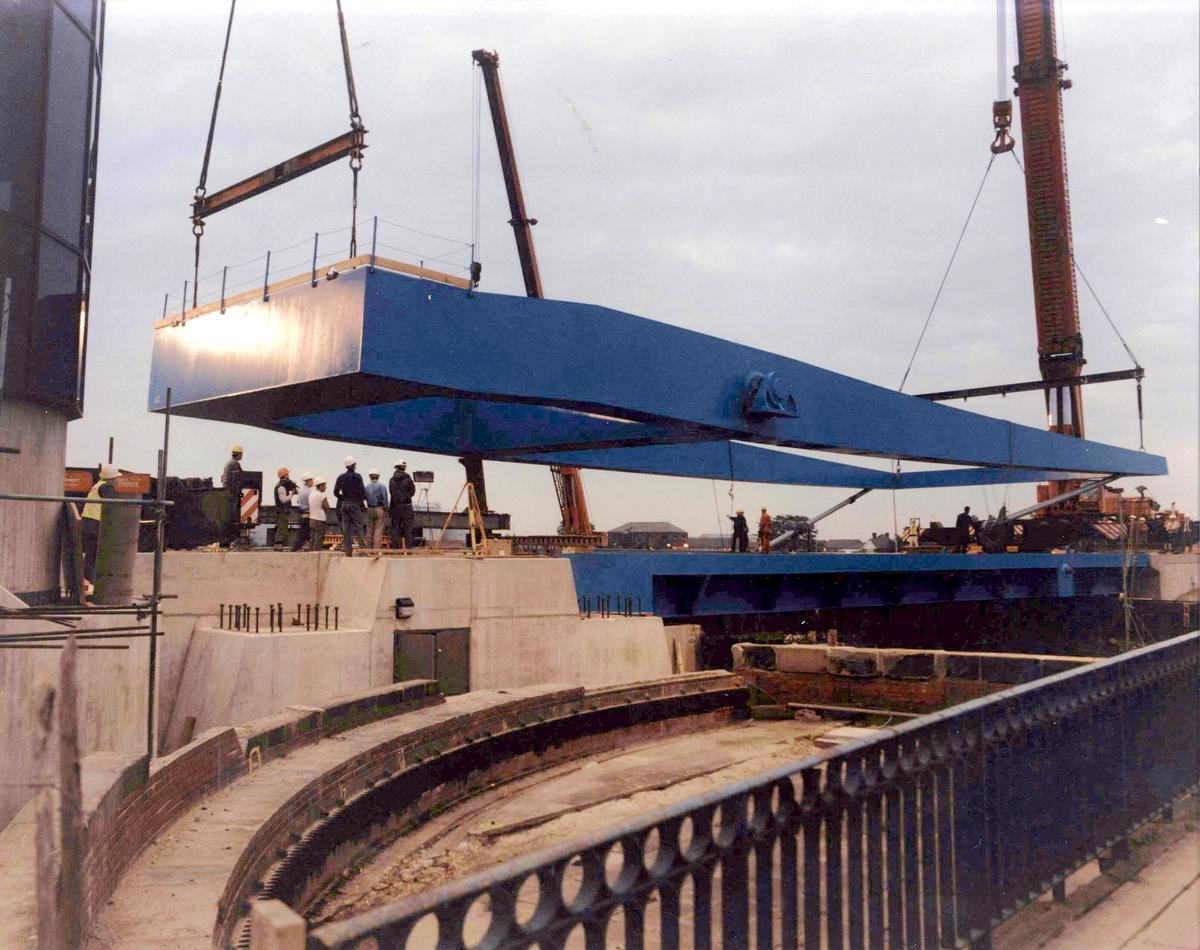
Erection of steel decks' A frame by the use of a combination of land and floating cranes.
Participants
Owner
Design
Main contractor
Relevant Web Sites
There currently are no relevant websites listed.
- About this
data sheet - Structure-ID
20013305 - Published on:
10/09/2004 - Last updated on:
14/12/2023
Structurae cooperates with


