
General Information
| Name in local language: | Barragem de Santa Luzia |
|---|---|
| Completion: | 1942 |
| Status: | in use |
Project Type
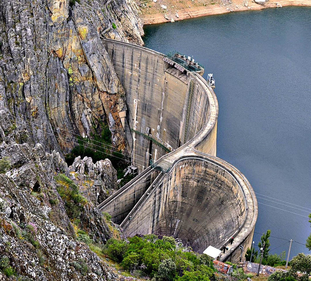
| Structure: |
Multiple arch and buttress dam |
|---|---|
| Function / usage: |
Hydroelectric dam / plant |
| Material: |
Concrete dam |
Location
Technical Information
Dimensions
| height | 76 m | |
| retained water volume | 53.7 hm³ | |
| crest length | 178 m | |
| dam volume | 80 000 m³ |
Excerpt from Wikipedia
Santa Luzia Dam (Portuguese:Barragem de Santa Luzia) is a concrete arch dam on the Unhais, a northern tributary of the Zêzere River, located in the municipality Pampilhosa da Serra, in Coimbra District, Portugal. The dam was constructed between 1930 and 1942 and was designed by André Coyne.
Design
Santa Luzia Dam is a 76 m tall and 115 m long arch dam. The volume of the dam is 80.000 m³. The dam contains 2 crest spillways and one bottom outlet. At full reservoir level the reservoir of the dam (Portuguese:Albufeira da Barragem de Santa Luzia) has a surface area of 2.46 km² and its total capacity is 53.7 Mio m³.
The concrete of the dam is affected by concrete swelling, caused by an alkali–silica reaction, that leads to tensions and cracks in the concrete.
Power plant
The power plant is one of the smaller hydroelectric power stations in Portugal with a nameplate capacity of 32 MW. Its average annual generation is 55 Mio. kWh. The power station contains four Pelton turbine-generators.
Text imported from Wikipedia article "Santa Luzia Dam" and modified on July 23, 2019 according to the CC-BY-SA 4.0 International license.
Participants
Relevant Web Sites

Relevant Publications
- Le Barrage de Santa-Luzia (Portugal). In: La Houille Blanche, v. 32, n. 6 (November 1946), pp. 376.
- About this
data sheet - Structure-ID
20012743 - Published on:
03/08/2004 - Last updated on:
30/09/2018


