
General Information
| Completion: | 1936 |
|---|---|
| Status: | in use |
Project Type
| Structure: |
Deck arch bridge |
|---|---|
| Function / usage: |
Road bridge |
| Material: |
Reinforced concrete bridge |
| Plan view: |
Structurae Plus/Pro - Subscribe Now! |
Awards and Distinctions
| 1994 |
for registered users |
|---|
Location
| Location: |
Manawatu-Wanganui, New Zealand |
|---|---|
| Coordinates: | 39° 16' 15.31" S 174° 58' 19.88" E |
Technical Information
Dimensions
| length | 39.6 m |
Materials
| deck |
reinforced concrete
|
|---|---|
| arches |
reinforced concrete
|
| abutments |
reinforced concrete
|
| piers on arch |
reinforced concrete
|
Excerpt from Wikipedia
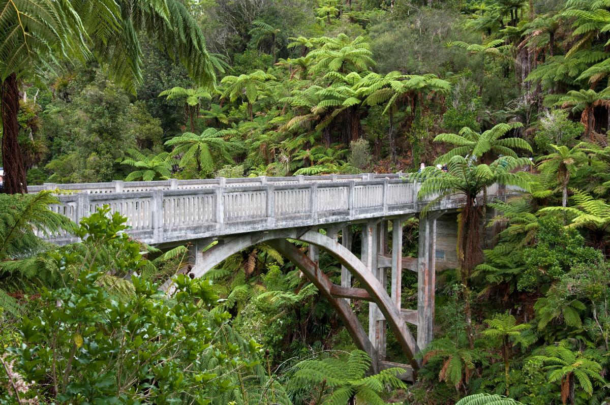
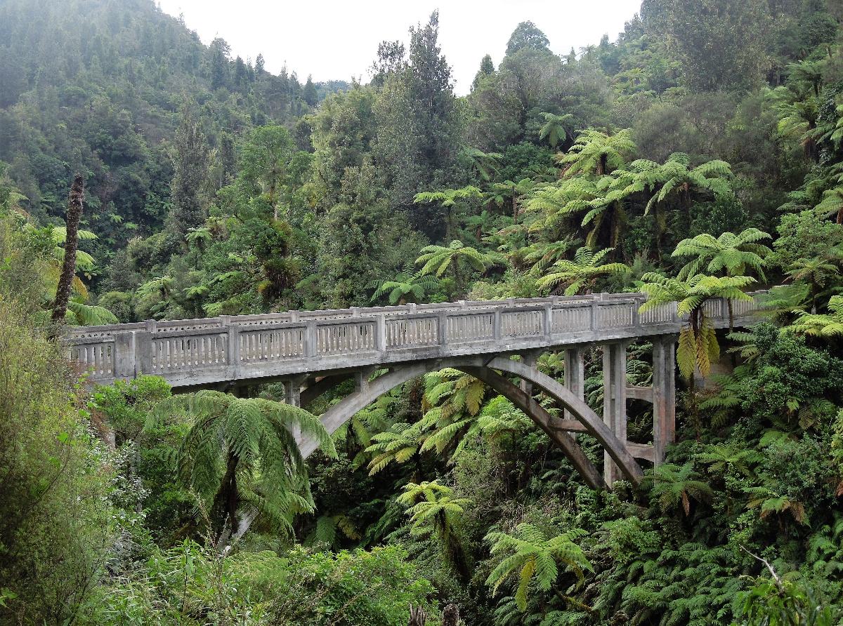
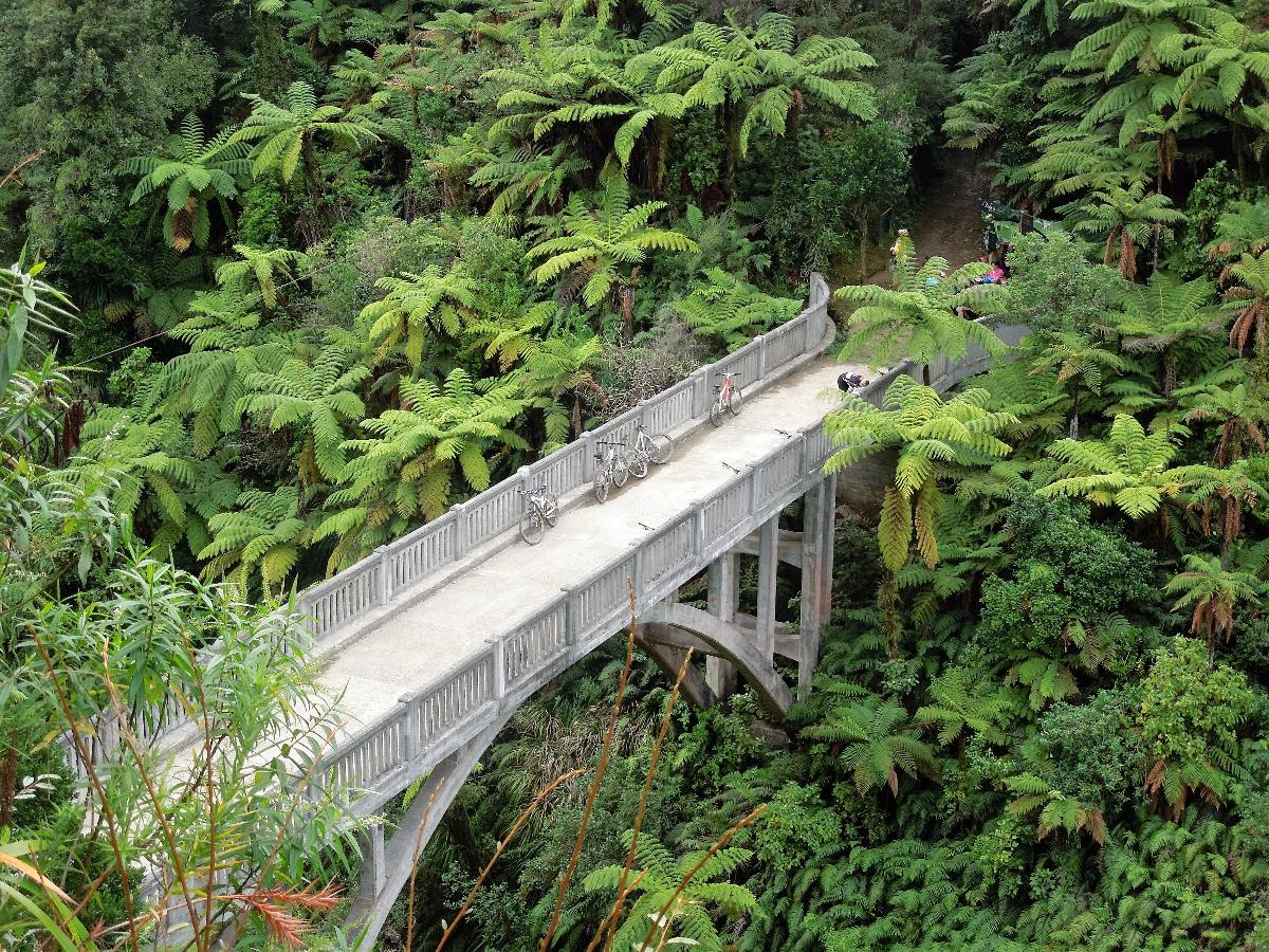
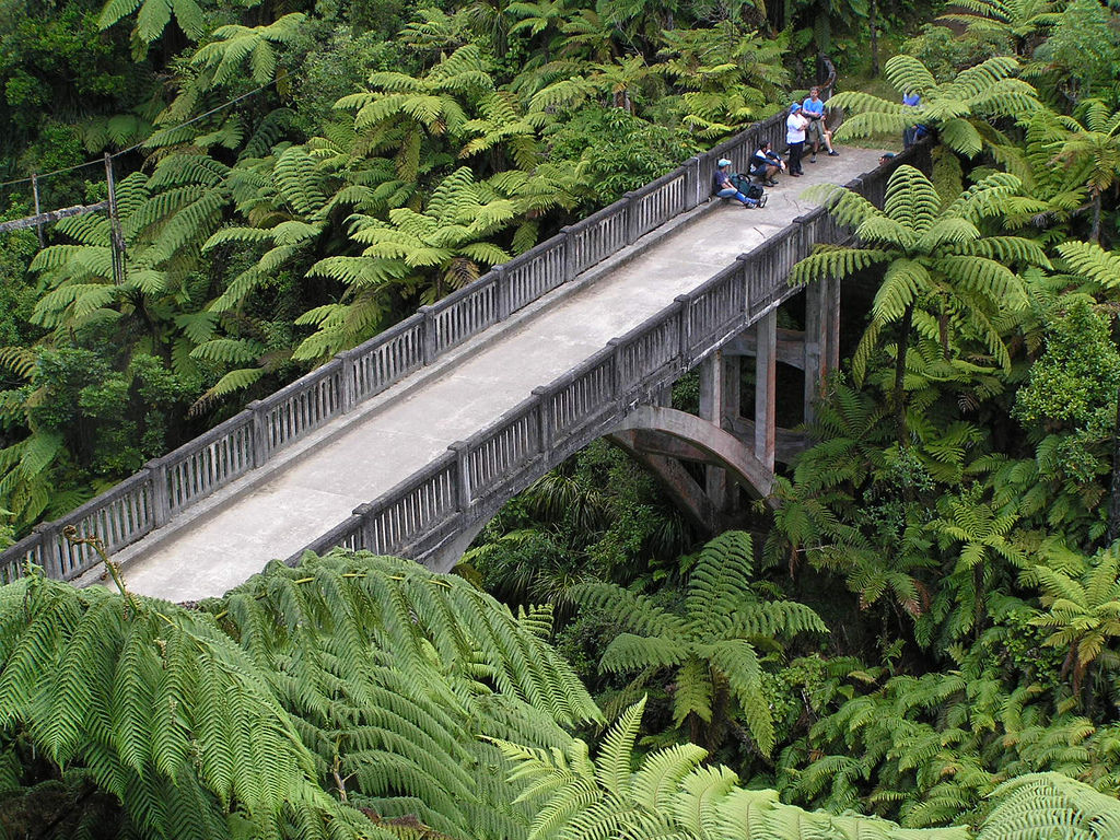
The Bridge to Nowhere is a concrete road bridge spanning the Mangapurua Stream in Whanganui National Park, North Island, New Zealand. It has no roads leading to it, but it is a popular tourist attraction, accessible by mountain bike or tramping on a variety of different tracks, or by boat or kayak, followed by a 45-minute (one way) walk along maintained bush trails.
It was built across the deep Mangapurua Gorge to provide access to an area where the government was opening up land in 1917 for pioneering farmers, mainly soldiers who had returned from World War I. The intention was to build roads to it later, but the area proved to be so remote and unsuitable for farming that the venture failed and the farms reverted to native bush.
A sign on the bridge states:
Started in January 1935 and completed in June 1936, this bridge was built by the Raetihi firm of Sandford and Brown, for the Public Works Department. It is 130 feet long, and 125 feet above the stream. The cost of labour was 598 pounds 11 shillings 7 pence, and cartage of all materials (via the Mangapurua Valley road) cost 419 pounds 14 shillings. Unfortunately the cost of materials was not recorded. Aggregate for the concrete is said to have been transported from the Rangitikei River. The completion of the bridge was delayed considerably due to floods, slips, and the consequent delay in the supply of materials. The bridge was built to facilitate vehicular access to the Wanganui River, to link the settlers of the valley with the riverboat service. In 1917 the Government opened up the valley for settlement by soldiers returning from World War I. Virgin forest was cleared, and a total of 35 holdings developed. A school was opened, and for some years the valley prospered. However economic hardship, and problems associated with the remoteness and difficulty of access, resulted in many families abandoning their farms. By 1942 there were only 3 families left. After a major flood in January 1942 the Government declined to make further funds available for road maintenance, and it officially closed the valley in May 1942. The disappearing road line, old fence lines, stands of exotic trees, occasional brick chimneys, and this bridge serve as reminders of the ill fated settlement of the Mangapurua valley.
The New Zealand Ministry for Culture and Heritage gives a translation of "abundant stream" for Mangapūrua.
Text imported from Wikipedia article "Bridge to Nowhere (New Zealand)" and modified on 4 April 2022 according to the CC-BY-SA 3.0 license.
Participants
Currently there is no information available about persons or companies having participated in this project.
Relevant Web Sites

Relevant Publications
- (2001): Bridging the Gap. Early Bridges in New Zealand 1830-1939. Reed Books, Auckland (New Zealand), pp. 281.
- About this
data sheet - Structure-ID
20052127 - Published on:
16/01/2010 - Last updated on:
31/03/2022
Structurae cooperates with


