
General Information
Project Type
| Structure: |
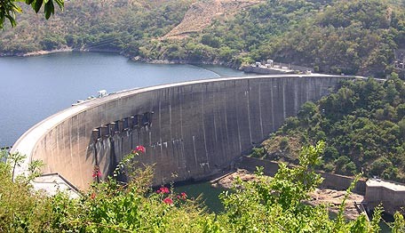
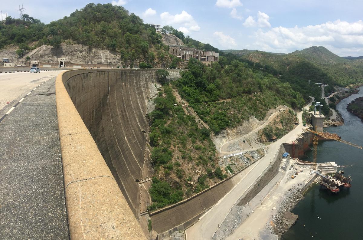
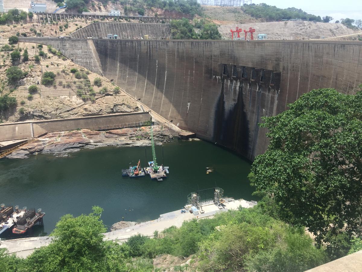
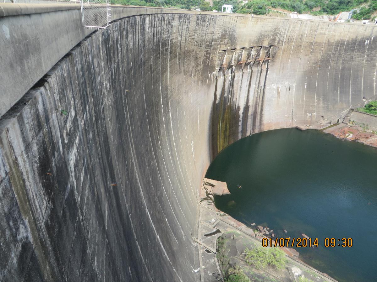
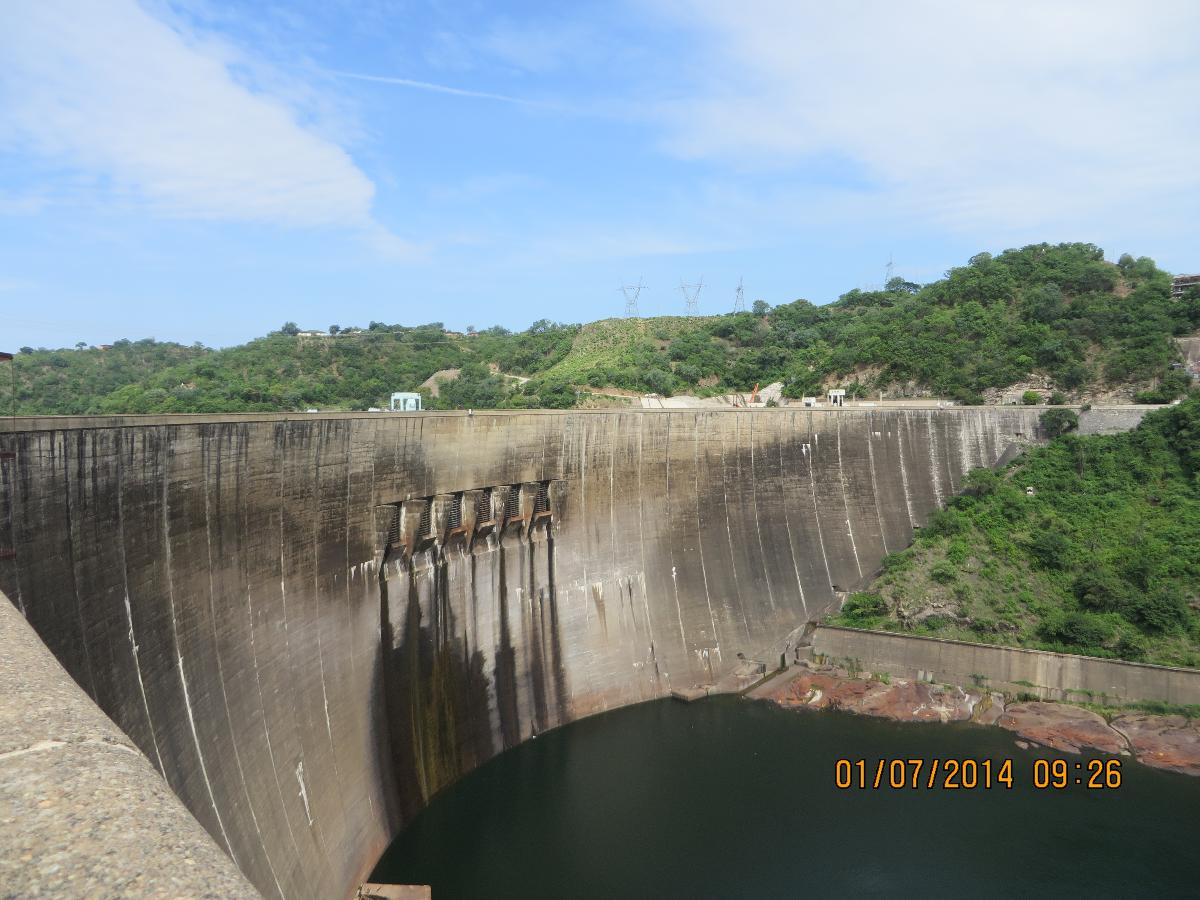
Arch dam |
|---|---|
| Function / usage: |
Hydroelectric dam / plant |
| Material: |
Concrete dam |
Location
Technical Information
Dimensions
| height | 128 m | |
| crest length | 617 m | |
| base thickness | 24 m |
Materials
| dam structure |
reinforced concrete
|
|---|
Excerpt from Wikipedia
The Kariba Dam is a double curvature concrete arch dam in the Kariba Gorge of the Zambezi river basin between Zambia and Zimbabwe. The dam stands 128 metres (420 ft) tall and 579 metres (1,900 ft) long. The dam forms Lake Kariba, which extends for 280 kilometres (170 mi) and holds 185 cubic kilometres (150,000,000 acre⋅ft) of water.
Construction
The dam was constructed on the orders of the Government of the Federation of Rhodesia and Nyasaland, a 'federal colony' within the British Empire. The double curvature concrete arch dam was designed by Coyne et Bellier and constructed between 1955 and 1959 by Impresit of Italy at a cost of $135,000,000 for the first stage with only the Kariba South power cavern. Final construction and the addition of the Kariba North Power cavern by Mitchell Construction was not completed until 1977 due to largely political problems for a total cost of $480,000,000. During construction, 86 men lost their lives.
The dam was officially opened by Queen Elizabeth The Queen Mother on 17 May 1960.
Power generation
The Kariba Dam supplies 1,626 megawatts (2,181,000 hp) of electricity to parts of both Zambia (the Copperbelt) and Zimbabwe and generates 6,400 gigawatt-hours (23,000 TJ) per annum. Each country has its own power station on the north and south bank of the dam respectively. The south station belonging to Zimbabwe has been in operation since 1960 and had six generators of 111 megawatts (149,000 hp) capacity each for a total of 666 megawatts (893,000 hp).
On November 11, 2013 it was announced by Zimbabwe's Finance Minister, Patrick Chinamasa that capacity at the Zimbabwean (South) Kariba hydropower station would be increased by 300 megawatts. The cost of upgrading the facility has been supported by a $319m loan from China. The deal is a clear example of Zimbabwe's "Look East" policy, which was adopted after falling out with Western powers. Construction on the Kariba South expansion began in mid-2014 and was initially expected to be complete in 2019.
In March 2018, president Emmerson Mnangagwa commissioned the completed expansion of Kariba South Hydroelectric Power Station. The addition of two new 150 megawatts (200,000 hp) turbines, brings to at capacity at this station to 1,050 megawatts (1,410,000 hp). The expansion work was done by Sinohydro, at a cost of US$533 million. Work started in 2014, and was completed in March 2018.
The north station belonging to Zambia has been in operation since 1976, and has four generators of 150 megawatts (200,000 hp) each for a total of 600 megawatts (800,000 hp); work to expand this capacity by an additional 360 megawatts (480,000 hp) to 960 megawatts (1,290,000 hp) was completed in December 2013. Two additional 180 MW generators were added.
Location
The Kariba Dam project was planned and carried out by the Government of the Federation of Rhodesia and Nyasaland. The Federation was often referred to as the Central African Federation (CAF). The CAF was a 'federal colony' within the British Empire in southern Africa that existed from 1953 to the end of 1963, comprising the former self-governing British colony of Southern Rhodesia and the former British protectorates of Northern Rhodesia and Nyasaland. Northern Rhodesia had decided earlier in 1953 (before the Federation was founded) to build a dam within its territory, on the Kafue River, a major tributary of the Zambezi. It would have been closer to Northern Rhodesia's Copperbelt, which was in need of more power. This would have been a cheaper and less grandiose project, with a smaller environmental impact. Southern Rhodesia, the richest of the three, objected to a Kafue dam and insisted that the dam be sited instead at Kariba. Also, the capacity of the Kafue dam was much lower than that at Kariba. Initially the dam was managed and maintained by the Central African Power Corporation. The Kariba Dam is now owned and operated by the Zambezi River Authority, which is jointly and equally owned by Zimbabwe and Zambia.
Since Zambia's independence, three dams have been built on the Kafue River: the Kafue Gorge Upper Dam, Kafue Gorge Lower Dam and the Itezhi-Tezhi Dam.
Environmental impacts
Population displacement and resettlement
The creation of the reservoir forced resettlement of about 57,000 Tonga people living along the Zambezi on both sides.
There are many different perspectives on how much resettlement aid was given to the displaced Tonga. British author David Howarth described the efforts in Northern Rhodesia:
"Everything that a government can do on a meagre budget is being done. Demonstration gardens have been planted, to try to teach the Tonga more sensible methods of agriculture, and to try to find cash crops that they can grow. The hilly land has been plowed in ridge contours to guard against erosion. In Sinazongwe, an irrigated garden has grown a prodigious crop of pawpaws, bananas, oranges, lemons, and vegetables, and shown that the remains of the valley could be made prolific if only money could be found for irrigation. Cooperative markets have been organized, and Tonga are being taught to run them. Enterprising Tonga have been given loans to set themselves up as farmers. More schools have been built than the Tonga ever had before, and most of the Tonga are now within reach of dispensaries and hospitals."
Anthropologist Thayer Scudder, who has studied these communities since the late 1950s, wrote:
"Today, most are still 'development refugees'. Many live in less-productive, problem-prone areas, some of which have been so seriously degraded within the last generation that they resemble lands on the edge of the Sahara Desert."
American writer Jacques Leslie, in Deep Water (2005), focused on the plight of the people displaced by Kariba Dam, and found the situation little changed since the 1970s. In his view, Kariba remains the worst dam-resettlement disaster in African history.
Basilwizi Trust
In an effort to regain control of their lives, the local people who were displaced by the Kariba dam's reservoir formed the Basilwizi Trust in 2002. The Trust seeks mainly to improve the lives of people in the area through organizing development projects and serving as a conduit between the people of the Zambezi Valley and their country's decision-making process.
River ecology
The Kariba Dam controls 90% of the total runoff of the Zambezi River, thus changing the downstream ecology dramatically.
Wildlife rescue
From 1958 to 1961, Operation Noah captured and removed around 6,000 large animals and numerous small ones threatened by the lake's rising waters.
Recent activity
On 6 February 2008, the BBC reported that heavy rain could lead to a release of water from the dam, which would force 50,000 people downstream to evacuate. Rising levels led to the opening of the floodgates in March 2010, requiring the evacuation of 130,000 people who lived in the floodplain, and causing concerns that flooding would spread to nearby areas.
In March 2014, at a conference organized by the Zambezi River Authority, engineers warned that the foundations of the dam had weakened and there was a possibility of dam failure unless repairs were made.
On 3 October 2014 the BBC reported that “The Kariba Dam is in a dangerous state. Opened in 1959, it was built on a seemingly solid bed of basalt. But, in the past 50 years, the torrents from the spillway have eroded that bedrock, carving a vast crater that has undercut the dam's foundations. … engineers are now warning that without urgent repairs, the whole dam will collapse. If that happened, a tsunami-like wall of water would rip through the Zambezi valley, reaching the Mozambique border within eight hours. The torrent would overwhelm Mozambique's Cahora Bassa Dam and knock out 40% of southern Africa's hydroelectric capacity. Along with the devastation of wildlife in the valley, the Zambezi River Authority estimates that the lives of 3.5 million people are at risk.”
In June 2015 The Institute of Risk Management South Africa completed a Risk Research Report entitled Impact of the failure of the Kariba Dam. It concluded: "Whilst we can debate whether the Kariba Dam will fail, why it might occur and when, there is no doubt that the impact across the region would be devastating."
In January 2016 it was reported that water levels at the dam had dropped to 12% of capacity. Levels fell by 5.58 metres (18.3 ft), which is just 1.75 metres (5 ft 9 in) above the minimum operating level for hydropower. Low rainfalls and overuse of the water by the power plants have left the reservoir near empty, raising the prospect that both Zimbabwe and Zambia will face water shortages.
In July and September 2018, The Lusaka Times reported that work had started relating to the plunge pool and cracks in the dam wall.
On 22 February 2019 Bloomberg reported "Zambia has reduced hydropower production at the Kariba Dam because of rapidly declining water levels" but "Zambia doesn’t anticipate power cuts as a result of shortages". On 5 August that year, the same publication reported that the reservoir was near empty, and that it may have to stop hydropower production.
As of November 2020 the water level in the Kariba reservoir has remained steady around the 25% capacity, up from nearly half that in November 2019. The Zambezi River Authority has stated that it is optimistic about rainfall estimates for the 2020/2021 rainfall season, allocating an increased amount of water for power production. As it sits now, the reservoir is holding 15.77 billion cubic meters of water, with the water line sitting at around 478.30 metres (1,569.23 ft), just above the minimum capacity for power generation of 475.50 metres (1,560.04 ft).
Text imported from Wikipedia article "Kariba Dam" and modified on 17 February 2022 according to the CC-BY-SA 3.0 license.
Participants
Design
Relevant Web Sites


Relevant Publications
- (1962): L'aménagement de Kariba, sur le Zambèze. In: La Technique des Travaux, v. 38, n. 1-2 (January 1962), pp. 36-56.
- (1959): Le barrage de Kariba. In: Travaux, n. 297 (July 1959), pp. 395.
- (2013): Kariba dam on Zambezi river: stabilizing the natural plunge pool. In: La Houille Blanche, v. 99, n. 1 (February 2013), pp. 34-41.
- (2013): Kariba Dam Plunge Pool Scour: quasi-3D Numerical Predictions. In: La Houille Blanche, v. 99, n. 1 (February 2013), pp. 42-49.
- Technique française à Kariba. Le plus grand barrage d'Afrique. In: Travaux, n. 309 (July 1960), pp. 516.
- About this
data sheet - Structure-ID
20003761 - Published on:
22/06/2002 - Last updated on:
22/03/2022
Structurae cooperates with


