
General Information
Project Type
| Structure: |
Cable-stayed bridge with semi-fan system |
|---|---|
| Material: |
Material hybrid bridge Structurae Plus/Pro - Subscribe Now! Structurae Plus/Pro - Subscribe Now! |
| Secondary structure(s): |
Structurae Plus/Pro - Subscribe Now! Structurae Plus/Pro - Subscribe Now! |
| Function / usage: |
upper deck: Motorway bridge / freeway bridge lower deck: Railroad (railway) bridge |
| Material: |
main span: Steel-reinforced concrete composite bridge side spans of main bridge: Prestressed concrete bridge |
Location
| Location: |
Lantau Island, Islands, Hong Kong, China Ma Wan, Tsuen Wan, Hong Kong, China |
|---|---|
| Part of: | |
| Connects to: |
Ma Wan Viaduct (1997)
|
| Coordinates: | 22° 20' 39" N 114° 3' 20" E |
Technical Information
Dimensions
| main span | 430 m | |
| total length | 820 m | |
| vertical navigation clearance | 47 m | |
| deck | deck depth | 7.46 m |
| deck width | 32.50 m | |
| pylons | pylon height | 133.00 m |
| stay cables | number of cables | 8 x 22 = 176 |
Design Loads
| design code(s) | BS 5400 | |
| design speed (rail) | 135 km/h | |
| design speed (road) | 100 km/h |
Materials
| superstructure |
composite steel-reinforced concrete
|
|---|---|
| approach viaducts |
prestressed concrete
|
| pylons |
reinforced concrete
|
Notes
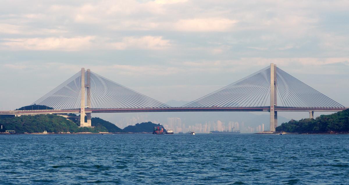
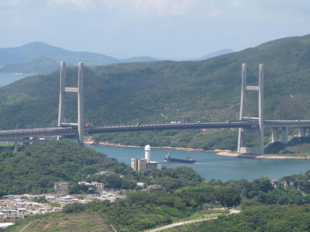
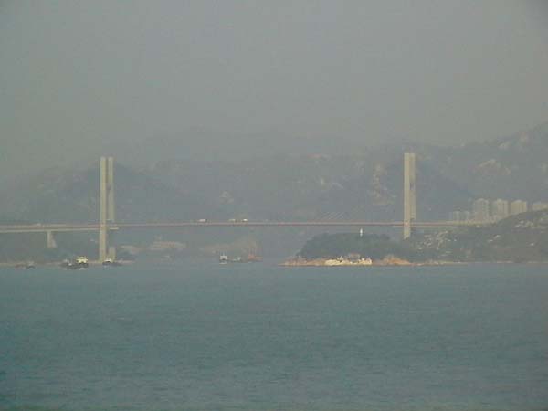
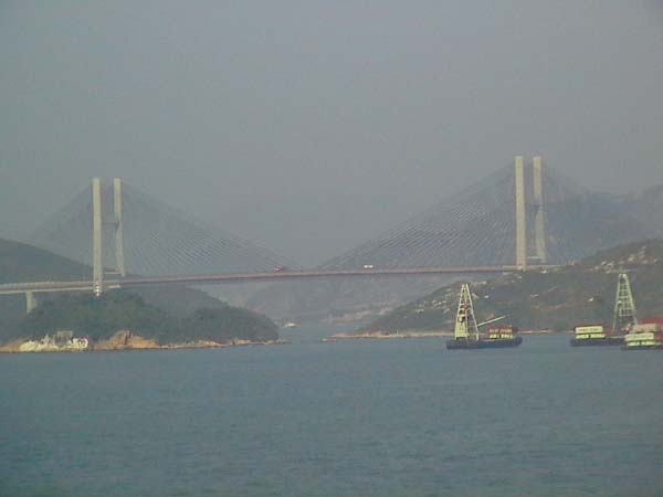
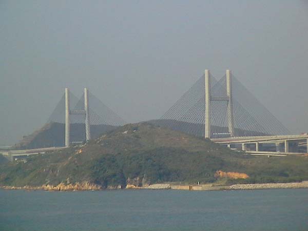
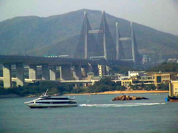
The Kap Shui Mun Bridge is one of the three long span bridges linking the New Territories in Hong Kong with the Island of Chep Lap Kok, where the territory's new airport is located. The other two bridges are the Tsing Ma Bridge and the Ting Kau Bridge.
Excerpt from Wikipedia
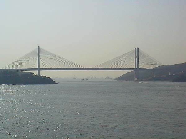
The Kap Shui Mun Bridge (KSMB) in Hong Kong is one of the longest cable-stayed bridges in the world that transports both road and railway traffic, with the upper deck used for motor vehicles and the lower deck used for both vehicles and the MTR. It has a main span of 430 metres (1,410 ft) and an overall length of 750 metres (2,460 ft). It spans the Kap Shui Mun marine channel between Ma Wan and Lantau and has a vertical clearance of 47 metres (154 ft) above sea level. The bridge was completed in 1997.
Structural information
The total length of the Kap Shui Mun Bridge includes a 70-metre (230 ft) approach span on the Lantau side. There is a column in each of the back spans of the cable stayed bridge, making four 80-metre (260 ft) spans, adding to the 430-metre (1,410 ft) main span. This makes the total length 820 metres (2,690 ft). The 503-metre (1,650 ft) Ma Wan Viaduct was constructed under the same contract as the KSMB. The viaduct connects the KSMB to the Tsing Ma Bridge, forming the Lantau Link, which was built to provide access to the new airport. The navigation clearance of 47 metres (154 ft) is part of the reason that the H-shaped towers are 150 metres (490 ft) tall.
The Kap Shui Mun Bridge is not symmetrical, in that the 160-metre (520 ft) back span length (two 80-metre (260 ft) spans) is less than half of the main span length (which would be 215 metres (705 ft)). To provide the balance that symmetry will normally provide, part of the bridge has a composite structure. The center 387 metres (1,270 ft) of the main span uses a steel-concrete composite to make the structure lighter. The back spans and the rest of the main span are concrete. Using the lighter steel cross section in the majority of the main span serves to equalize the horizontal forces on the towers and balance the bridge.
Because the lower deck carries both rail and traffic, the cross section is designed as a Vierendeel truss. This means that there are no diagonal members in the cross section and that vehicles and rail cars drive through the openings provided by the Vierendeel design.
Along with the Tsing Ma Bridge and Ting Kau Bridge, it is closely monitored by the Wind and Structural Health Monitoring System (WASHMS).
Crane strike
The bridge has a height restriction of 41 metres for vessels passing underneath. On 23 October 2015, a barge attempted to pass under the bridge with a broken-down crane that could not be lowered. The crane had a maximum height of 43 metres, but was tilted slightly to 41 metres. The bridge has an actual clearance of 47 metres, but potentially due to the high tide and wave action, the crane struck the bridge and damaged its underside. The Tsing Ma Bridge has a higher height clearance of 53 metres but a source said the captain of the tugboat towing the barge may have opted to take Kap Shui Mun to save time.
The strike triggered the Ship Impact Detection System to issue an alarm and both the road and railway were shut down immediately, severing Lantau Island and the airport from the city from about 7:40 pm to 10:00 pm. The government's contingency plan to implement emergency ferry service between Tsuen Wan and Tung Chung failed as the ferry operator took almost two hours to ready the service. Some travelers attempted to reach the airport via the Discovery Bay Ferry Pier, although many missed their flights.
The Highways Department inspected the bridge and found that only the inspection platform rails were damaged by the collision, and that the structural integrity of the bridge was not jeopardised. In the days following the incident there were calls in local media for the government to build a second link to the airport. In fact, such a link was already under construction: the Tuen Mun–Chek Lap Kok Link road tunnel was being constructed as part of the Hong Kong–Zhuhai–Macau Bridge project. This opened in 2020.
Text imported from Wikipedia article "Kap Shui Mun Bridge" and modified on March 2, 2021 according to the CC-BY-SA 4.0 International license.
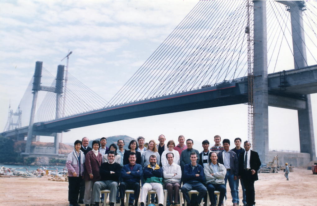
Participants
- Flint & Neill (superstructure)
- Harris and Sutherland (superstructure)
- Fugro Hong Kong Ltd
- Hitachi Zosen Inc.
- Hsin Chong Group
- Kumagai Gumi (Hong Kong) Ltd.
- Maeda Corporation
- Yokogawa Bridge Corporation
- B. Reynolds (resident engineer)

Relevant Web Sites

Relevant Publications
- (2002): Bridges - Ponts - Brücken. Atrium, Mexico City (Mexico), pp. 328-333.
- (2007): Cable Vibrations in Cable-Stayed Bridges. International Association for Bridge and Structural Engineering (IABSE), Zurich (Switzerland), ISBN 978-3-85748-115-4, pp. 124-128.
- (2001): Finite-Element Model Updating for the Kap Shui Mun Cable-Stayed Bridge. In: Journal of Bridge Engineering (ASCE), v. 6, n. 4 (August 2001), pp. 285-293.
- (1999): An innovative technique for fitting trackwork alignments through the railway envelope of a cable-stayed bridge. Presented at: IABSE Conference: Cable-Stayed Bridges - Past, Present and Future, Malmö, Sweden, 2-4 June 1999, pp. 501-510.
- Kap Shui Mun Bridge and Mawan Viaduct. In: VSL News, v. 7, n. 2 ( 1996), pp. 3.
- About this
data sheet - Structure-ID
20000039 - Published on:
28/10/1998 - Last updated on:
05/02/2016


