


General Information
| Other name(s): | Kentucky Lake US 68 Bridge; Tennessee River US 68 Bridge |
|---|---|
| Completion: | 1932 |
| Status: | in use |
Project Type
| Structure: |
Through truss bridge Pratt type truss bridge Parker type truss bridge |
|---|---|
| Support conditions: |
for registered users |
| Function / usage: |
Road bridge |
| Material: |
Steel bridge Structurae Plus/Pro - Subscribe Now! |
Location
| Location: |
Marshall County, Kentucky, USA Trigg County, Kentucky, USA |
|---|---|
| Address: | U.S. Route 68 / KY Route 80 |
| Crosses: |
|
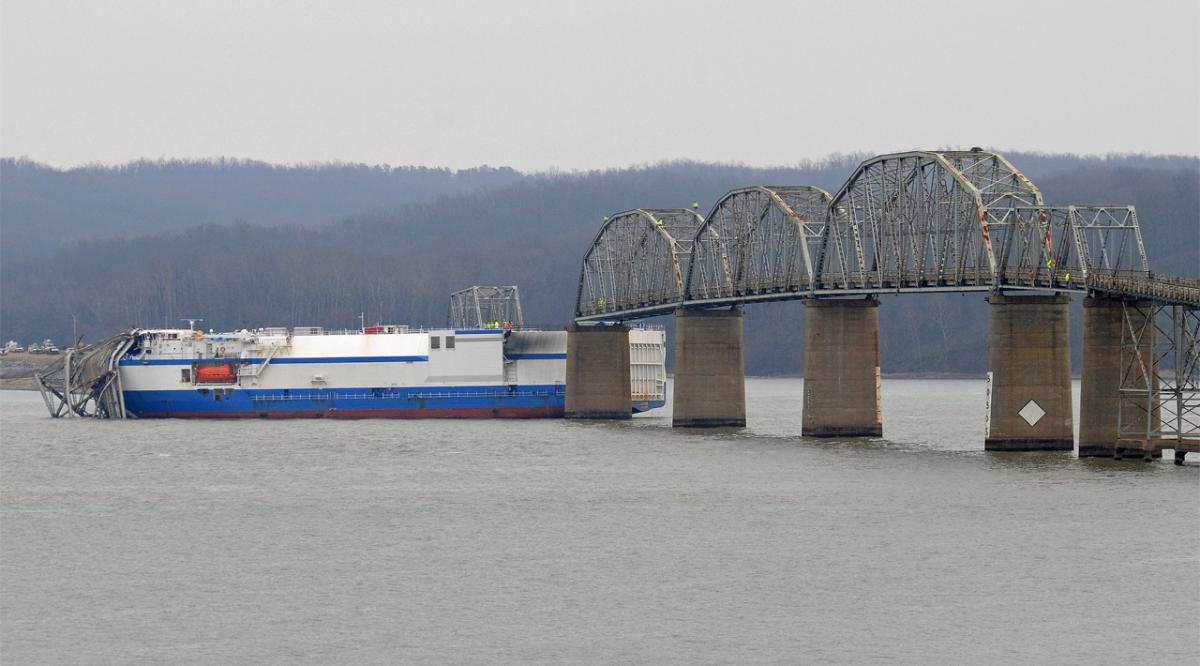
| Replaced by: |
Eggner's Ferry Bridge (2016)
|
| Coordinates: | 36° 46' 19.85" N 88° 7' 13.65" W |
Technical Information
Dimensions
| main span | 112.17 m | |
| total length | 1 065.31 m | |
| deck width | 6.1 m |
Chronology
| 10 July 1943 | Because of the construction of Kentucky Dam and the resulting lake that would otherwise overflow the bridge, the road is closed for five months. In this time the structure is sufficiently raised to keep the existing bridge. |
|---|
Participants
Currently there is no information available about persons or companies having participated in this project.
Relevant Web Sites

- About this
data sheet - Structure-ID
20043353 - Published on:
03/02/2009 - Last updated on:
13/11/2021
Structurae cooperates with


