
General Information
| Name in local language: | Pont suspendu de Bonpas |
|---|---|
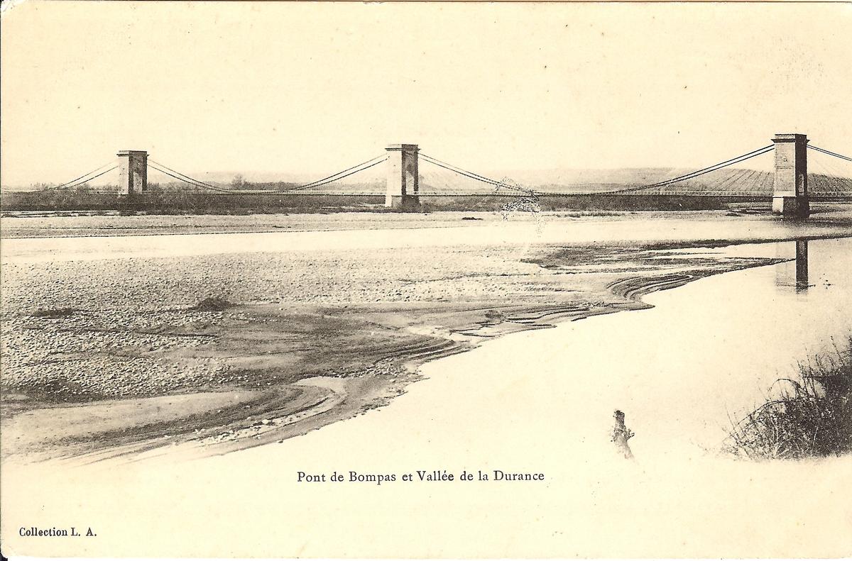
| Completion: | 1894 |
| Status: | destroyed (1944) |
Project Type
| Structure: |
Suspension bridge with cable-stays Multi-span suspension bridge |
|---|---|
| Function / usage: |
Road bridge |
| Material: |
Structurae Plus/Pro - Subscribe Now! |
Location
| Location: |
Bonpas, Avignon, Vaucluse (84), Provence-Alpes-Côte d'Azur, France |
|---|---|
| Crossed: |
|
| Carried: |
|
| Replaced by: |
Pont de Bonpas
|
| Coordinates: | 43° 53' 16.88" N 4° 54' 58.64" E |
Technical Information
Dimensions
| width | 6.10 m | |
| total length | 520 m | |
| number of spans | 4 |
Chronology
| August 1944 | Destroyed. |
|---|
Excerpt from Wikipedia
The Pont de Bonpas is a bridge over the Durance river, connecting the south of Vaucluse to the north of Bouches-du-Rhône in southern France. The initial stone bridge was constructed between 1189 and 1199, which was destroyed by a 1272 flood. Reconstruction was attempted in 1316 but ultimately failed, and a new bridge was not completed until 1812. This was later damaged by flood and a suspension bridge opened in 1894, but was destroyed in 1944 by retreating Nazi troops. The current bridge was constructed in 1954 and is 500 metres (1,600 ft) long with twelve arches.
History
Prior to the construction of a bridge to cross the Durance river, there is evidence that a reaction ferry was used from 1166. Religious organisation the Bridge-Building Brotherhood were involved in bridge construction, road repairs, and a variety of other tasks. They began constructing a bridge whilst providing housing for foreigners beside the Durance river, and later completed a stone bridge; it was constructed between 1189 and 1199. In 1270 Alphonse, Count of Poitiers granted the Bridge-Building Brotherhood the rights over the bridge over the Durance and confirmed their fiefs, rights and jurisdictions they had in the counties of Venaissin and Toulouse. It was destroyed by a flood in 1272.
In 1316 the construction of a new bridge using stones from the old bridge was authorised but failed in 1320. In 1804 plans to construct a new wooden bridge were made and a 548-metre-long (1,798 ft) bridge with forty-seven spans opened in 1812. Nine spans were damaged in an 1886 flood and it became a footbridge. A new suspension bridge opened in 1894 with a length of 520 metres (1,710 ft). In 1944 during the Nazi German retreat from France, Hitler's forces destroyed the suspension bridge. In 1954 a new bridge was completed to allow river crossings, consisting of 12 arches supporting the 500-metre-long (1,600 ft) structure.
Text imported from Wikipedia article "Pont de Bonpas" and modified on 22 July 2020 according to the CC-BY-SA 3.0 license.
Participants
Relevant Web Sites

- About this
data sheet - Structure-ID
20012242 - Published on:
07/06/2004 - Last updated on:
05/02/2016
Structurae cooperates with


