
General Information
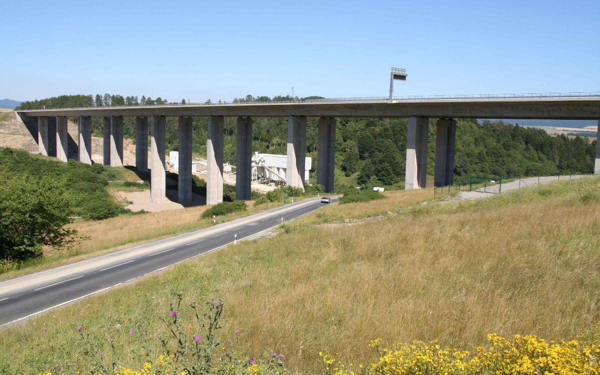
| Other name(s): | Talbrücke Schindgraben |
|---|---|
| Official designation: | 5321/16 |
| Beginning of works: | 2000 |
| Completion: | 2002 |
| Duration of works: | 57 months |
| Status: | in use |
Project Type
| Structure: |
Box girder bridge |
|---|---|
| Function / usage: |
Motorway bridge / freeway bridge |
| Material: |
Prestressed concrete bridge Structurae Plus/Pro - Subscribe Now! |
| Construction method: |
Incremental launching |
Location
| Location: |
Rohr, Schmalkalden-Meiningen, Thuringia, Germany |
|---|---|
| Carries: |
|
| Part of: |
|
| Coordinates: | 50° 34' 54.92" N 10° 29' 6.95" E |
Technical Information
Dimensions
| width | 28.50 m | |
| total length | 2 x 464.00 m | |
| span lengths | 46.5 m - 8 x 47.50 m - 46.50 m | |
| number of spans | 10 | |
| bridge surface | 13 224 m² | |
| height above valley floor or water | 55 m | |
| deck | deck depth | 3.2 m |
| piers | height | 14.0 - 48.0 m |
Quantities
| deck | concrete volume | 10 000 m³ |
| reinforcing steel | 1 300 t | |
| internal prestressing | 330 t | |
| external prestressing | 100 t | |
| substructure | concrete volume | 9 400 m³ |
| concrete volume | 1 200 t |
Cost
| cost of construction (incl. taxes) | German Mark 20 000 000 |
Materials
| deck |
prestressed concrete
|
|---|---|
| piers |
reinforced concrete
|
Participants
Owner
Client
Original design
Alternative design
Structural engineering
Checking engineering
- Heinrich Bökamp (checking engineer)
-
Leonhardt, Andrä und Partner
- J. Dietzel (checking engineer)
Contractor
Bearings

Construction supervision
Project management
Relevant Web Sites
There currently are no relevant websites listed.
Relevant Publications
- Brückenbauwerke in den neuen Bundesländern. Wilhelm Ernst & Sohn Verlag für Architektur und technische Wissenschaften GmbH, Berlin (Germany), 2004, pp. 213-217.
- About this
data sheet - Structure-ID
20005135 - Published on:
18/09/2002 - Last updated on:
05/02/2016
Structurae cooperates with


