
General Information
Project Type
| Structure: |
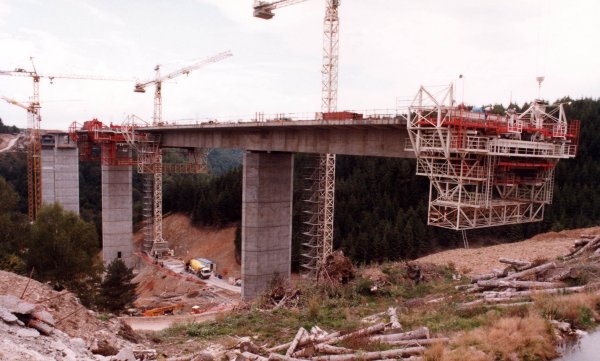
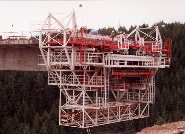
Haunched girder bridge |
|---|---|
| Function / usage: |
Motorway bridge / freeway bridge |
| Material: |
Prestressed concrete bridge Structurae Plus/Pro - Subscribe Now! |
Location
| Location: |
Bourg-Lastic, Puy-de-Dôme (63), Auvergne-Rhône-Alpes, France |
|---|---|
| Crosses: |
|
| Carries: |
|
| Part of: | |
| Coordinates: | 45° 37' 47.68" N 2° 31' 51.26" E |
Technical Information
Dimensions
| main span | 132 m | |
| total length | 540 m | |
| span lengths | 43.3 m - 85.5 m - 132 m - 112.2 m - 93.4 m - 74.3 m | |
| number of spans | 6 | |
| pier height | max. 70 m | |
| deck | deck width | 18.10 m |
Materials
| superstructure |
prestressed concrete
|
|---|---|
| piers |
reinforced concrete
|
Participants
Owner
Design
Architecture
- Charles Lavigne (architect)
-
Architecture et Ouvrages d'art
- Alain Montois (architect)
Structural engineering
Contractor
Reinforcing steel

Relevant Web Sites
There currently are no relevant websites listed.
Relevant Publications
- (2000): L'autoroute sous l'emprise du paysage. In: Construction moderne ( 2000), pp. 8-16.
- (2000): Le Viaduc de la Clidane. In: Travaux, n. 768 (October 2000), pp. 59-67.
- About this
data sheet - Structure-ID
20002539 - Published on:
01/01/2002 - Last updated on:
05/02/2016
Structurae cooperates with


