
General Information
| Name in local language: | Pont-aqueduc de Roquefavour |
|---|---|
| Beginning of works: | 1841 |
| Completion: | May 1847 |
| Status: | in use |
Project Type
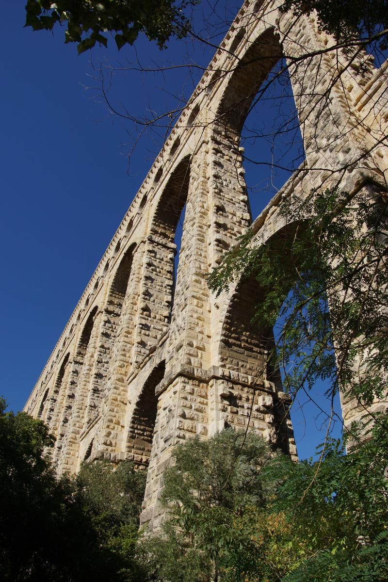
| Structure: |
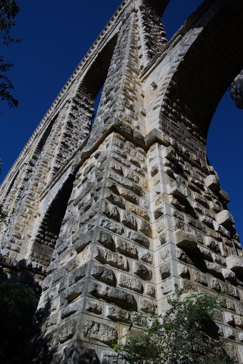
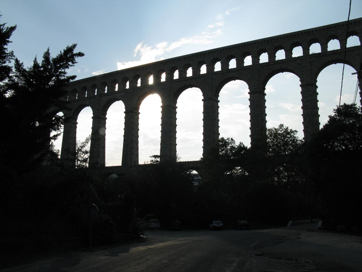
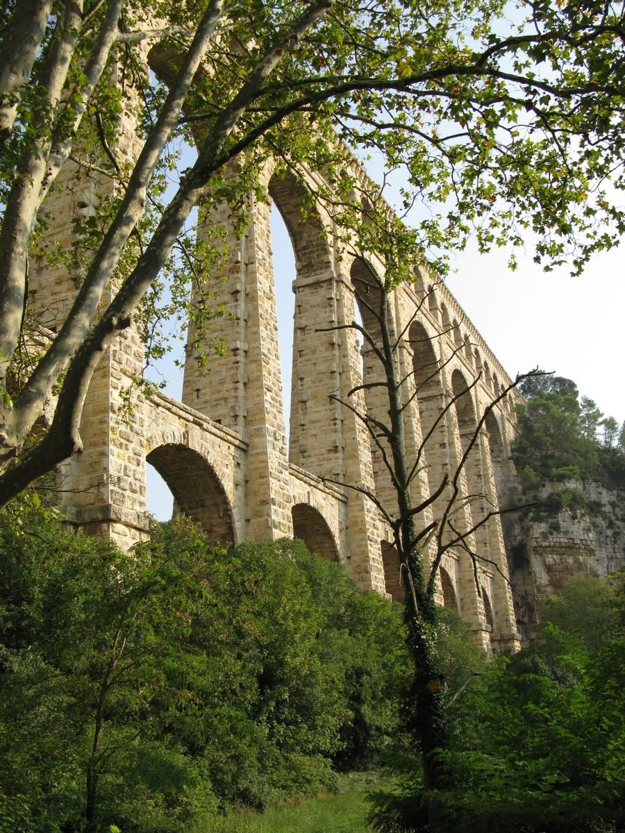
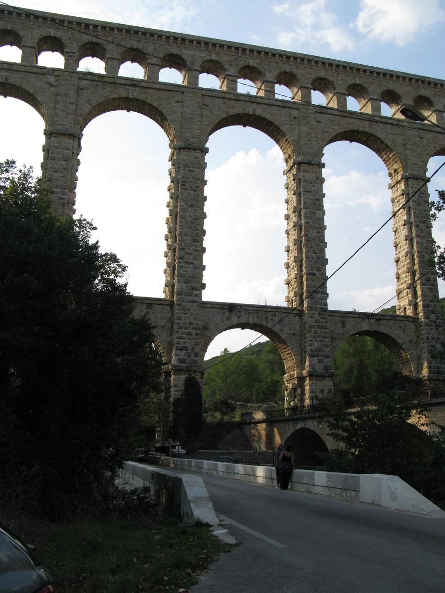
Three-story semi-circular arch bridge |
|---|---|
| Function / usage: |
Aqueduct bridge |
| Material: |
Masonry bridge Structurae Plus/Pro - Subscribe Now! |
Location
| Location: |
Ventabren, Bouches-du-Rhône (13), Provence-Alpes-Côte d'Azur, France |
|---|---|
| Crosses: |
|
| Part of: | |
| Next to: |
Roquefavour Rail Bridge
|
| Coordinates: | 43° 30' 59.04" N 5° 18' 46.10" E |
Technical Information
Dimensions
| main span | 16 m | |
| height | 82.65 m | |
| total length | 393 m |
Cost
| cost of construction | French Franc 3 784 871 | |
| cost of construction per m² | French Franc 168 |
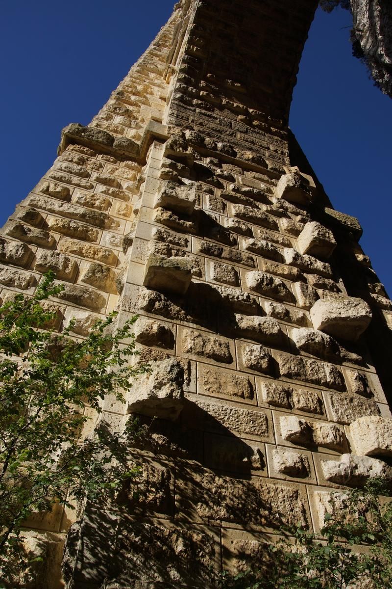
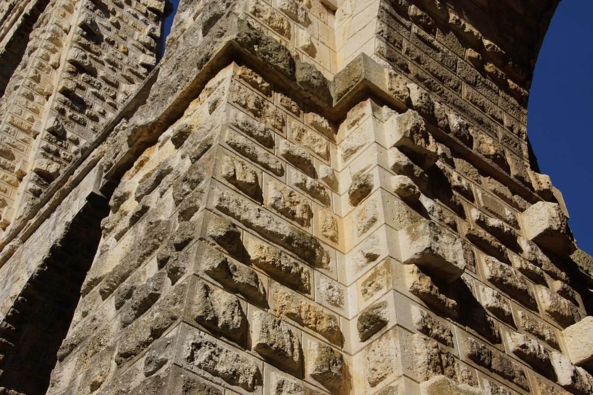
Materials
| piers |
stone
|
|---|---|
| arches |
stone
|
Chronology
| Beginning of 1841 | Construction begins. |
|---|---|
| 16 April 1842 | The ministry of public works authorizes construction. |
| June 1845 | The arches of the first level are completed. |
| January 1846 | Construction of the second level begins. |
| December 1846 | Completion of the second arch level. |
| May 1847 | The bridge is completed. |
| 30 June 1847 | Water from the Durance first flows over the aqueduct. |
Excerpt from Wikipedia
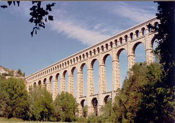
The Roquefavour Aqueduct (French:Aqueduc de Roquefavour) is an aqueduct in Ventabren, near Aix-en-Provence, Bouches-du-Rhône, France. The aqueduct was first planned in 1565, but it was not realized until the 19th century. It was designed by Jean François Mayor de Montricher, built between 1841 and 1847, and is the largest stone aqueduct in the world. It was designated as a " monument historique" (national heritage site) in 2002.
Location
The aqueduct is located near Aix-en-Provence. It can be reached via the D64 road. It crosses the Arc river in Ventabren.
History
The idea of the aqueduct was first envisaged by Adam de Craponne, an engineer from Salon de Provence, in 1565. After the drought of 1834 and the subsequent cholera epidemics, the idea resurfaced. Maximin-Dominique Consolat (1785-1858), who served as the Mayor of Marseille from 1832 to 1843, championed the idea. He hired engineer Jean François Mayor de Montricher (1810–1858) to design it. Its construction took six years, from 1841 to 1847. It took 5,000 labourers, including 300 stone-cutters, and it cost 3,800,000 French francs. It is 83 metres high, 375 metres long, and the foundations are 9 to 10 metres deep.
The aqueduct brings water (Canal de Marseille) from the Durance river to the Palais Longchamp in Marseille, all the way to La Ciotat. The water began to flow on 30 June 1847. On 30 September 1852, Emperor Louis Napoléon Bonaparte awarded Jean François Mayor de Montricher the Legion of Honour for his work. It was later photographed by renowned photographer Édouard Baldus.
On 12 September 1992 the 150th anniversary of the aqueduct was celebrated. The ceremony was attended by Jean-Claude Gaudin (Senator and President of the Conseil Régional), Lucien Weygand (the President of the Conseil Général of Bouches-du-Rhone), Robert Vigouroux (Senator and Mayor of Marseille), Jean-François Picheral (Mayor of Aix-en-Provence), Bertrand Dauberlieu (President of the Société des Eaux de Marseille), and Jean-Marie Duron (Mayor of Ventabren).
Heritage significance
The aqueduct has been a monument historique (English: national heritage site) since 2002.
Text imported from Wikipedia article "Roquefavour Aqueduct"
and modified on 03 June 2020 according to the CC-BY-SA 3.0 license.
Participants
Engineering
- Frantz Mayor de Montricher (engineer)
Relevant Web Sites


Relevant Publications
- (1855): Description of the Bridge-Aqueduct of Roquefavour on the line of the Canal of Marseilles. In: Minutes of the Proceedings of the Institution of Civil Engineers, v. 14, n. 1855 ( 1855), pp. 190-201.
- (2001): Les plus beaux ponts de France. Bonneton, Paris (France), pp. 66.
- (1984): Ponts de France. Presses Ponts et chaussées, Paris (France), pp. 106.
- (1988): Ponts et viaducs au XIXème siècle. Poitiers (France), pp. 225-227.
- (1990): Les ponts modernes - 18e et 19e siècles. 1st edition, Picard Editeur, Paris (France), pp. 236-237.
- About this
data sheet - Structure-ID
20001429 - Published on:
22/04/2001 - Last updated on:
24/06/2022
Structurae cooperates with


