
General Information
| Completion: | 1330 |
|---|---|
| Status: | in use |
Project Type
| Structure: |
Two-story semi-circular arch bridge |
|---|---|
| Function / usage: |
Road bridge |
| Material: |
Masonry bridge Structurae Plus/Pro - Subscribe Now! |
Location
| Location: |
Rothenburg ob der Tauber, Ansbach (Kreis), Bavaria, Germany |
|---|---|
| Crosses: |
|
| Coordinates: | 49° 22' 22" N 10° 10' 35" E |
Technical Information
Dimensions
| main spans | 13.20 m - 2 x 11.20 m |
Materials
| piers |
stone
|
|---|---|
| arches |
stone
|
Excerpt from Wikipedia
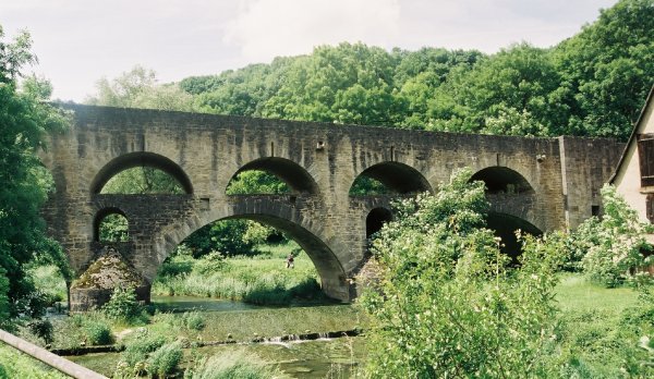
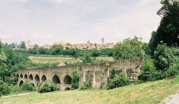
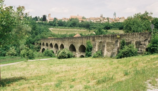
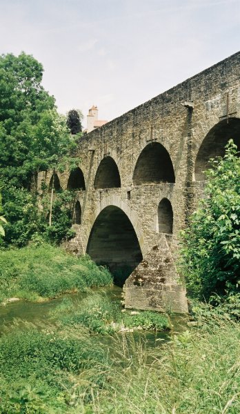
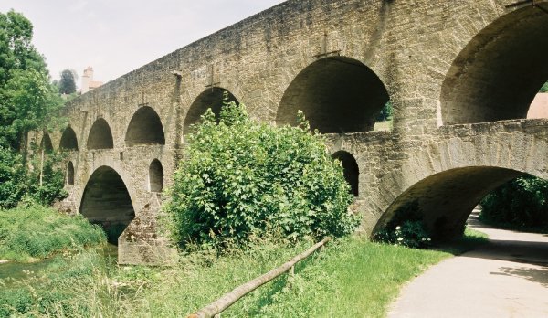
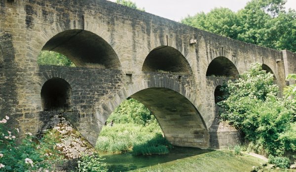
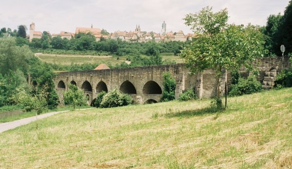
The Tauber Bridge at Rothenburg ob der Tauber is an historic road bridge that spans the Tauber Valley west of the town centre of the Middle Franconian town of Rothenburg ob der Tauber in Bavaria. The structure carries a local link road to Leuzenbronn and the Tauber Valley Way and has a 4.0 metre wide roadway and a 1.0 metre wide footpath.
History
The double bridge with its two rows of arches, one on top of the other, was probably built around 1330. It lies at the foot of the southwestern valley side below Rothenburg ob der Tauber and was part of a trade route from Augsburg to Würzburg. In terms of building activity, it is known that it was renovated in 1791, after the four upper arches had collapsed the year before. In 1925, the eastern approach to the bridge was widened and, twenty years later. In 1945, the structure was blown up by German troops. Rebuilding commenced in 1955, and took a good year. The rebuilt bridge was opened on 10 November 1956.
Text imported from Wikipedia article "Tauber Bridge, Rothenburg ob der Tauber"
and modified on 12 June 2021 according to the CC-BY-SA 3.0 license.
Participants
Currently there is no information available about persons or companies having participated in this project.
Relevant Web Sites

Relevant Publications
- (2007): Brücken in Deutschland II. für Straßen und Wege. Deutscher Bundes-Verlag, Cologne (Germany), ISBN 978-3-935064-46-0, pp. 14-15.
- Steinbrücken in Deutschland. Beton-Verlag, Düsseldorf (Germany), 1988, pp. 131-133.
- About this
data sheet - Structure-ID
20001018 - Published on:
01/10/2000 - Last updated on:
28/05/2021
Structurae cooperates with


