


General Information
| Other name(s): | Ophir Historic Bridge |
|---|---|
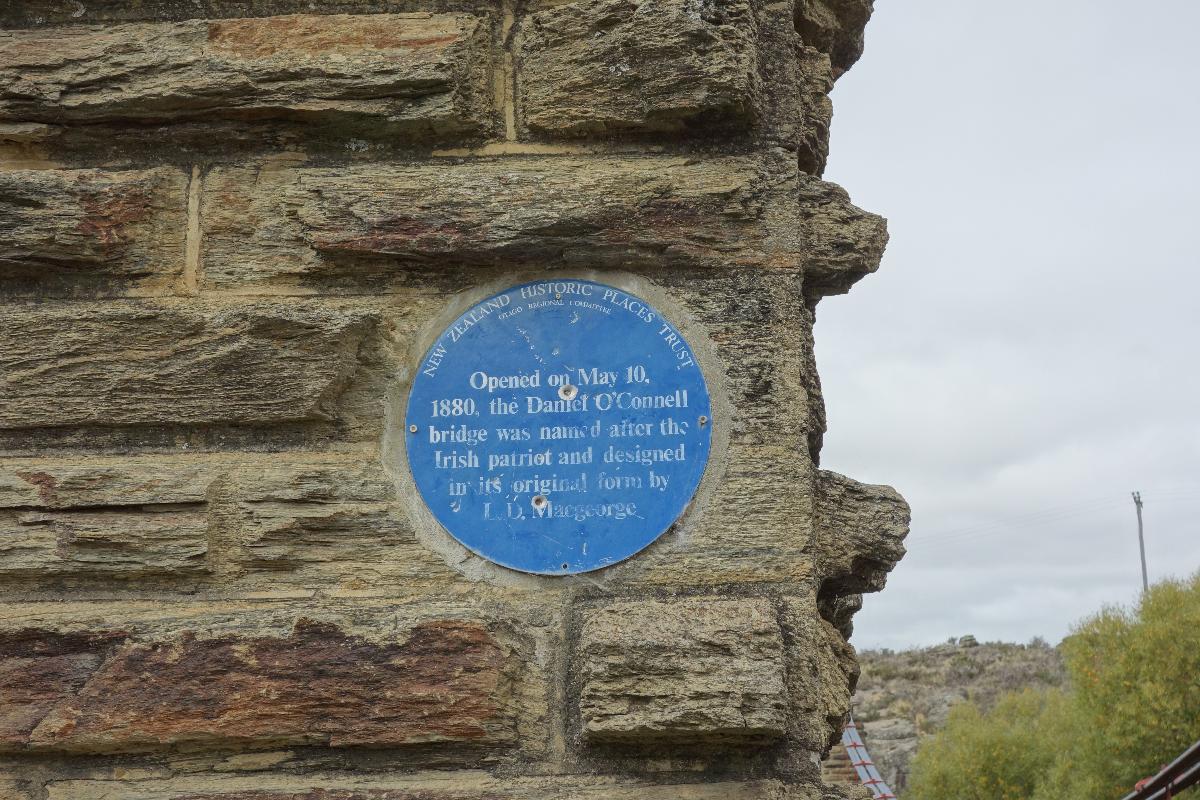
| Completion: | 10 May 1880 |
| Status: | in use |
Project Type
| Structure: |
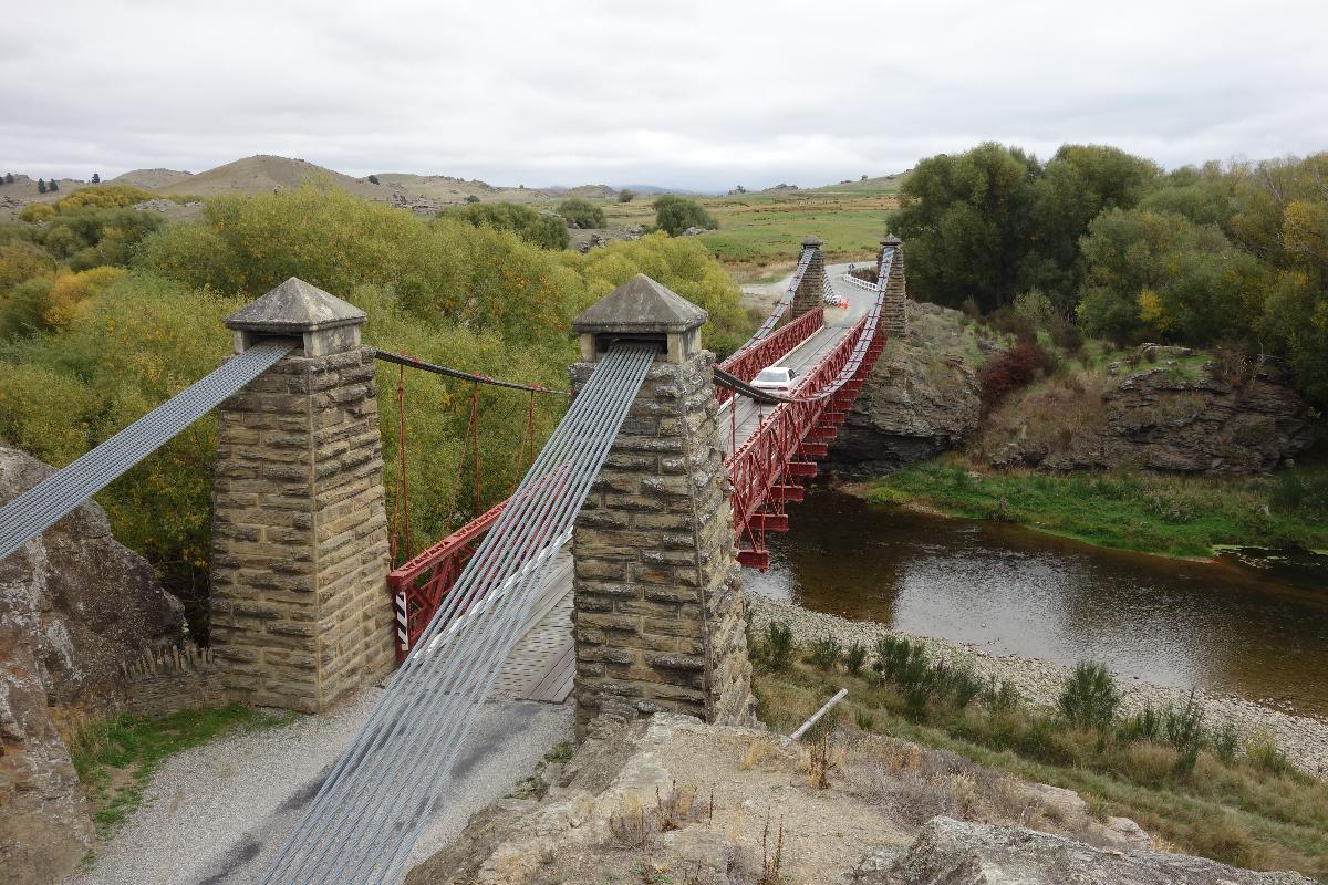
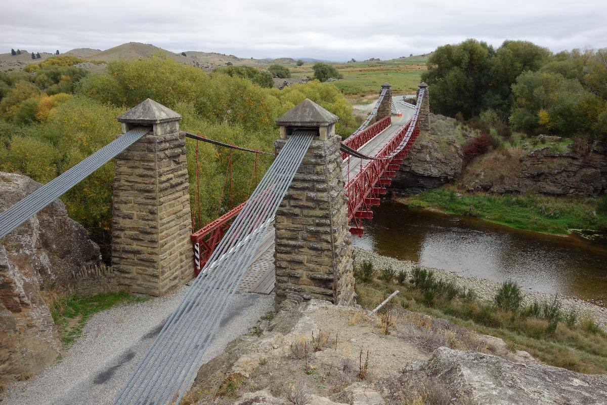
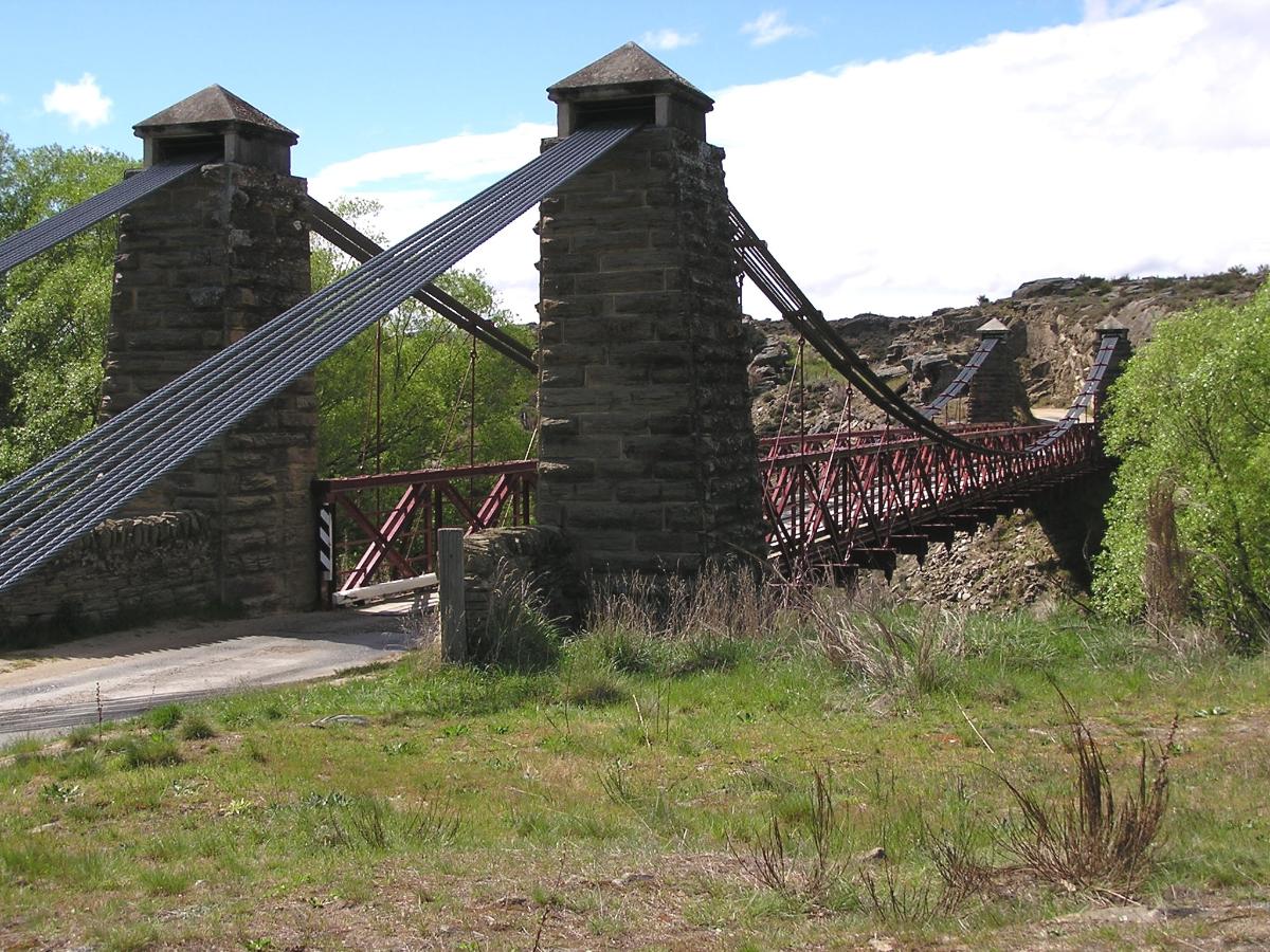
Single-span two-tower suspension bridge |
|---|---|
| Function / usage: |
Road bridge |
| Material: |
Steel bridge Structurae Plus/Pro - Subscribe Now! |
| Plan view: |
Structurae Plus/Pro - Subscribe Now! |
Awards and Distinctions
| 1984 |
for registered users |
|---|
Location
| Location: |
Ophir, Otago, New Zealand |
|---|---|
| Address: | Ophir Bridge Road |
| Crosses: |
|
| Coordinates: | 45° 6' 38.78" S 169° 35' 25" E |
Technical Information
Dimensions
| number of spans | 1 | |
| number of lanes | 1 | |
| pylons | number | 2 x 2 |
Materials
| cables |
steel wire
|
|---|---|
| pylons |
masonry
|
| truss |
steel
|
Participants
Design
- L. D. Macgeorge (designer)
Relevant Web Sites
There currently are no relevant websites listed.
Relevant Publications
- (2001): Bridging the Gap. Early Bridges in New Zealand 1830-1939. Reed Books, Auckland (New Zealand), pp. 184.
- About this
data sheet - Structure-ID
20024851 - Published on:
07/11/2006 - Last updated on:
15/01/2024
Structurae cooperates with


